File:Locator map of North Korea 1945-50.svg
Jump to navigation
Jump to search

Size of this PNG preview of this SVG file: 250 × 115 pixels. Other resolutions: 320 × 147 pixels | 640 × 294 pixels | 1,024 × 471 pixels | 1,280 × 589 pixels | 2,560 × 1,178 pixels.
Original file (SVG file, nominally 250 × 115 pixels, file size: 1.23 MB)
Captions
Captions
Add a one-line explanation of what this file represents
Summary[edit]
| Description |
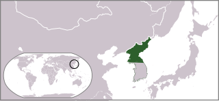
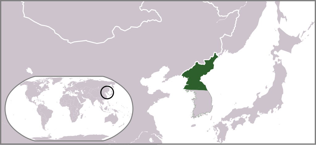
English: Locator map of North Korea (1945-1950) |
| Date | (UTC) |
| Source |
This file was derived from: Locator map of North Korea.svg: |
| Author |
|
| This is a retouched picture, which means that it has been digitally altered from its original version. Modifications: Changed to the 1948 boundaries. The original can be viewed here: Locator map of North Korea.svg:
|
Licensing[edit]
I, the copyright holder of this work, hereby publish it under the following license:
| I, the copyright holder of this work, release this work into the public domain. This applies worldwide. In some countries this may not be legally possible; if so: I grant anyone the right to use this work for any purpose, without any conditions, unless such conditions are required by law. |
Original upload log[edit]
This image is a derivative work of the following images:
- File:Locator_map_of_North_Korea.svg licensed with PD-self
- 2009-07-10T17:34:21Z Ksiom 250x115 (1235136 Bytes) revised version
- 2008-10-19T20:29:55Z Ksiom 250x115 (1403117 Bytes) {{Information |Description={{en|1=Locator map of North Korea.}} |Source=Own work by uploader |Author=[[User:Ksiom|Ksiom]] |Date=2008-10-20 |Permission= |other_versions=[[:Image:LocationNorthKorea.png]] }} [[Category:Locator
Uploaded with derivativeFX
File history
Click on a date/time to view the file as it appeared at that time.
| Date/Time | Thumbnail | Dimensions | User | Comment | |
|---|---|---|---|---|---|
| current | 23:13, 26 June 2012 | | 250 × 115 (1.23 MB) | TKostolany (talk | contribs) |
You cannot overwrite this file.
File usage on Commons
The following page uses this file:
File usage on other wikis
The following other wikis use this file:
- Usage on ar.wikipedia.org
- Usage on ast.wikipedia.org
- Usage on bg.wikipedia.org
- Usage on en.wikipedia.org
- Usage on es.wikipedia.org
- Usage on fa.wikipedia.org
- Usage on fr.wikipedia.org
- Usage on he.wikipedia.org
- Usage on hu.wikipedia.org
- Usage on id.wikipedia.org
- Usage on it.wikipedia.org
- Usage on ja.wikipedia.org
- Usage on ko.wikipedia.org
- Usage on ms.wikipedia.org
- Usage on mzn.wikipedia.org
- Usage on pl.wikipedia.org
- Usage on pt.wikipedia.org
- Usage on ru.wikipedia.org
- Usage on sh.wikipedia.org
- Usage on th.wikipedia.org
- Usage on tl.wikipedia.org
- Usage on tr.wikipedia.org
- Usage on uk.wikipedia.org
- Usage on vi.wikipedia.org
- Usage on www.wikidata.org
View more global usage of this file.