File:Majapahit Empire.svg
Jump to navigation
Jump to search

ഈ SVG പ്രമാണത്തിന്റെ PNG പ്രിവ്യൂവിന്റെ വലിപ്പം: 512 × 297 പിക്സലുകൾ. മറ്റ് റെസലൂഷനുകൾ: 320 × 186 പിക്സലുകൾ | 640 × 371 പിക്സലുകൾ | 1,024 × 594 പിക്സലുകൾ | 1,280 × 743 പിക്സലുകൾ | 2,560 × 1,485 പിക്സലുകൾ.
പൂർണ്ണ വലിപ്പം (എസ്.വി.ജി. പ്രമാണം, നാമമാത്രമായ 512 × 297 പിക്സലുകൾ, പ്രമാണത്തിന്റെ വലിപ്പം: 524 കെ.ബി.)
തലവാചകം
തലവാചകങ്ങൾ
ഈ പ്രമാണം എന്തിനെ പ്രതിനിധീകരിക്കുന്നുവെന്ന ഒറ്റവരി വിശദീകരണം ചേർക്കുക
ചുരുക്കം
[തിരുത്തുക]| വിവരണം |
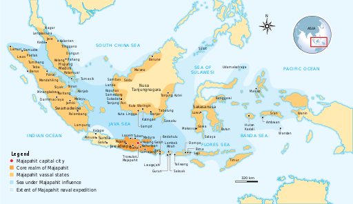
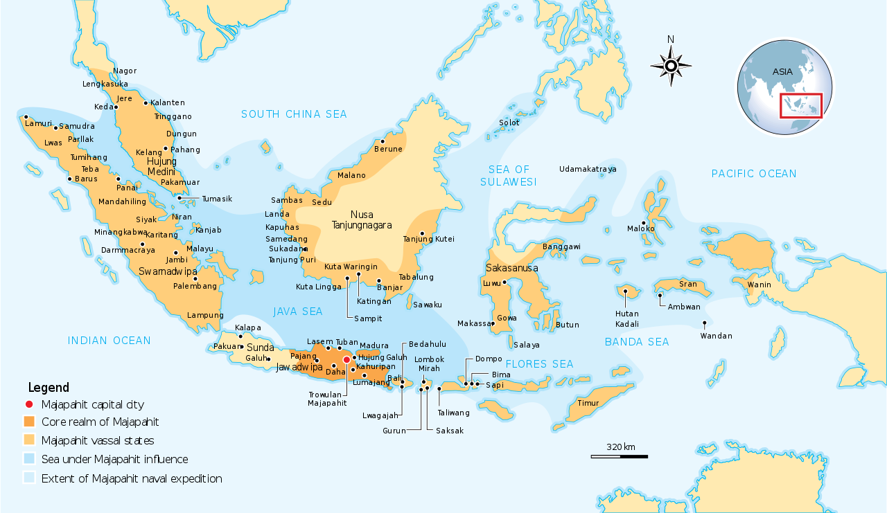
English: The Nusantara Archipelago during the height of Majapahit Empire in XIV century.
The red dot is Trowulan; Majapahit capital city. The dark orange area is core realm of Majapahit on eastern part of Java. The light orange area is vassal states of Majapahit mentioned in Nagarakretagama. The pale yellow is outer realm or independent states from Majapahit. The dark cyan is the sea area under influence or effective control of Majapahit. The light cyan is the extent of Majapahit naval expedition. |
||
| തീയതി | |||
| സ്രോതസ്സ് | Own work by uploader, see #References for references used creating the map. | ||
| സ്രഷ്ടാവ് | Gunawan Kartapranata | ||
| അനുമതി (ഈ പ്രമാണത്തിന്റെ പുനരുപയോഗം) |
ഈ സൃഷ്ടിയുടെ പകർപ്പവകാശ ഉടമയായ ഞാൻ, താഴെ പറയുന്ന അനുമതികളിൽ ഈ സൃഷ്ടി ഇതിനാൽ പ്രസിദ്ധീകരിക്കുന്നു: ഈ പ്രമാണത്തിന് അനുമതി നൽകപ്പെട്ടിരിക്കുന്നത് ക്രിയേറ്റീവ് കോമൺസ് ആട്രിബ്യൂഷൻ-ഷെയർ എലൈക് 3.0 അൺപോർട്ടഡ് അനുവാദപത്ര പ്രകാരമാണ്.
താങ്കൾക്ക് താങ്കളുടെ ഇച്ഛാനുസരണം അനുമതി തിരഞ്ഞെടുക്കാം. |
||
| മറ്റു പതിപ്പുകൾ |
[] []
|


|
എസ്.വി.ജി. പിന്തുണയുള്ള എഡിറ്ററിൽ (എക്സ്.എം.എൽ. അല്ലെങ്കിൽ എഴുത്ത് തിരുത്തലിനുള്ള ഉപകരണം) താങ്കളുടെ ഭാഷയിലേയ്ക്ക് എളുപ്പം പരിഭാഷപ്പെടുത്താവുന്ന എഴുത്തുകൾ ഈ എസ്.വി.ജി. പ്രമാണത്തിൽ ഉൾപ്പെടുത്തിയിരിക്കുന്നു. കൂടുതൽ വിവരങ്ങൾക്ക് എസ്.വി.ജി. പ്രമാണങ്ങൾ പരിഭാഷപ്പെടുത്തൽ കാണുക. |
References
[തിരുത്തുക]
Resources used to create the map:
- (21 ജൂൺ 2007) Majapahit, Kompas Daily, Jakarta Indonesia
- Latif, Chalid; Irwin Lay , ed. (1997) Atlas Sejarah Indonesia dan Dunia (Historical Atlas of Indonesia and World), PT Pembina Peraga, Jakarta
- (indonesian) IPS Terpadu (Sosiologi, Geografi, Ekonomi, Sejarah), PT Grafindo Media Pratama, p. 219 ISBN: 9789797583378.
പ്രമാണ നാൾവഴി
ഏതെങ്കിലും തീയതി/സമയ കണ്ണിയിൽ ഞെക്കിയാൽ പ്രസ്തുതസമയത്ത് ഈ പ്രമാണം എങ്ങനെയായിരുന്നു എന്നു കാണാം.
| തീയതി/സമയം | ലഘുചിത്രം | അളവുകൾ | ഉപയോക്താവ് | അഭിപ്രായം | |
|---|---|---|---|---|---|
| നിലവിലുള്ളത് | 13:07, 28 ഒക്ടോബർ 2016 | | 512 × 297 (524 കെ.ബി.) | Gunkarta (സംവാദം | സംഭാവനകൾ) | Correction on Luwu location |
| 10:13, 5 നവംബർ 2009 |  | 781 × 457 (525 കെ.ബി.) | Gunkarta (സംവാദം | സംഭാവനകൾ) | Corrected the location of Malano in northeast coast of Borneo and Wanin/Onin in Papua (today Fak-fak). | |
| 15:43, 10 ഓഗസ്റ്റ് 2009 |  | 781 × 457 (525 കെ.ബി.) | Gunkarta (സംവാദം | സംഭാവനകൾ) | Crop the map again | |
| 15:37, 10 ഓഗസ്റ്റ് 2009 |  | 781 × 463 (529 കെ.ബി.) | Gunkarta (സംവാദം | സംഭാവനകൾ) | Crop the map | |
| 15:27, 10 ഓഗസ്റ്റ് 2009 |  | 986 × 610 (582 കെ.ബി.) | Gunkarta (സംവാദം | സംഭാവനകൾ) | {{Information |Description={{en|1=The Nusantara Archipelago during the height of Majapahit Empire in XIV century. 1. The red dot is Trowulan; Majapahit capital city 2. The dark orange area is core realm of Majapahit on eastern part of Java 3. The light o |
ഈ പ്രമാണത്തിനു മുകളിൽ മറ്റൊരു പ്രമാണം ചേർക്കാൻ താങ്കൾക്ക് കഴിയില്ല.
പ്രമാണത്തിന്റെ ഉപയോഗം
താഴെ കാണുന്ന 11 താളുകളിൽ ഈ ചിത്രം ഉപയോഗിക്കുന്നു:
- Atlas of Indonesia
- User:Gunkarta
- File:Majapahit Empire-pt.svg
- File:Majapahit Empire-sr.svg
- File:Majapahit Empire-zh-hans.svg
- File:Majapahit Empire.svg
- File:Majapahit Empire de.svg
- File:Majapahit Empire id.svg
- File:Selat Muria di abad ke-16.svg
- Template:Other versions/Majapahit Empire
- Category:Majapahit Empire
പ്രമാണത്തിന്റെ ആഗോള ഉപയോഗം
താഴെ കൊടുത്തിരിക്കുന്ന മറ്റ് വിക്കികൾ ഈ പ്രമാണം ഉപയോഗിക്കുന്നു:
- ar.wikipedia.org സംരംഭത്തിലെ ഉപയോഗം
- arz.wikipedia.org സംരംഭത്തിലെ ഉപയോഗം
- ast.wikipedia.org സംരംഭത്തിലെ ഉപയോഗം
- ba.wikipedia.org സംരംഭത്തിലെ ഉപയോഗം
- bcl.wikipedia.org സംരംഭത്തിലെ ഉപയോഗം
- bg.wikipedia.org സംരംഭത്തിലെ ഉപയോഗം
- bn.wikipedia.org സംരംഭത്തിലെ ഉപയോഗം
- ca.wikipedia.org സംരംഭത്തിലെ ഉപയോഗം
- cs.wikipedia.org സംരംഭത്തിലെ ഉപയോഗം
- de.wikipedia.org സംരംഭത്തിലെ ഉപയോഗം
- en.wikipedia.org സംരംഭത്തിലെ ഉപയോഗം
- eo.wikipedia.org സംരംഭത്തിലെ ഉപയോഗം
- eu.wikipedia.org സംരംഭത്തിലെ ഉപയോഗം
- fa.wikipedia.org സംരംഭത്തിലെ ഉപയോഗം
- fi.wikipedia.org സംരംഭത്തിലെ ഉപയോഗം
- fr.wikipedia.org സംരംഭത്തിലെ ഉപയോഗം
- gl.wikipedia.org സംരംഭത്തിലെ ഉപയോഗം
- he.wikipedia.org സംരംഭത്തിലെ ഉപയോഗം
- hi.wikipedia.org സംരംഭത്തിലെ ഉപയോഗം
- id.wikipedia.org സംരംഭത്തിലെ ഉപയോഗം
- id.wikisource.org സംരംഭത്തിലെ ഉപയോഗം
- id.wiktionary.org സംരംഭത്തിലെ ഉപയോഗം
- it.wikipedia.org സംരംഭത്തിലെ ഉപയോഗം
- ja.wikipedia.org സംരംഭത്തിലെ ഉപയോഗം
- km.wikipedia.org സംരംഭത്തിലെ ഉപയോഗം
- ko.wikipedia.org സംരംഭത്തിലെ ഉപയോഗം
- lt.wikipedia.org സംരംഭത്തിലെ ഉപയോഗം
- min.wikipedia.org സംരംഭത്തിലെ ഉപയോഗം
- ml.wikipedia.org സംരംഭത്തിലെ ഉപയോഗം
- mr.wikipedia.org സംരംഭത്തിലെ ഉപയോഗം
- ms.wikipedia.org സംരംഭത്തിലെ ഉപയോഗം
- ne.wikipedia.org സംരംഭത്തിലെ ഉപയോഗം
- nl.wikipedia.org സംരംഭത്തിലെ ഉപയോഗം
ഈ പ്രമാണത്തിന്റെ കൂടുതൽ ആഗോള ഉപയോഗം കാണുക.