File:Map-DR-Wuerttemberg.svg

Original file (SVG file, nominally 2,621 × 2,224 pixels, file size: 712 KB)
Captions
Captions
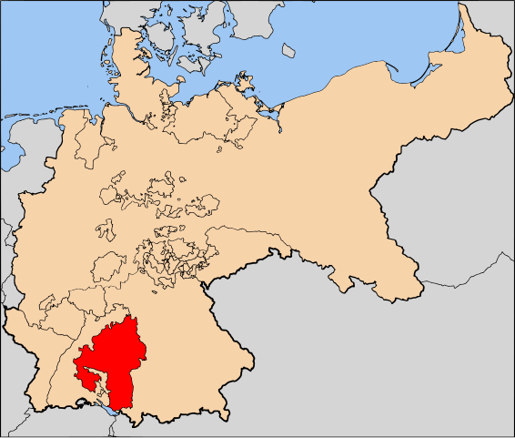
| Description | The Kingdom of Württemberg (Königreich Württemberg) within Germany at the time of the German Empire | |||||||||||
| Date | ||||||||||||
| Source | Based on map data of the IEG-Maps project (Andreas Kunz, B. Johnen and Joachim Robert Moeschl: University of Mainz) - http://www.ieg-maps.uni-mainz.de | |||||||||||
| Author | User:52 Pickup | |||||||||||
| Permission (Reusing this file) |
This file is licensed under the Creative Commons Attribution-Share Alike 2.5 Generic license.
|

File history
Click on a date/time to view the file as it appeared at that time.
| Date/Time | Thumbnail | Dimensions | User | Comment | |
|---|---|---|---|---|---|
| current | 13:16, 11 May 2007 | | 2,621 × 2,224 (712 KB) | 52 Pickup (talk | contribs) | {{Information| |Description= The Kingdom of Württemberg (Königreich Württemberg) within Germany at the time of the German Empire |Source= Based on map data of the |
You cannot overwrite this file.
File usage on Commons
The following page uses this file:
File usage on other wikis
The following other wikis use this file:
- Usage on en.wikipedia.org
- Usage on mn.wikipedia.org