File:Map Tokyo special wards.jpg
Jump to navigation
Jump to search

Size of this preview: 582 × 600 pixels. Other resolutions: 233 × 240 pixels | 466 × 480 pixels | 745 × 768 pixels | 994 × 1,024 pixels | 1,963 × 2,023 pixels.
Original file (1,963 × 2,023 pixels, file size: 4.48 MB, MIME type: image/jpeg)
Captions
Captions
Add a one-line explanation of what this file represents
Summary[edit]
| Description |
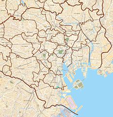
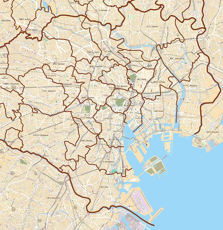
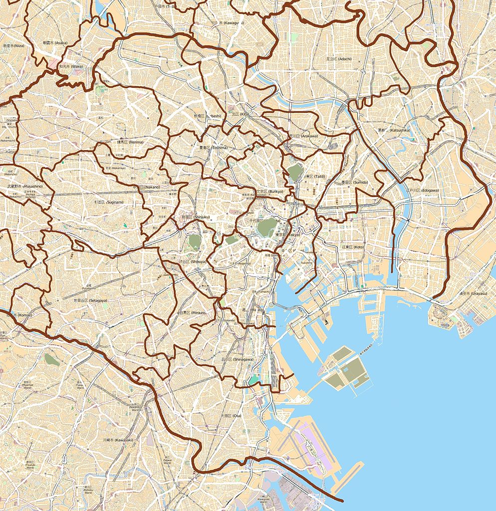
This map of English: Map of the 23 special wards of Tokyo, Japan
Français : Carte des 23 arrondissements spéciaux de Tokyo, Japon was created from OpenStreetMap project data, collected by the community. This map may be incomplete, and may contain errors. Don't rely solely on it for navigation. |
|||||||||
| Date | (see file history) | |||||||||
| Source | openstreetmap.org | |||||||||
| Creator |
OpenStreetMap contributors |
|||||||||
| Permission (Reusing this file) |
OpenStreetMap data and maps are licensed under the Creative Commons Attribution-ShareAlike 2.0 license (CC-BY-SA 2.0). This file is licensed under the Creative Commons Attribution-Share Alike 2.0 Generic license.
|
|||||||||
| Geotemporal data | ||||||||||
| Bounding box |
|
|||||||||
| Georeferencing | If inappropriate please set warp_status = skip to hide. | |||||||||
Licensing[edit]
I, the copyright holder of this work, hereby publish it under the following license:
This file is licensed under the Creative Commons Attribution-Share Alike 3.0 Unported license.
- You are free:
- to share – to copy, distribute and transmit the work
- to remix – to adapt the work
- Under the following conditions:
- attribution – You must give appropriate credit, provide a link to the license, and indicate if changes were made. You may do so in any reasonable manner, but not in any way that suggests the licensor endorses you or your use.
- share alike – If you remix, transform, or build upon the material, you must distribute your contributions under the same or compatible license as the original.
| This work contains information from OpenStreetMap, which is made available under the Open Database License (ODbL).
The ODbL does not require any particular license for maps produced from ODbL data. Prior to 1 August 2020, map tiles produced by the OpenStreetMap Foundation were licensed under the CC-BY-SA-2.0 license. Maps produced by other people may be subject to other licences. |
File history
Click on a date/time to view the file as it appeared at that time.
| Date/Time | Thumbnail | Dimensions | User | Comment | |
|---|---|---|---|---|---|
| current | 15:45, 19 July 2012 | | 1,963 × 2,023 (4.48 MB) | XIIIfromTOKYO (talk | contribs) | colors |
| 19:56, 4 February 2012 |  | 1,963 × 2,023 (4.56 MB) | XIIIfromTOKYO (talk | contribs) | Colors | |
| 18:06, 4 February 2012 |  | 1,963 × 2,023 (1.47 MB) | XIIIfromTOKYO (talk | contribs) | {{Information |Description ={{en|1=Map of the 23 special wards of Tokyo, Japan}} {{fr|1=Carte des 23 arrondissements spéciaux de Tokyo, Japon}} |Source ={{openstreetmap}} |Author =OpenStreetMap contributors |Date =2012-02-04 |
You cannot overwrite this file.
File usage on Commons
There are no pages that use this file.
File usage on other wikis
The following other wikis use this file:
- Usage on ar.wikipedia.org
- Usage on bg.wikipedia.org
- Usage on ca.wikipedia.org
- Usage on ceb.wikipedia.org
- Usage on en.wikipedia.org
- Akihabara
- Roppongi
- Shibuya
- Harajuku
- Ōta, Tokyo
- Tokyo Station
- Ōsaki Station
- Shinagawa Station
- Tamachi Station (Tokyo)
- Hamamatsuchō Station
- Harajuku Station
- Shinjuku Station
- Yūrakuchō Station
- Gotanda Station
- Meguro Station
- Ebisu Station (Tokyo)
- Ueno Station
- Ikebukuro Station
- Shibuya Station
- Shimbashi Station
- Yoyogi Station
- Okachimachi Station
- Akihabara Station
- Kanda Station (Tokyo)
- Nakano Station (Tokyo)
- Ochanomizu Station
- Iidabashi Station
- Takadanobaba Station
- Kyōbashi Station (Tokyo)
- Kabukichō
- Mejiro Station
- Nishi-Nippori Station
- Nippori Station
- Shin-Ōkubo Station
- Ōtsuka Station
- Sugamo Station
- Komagome Station
- Futako-tamagawa Station
- Tennōzu Isle Station
- Hiroo Station
- Daikan-yama Station
- Nezu Station
- Kamezuka Park
- Ōtemachi Station (Tokyo)
- Ogikubo Station
View more global usage of this file.