File:Map of Delaware highlighting New Castle County.svg
Jump to navigation
Jump to search

Size of this PNG preview of this SVG file: 251 × 598 pixels. Other resolutions: 100 × 240 pixels | 201 × 480 pixels | 322 × 768 pixels | 430 × 1,024 pixels | 860 × 2,048 pixels | 926 × 2,205 pixels.
Original file (SVG file, nominally 926 × 2,205 pixels, file size: 7 KB)
Captions
Captions
Add a one-line explanation of what this file represents
Summary
[edit]
| Description |
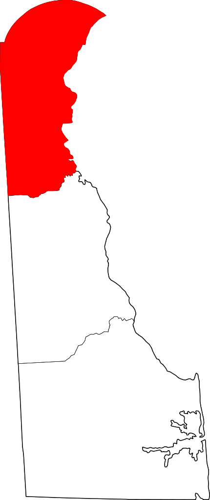
English: This is a locator map showing New Castle County in Delaware. For more information, see Commons:United States county locator maps. |
| Date | |
| Source |
Own work: English: The maps use data from nationalatlas.gov, specifically countyp020.tar.gz on the Raw Data Download page. The maps also use state outline data from statesp020.tar.gz. The Florida maps use hydrogm020.tar.gz to display Lake Okeechobee. |
| Author | David Benbennick |
Licensing
[edit]
| I, the copyright holder of this work, release this work into the public domain. This applies worldwide. In some countries this may not be legally possible; if so: I grant anyone the right to use this work for any purpose, without any conditions, unless such conditions are required by law. |
File history
Click on a date/time to view the file as it appeared at that time.
| Date/Time | Thumbnail | Dimensions | User | Comment | |
|---|---|---|---|---|---|
| current | 19:00, 19 June 2024 | | 926 × 2,205 (7 KB) | Nux (talk | contribs) | fix rendering (remove clipping) |
| 18:59, 19 June 2024 |  | 926 × 2,205 (7 KB) | Nux (talk | contribs) | fix rendering (remove clipping) | |
| 10:31, 12 February 2006 |  | 6,483 × 15,432 (11 KB) | David Benbennick (talk | contribs) | {{subst:User:Dbenbenn/clm|county=New Castle County|state=Delaware}} |
You cannot overwrite this file.
File usage on Commons
There are no pages that use this file.
File usage on other wikis
The following other wikis use this file:
- Usage on ar.wikipedia.org
- ويلمنغتون (ديلاوير)
- نيوارك (ديلاوير)
- نيو كاسل (ديلاوير)
- ديلاوير سيتي
- أردن (ديلاوير)
- أردنتاون (ديلاوير)
- أردنكروفت (ديلاوير)
- بيلفونت (ديلاوير)
- كلايتون (ديلاوير)
- إلسمر (ديلاوير)
- أوديسا (ديلاوير)
- تاونسند (ديلاوير)
- سميرنا (ديلاوير)
- ميلدتاون (ديلاوير)
- نيوبورت (ديلاوير)
- قائمة مقاطعات ديلاوير
- بروكسايد (ديلاوير)
- غرينفيل (ديلاوير)
- نورث ستار (ديلاوير)
- بير (ديلاوير)
- بايك كريك (ديلاوير)
- قالب:مقاطعة نيو كاسل (ديلاوير)
- إدجيمور (ديلاوير)
- كلايمونت (ديلاوير)
- هوكيسين (ديلاوير)
- Usage on bg.wikipedia.org
- Usage on bn.wikipedia.org
- Usage on bpy.wikipedia.org
- Usage on bs.wikipedia.org
- Usage on cdo.wikipedia.org
- Usage on cs.wikipedia.org
- Usage on da.wikipedia.org
- Usage on de.wikipedia.org
- Liste der Countys in Delaware
- Bear (Delaware)
- Bellefonte (Delaware)
- Brookside (Delaware)
- Claymont
- Clayton (Delaware)
- Delaware City
- Edgemoor (Delaware)
- Elsmere (Delaware)
- Glasgow (Delaware)
- Greenville (Delaware)
- Hockessin
- Middletown (Delaware)
- Newark (Delaware)
- New Castle (Delaware)
- Newport (Delaware)
View more global usage of this file.