File:Map of North Carolina highlighting Rowan County.svg
Jump to navigation
Jump to search

Size of this PNG preview of this SVG file: 800 × 303 pixels. Other resolutions: 320 × 121 pixels | 640 × 243 pixels | 1,024 × 388 pixels | 1,280 × 485 pixels | 2,560 × 971 pixels | 8,061 × 3,056 pixels.
Original file (SVG file, nominally 8,061 × 3,056 pixels, file size: 236 KB)
Captions
Captions
Add a one-line explanation of what this file represents
| Description |
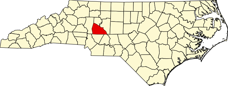
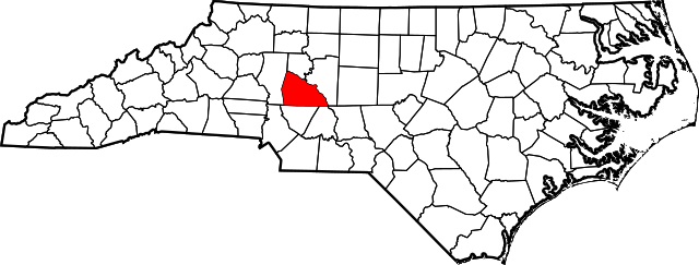
English: This is a locator map showing Rowan County in North Carolina. |
| Source | Own work |
| Author | David Benbennick made this map. For more information, see Commons:United States county locator maps. |
| I, the copyright holder of this work, release this work into the public domain. This applies worldwide. In some countries this may not be legally possible; if so: I grant anyone the right to use this work for any purpose, without any conditions, unless such conditions are required by law. |
File history
Click on a date/time to view the file as it appeared at that time.
| Date/Time | Thumbnail | Dimensions | User | Comment | |
|---|---|---|---|---|---|
| current | 15:57, 12 February 2006 | 8,061 × 3,056 (236 KB) | David Benbennick (talk | contribs) | {{subst:User:Dbenbenn/clm|county=Rowan County|state=North Carolina|type=county}} |
You cannot overwrite this file.
File usage on Commons
The following 4 pages use this file:
File usage on other wikis
The following other wikis use this file:
- Usage on af.wikipedia.org
- Usage on ar.wikipedia.org
- Usage on bg.wikipedia.org
- Usage on bpy.wikipedia.org
- Usage on cdo.wikipedia.org
- Usage on ceb.wikipedia.org
- Usage on ce.wikipedia.org
- Usage on cs.wikipedia.org
- Usage on cy.wikipedia.org
- Usage on de.wikipedia.org
- Usage on en.wikipedia.org
- Usage on es.wikipedia.org
- Usage on et.wikipedia.org
- Usage on eu.wikipedia.org
- Usage on fa.wikipedia.org
- Usage on ga.wikipedia.org
- Usage on hu.wikipedia.org
- Usage on id.wikipedia.org
- Usage on it.wikipedia.org
- Usage on ja.wikipedia.org
- Usage on ko.wikipedia.org
- Usage on nds.wikipedia.org
- Usage on nl.wikipedia.org
- Usage on no.wikipedia.org
- Usage on pl.wikipedia.org
- Usage on pnb.wikipedia.org
- Usage on pt.wikipedia.org
- Usage on ro.wikipedia.org
- Usage on ru.wikipedia.org
- Usage on sh.wikipedia.org
- Usage on simple.wikipedia.org
- Usage on sr.wikipedia.org
- Usage on sv.wikipedia.org
- Usage on tr.wikipedia.org
View more global usage of this file.