File:Map of North Dakota highlighting Cass County.svg
Jump to navigation
Jump to search

Size of this PNG preview of this SVG file: 800 × 476 pixels. Other resolutions: 320 × 191 pixels | 640 × 381 pixels | 1,024 × 610 pixels | 1,280 × 762 pixels | 2,560 × 1,524 pixels | 1,935 × 1,152 pixels.
Original file (SVG file, nominally 1,935 × 1,152 pixels, file size: 41 KB)
Captions
Captions
Add a one-line explanation of what this file represents
Summary
[edit]
| Description |
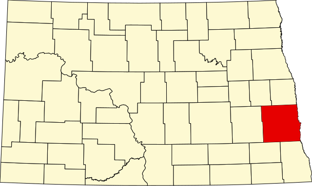
English: This is a locator map showing Cass County in North Dakota. For more information, see Commons:United States county locator maps. |
| Date | |
| Source |
Own work: English: The maps use data from nationalatlas.gov, specifically countyp020.tar.gz on the Raw Data Download page. The maps also use state outline data from statesp020.tar.gz. The Florida maps use hydrogm020.tar.gz to display Lake Okeechobee. |
| Author | David Benbennick |
Licensing
[edit]
| I, the copyright holder of this work, release this work into the public domain. This applies worldwide. In some countries this may not be legally possible; if so: I grant anyone the right to use this work for any purpose, without any conditions, unless such conditions are required by law. |
File history
Click on a date/time to view the file as it appeared at that time.
| Date/Time | Thumbnail | Dimensions | User | Comment | |
|---|---|---|---|---|---|
| current | 18:47, 19 June 2024 | | 1,935 × 1,152 (41 KB) | Nux (talk | contribs) | fix rendering (remove clipping) |
| 16:03, 12 February 2006 |  | 5,804 × 3,456 (56 KB) | David Benbennick (talk | contribs) | {{subst:User:Dbenbenn/clm|county=Cass County|state=North Dakota|type=county}} |
You cannot overwrite this file.
File usage on Commons
The following 4 pages use this file:
File usage on other wikis
The following other wikis use this file:
- Usage on ar.wikipedia.org
- مقاطعة كاس (داكوتا الشمالية)
- فارغو
- أليس (داكوتا الشمالية)
- أمينيا
- أرغوسفيل
- آرثر (داكوتا الشمالية)
- آير، داكوتا الشمالية
- بريروود
- بوفالو (داكوتا الشمالية)
- كازلتون
- دافنبورت (داكوتا الشمالية)
- إندرلين
- فرونتير
- غاردنر (داكوتا الشمالية)
- غراندين
- هاروود
- هوراس (داكوتا الشمالية)
- هانتر
- كندريد
- ليونارد (داكوتا الشمالية)
- مابلتون (داكوتا الشمالية)
- نورث ريفر
- أوكسبو
- بيج (داكوتا الشمالية)
- برايري روز
- ريليس أكريس
- تاور سيتي
- ويست فارغو
- قالب:مقاطعة كاس (داكوتا الشمالية)
- Usage on bg.wikipedia.org
- Usage on bpy.wikipedia.org
- Usage on ca.wikipedia.org
- Amenia (Dakota del Nord)
- Argusville
- Arthur (Dakota del Nord)
- Ayr (Dakota del Nord)
- Briarwood (Dakota del Nord)
- Buffalo (Dakota del Nord)
- Casselton
- Davenport (Dakota del Nord)
- Enderlin
- Erie (Dakota del Nord)
- Fargo (Dakota del Nord)
- Frontier (Dakota del Nord)
- Gardner (Dakota del Nord)
- Grandin (Dakota del Nord)
- Harwood (Dakota del Nord)
- Horace (Dakota del Nord)
- Hunter (Dakota del Nord)
- Kindred
View more global usage of this file.