File:Map of Ohio highlighting Vinton County.svg
Jump to navigation
Jump to search

Size of this PNG preview of this SVG file: 551 × 599 pixels. Other resolutions: 221 × 240 pixels | 442 × 480 pixels | 706 × 768 pixels | 942 × 1,024 pixels | 1,884 × 2,048 pixels | 3,675 × 3,995 pixels.
Original file (SVG file, nominally 3,675 × 3,995 pixels, file size: 58 KB)
Captions
Captions
Add a one-line explanation of what this file represents
Summary[edit]
| Description |
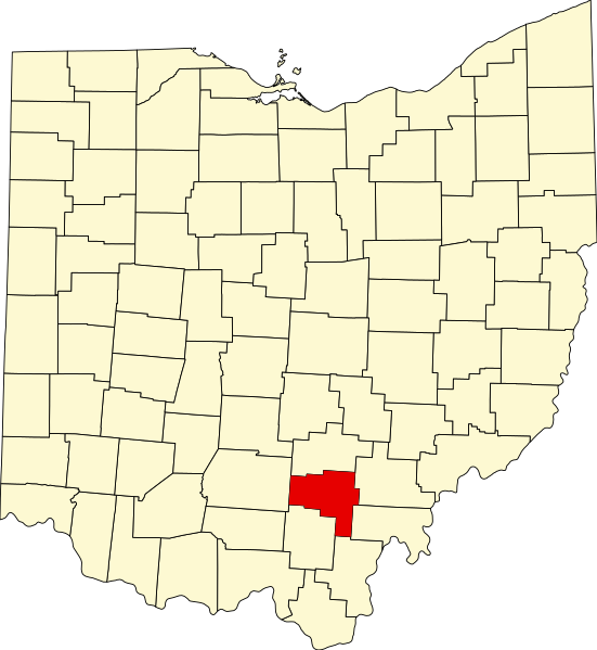
English: This is a locator map showing Vinton County in Ohio. For more information, see Commons:United States county locator maps. |
| Date | |
| Source |
Own work: English: The maps use data from nationalatlas.gov, specifically countyp020.tar.gz on the Raw Data Download page. The maps also use state outline data from statesp020.tar.gz. The Florida maps use hydrogm020.tar.gz to display Lake Okeechobee. |
| Author | David Benbennick |
Licensing[edit]
| I, the copyright holder of this work, release this work into the public domain. This applies worldwide. In some countries this may not be legally possible; if so: I grant anyone the right to use this work for any purpose, without any conditions, unless such conditions are required by law. |
File history
Click on a date/time to view the file as it appeared at that time.
| Date/Time | Thumbnail | Dimensions | User | Comment | |
|---|---|---|---|---|---|
| current | 16:11, 12 February 2006 | | 3,675 × 3,995 (58 KB) | David Benbennick (talk | contribs) | {{subst:User:Dbenbenn/clm|county=Vinton County|state=Ohio|type=county}} |
You cannot overwrite this file.
File usage on Commons
The following 7 pages use this file:
- Category:Geography of Vinton County, Ohio
- Category:Maps of Vinton County, Ohio
- Category:National Register of Historic Places in Vinton County, Ohio
- Category:People of Vinton County, Ohio
- Category:Populated places in Vinton County, Ohio
- Category:Villages in Vinton County, Ohio
- Category:Vinton County, Ohio
File usage on other wikis
The following other wikis use this file:
- Usage on ar.wikipedia.org
- Usage on bg.wikipedia.org
- Usage on bpy.wikipedia.org
- Usage on cdo.wikipedia.org
- Usage on ceb.wikipedia.org
- Usage on cy.wikipedia.org
- Usage on da.wikipedia.org
- Usage on de.wikipedia.org
- Usage on en.wikipedia.org
- List of counties in Ohio
- Vinton County, Ohio
- Hamden, Ohio
- McArthur, Ohio
- Wilkesville, Ohio
- Zaleski, Ohio
- Moonville, Ohio
- Eagle Township, Vinton County, Ohio
- Template:Vinton County, Ohio
- Brown Township, Vinton County, Ohio
- Clinton Township, Vinton County, Ohio
- Elk Township, Vinton County, Ohio
- Harrison Township, Vinton County, Ohio
- Jackson Township, Vinton County, Ohio
- Knox Township, Vinton County, Ohio
- Madison Township, Vinton County, Ohio
- Richland Township, Vinton County, Ohio
- Swan Township, Vinton County, Ohio
- Vinton Township, Vinton County, Ohio
- Wilkesville Township, Vinton County, Ohio
- Creola, Ohio
- New Plymouth, Ohio
- Ray, Ohio
- Ingham, Ohio
- Oreton, Ohio
- Trinity Episcopal Church (McArthur, Ohio)
- User:Nyttend/County templates/OH/2
- Wikipedia:WikiProject Ohio/County Templates/2
- National Register of Historic Places listings in Vinton County, Ohio
- Masonic Lodge No. 472
- Template:NRHP in Vinton County, Ohio
- Zaleski Mound Group
- Ratcliffe Mound
- Hope Furnace
View more global usage of this file.