File:Map to show the Limits of Kuwait and Adjacent Country (1913).jpg
קפיצה לניווט
קפיצה לחיפוש

גודל התצוגה המקדימה הזאת: 614 × 599 פיקסלים. רזולוציות אחרות: 246 × 240 פיקסלים | 492 × 480 פיקסלים | 787 × 768 פיקסלים | 1,050 × 1,024 פיקסלים | 2,099 × 2,048 פיקסלים | 3,457 × 3,373 פיקסלים.
לקובץ המקורי (3,457 × 3,373 פיקסלים, גודל הקובץ: 1.13 מ"ב, סוג MIME: image/jpeg)
כיתובים
כיתובים
נא להוסיף משפט שמסביר מה הקובץ מייצג
תקציר
[עריכה].jpg&action=edit§ion=1)
| תיאור |
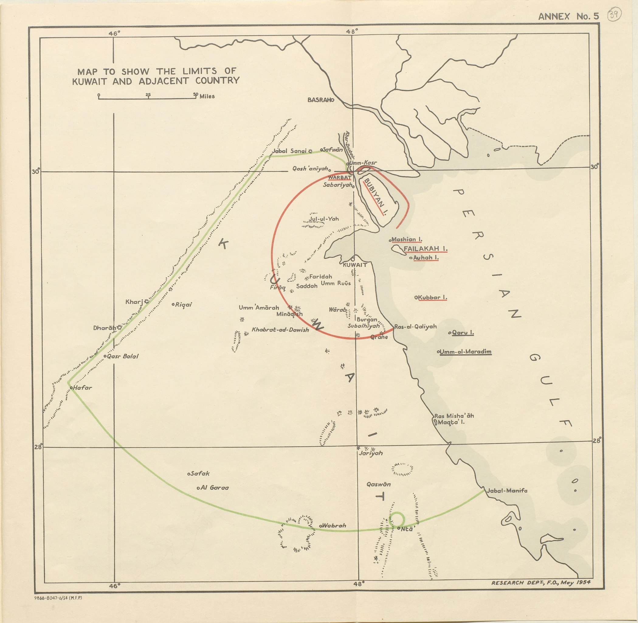
English: Map of the inner and outer zones of diminishing Kuwaiti Authority (Red Line and Green Line) defined by the 1913 Anglo-Ottoman Convention [1] |
| תאריך יצירה | 1913? 1954? |
| מקור | https://www.qdl.qa/en/archive/81055/vdc_100023550810.0x000050 |
| יוצר | British Government |
רישיון
[עריכה].jpg&action=edit§ion=2)
This work created by the United Kingdom Government is in the public domain.
This is because it is one of the following:
HMSO has declared that the expiry of Crown Copyrights applies worldwide (ref: HMSO Email Reply)
|
 |
היסטוריית הקובץ
ניתן ללחוץ על תאריך/שעה כדי לראות את הקובץ כפי שנראה באותו זמן.
| תאריך/שעה | תמונה ממוזערת | ממדים | משתמש | הערה | |
|---|---|---|---|---|---|
| נוכחית | 12:37, 26 ביולי 2018 | | 3,373 × 3,457 (1.13 מ"ב) | Ratzer (שיחה | תרומות) | Cropped 4 % horizontally, 6 % vertically using CropTool with precise mode. |
| 10:02, 26 ביולי 2018 |  | 3,600 × 3,611 (1.31 מ"ב) | Ratzer (שיחה | תרומות) | User created page with UploadWizard |
אין באפשרותך לדרוס את הקובץ הזה.
שימוש בקובץ
אין דפים המשתמשים בקובץ זה.
שימוש גלובלי בקובץ
אתרי הוויקי השונים הבאים משתמשים בקובץ זה:
- שימוש באתר ar.wikipedia.org
- שימוש באתר bs.wikipedia.org
- שימוש באתר en.wikipedia.org
- שימוש באתר fa.wikipedia.org
- שימוש באתר he.wikipedia.org
- שימוש באתר hr.wikipedia.org
- שימוש באתר id.wikipedia.org
- שימוש באתר it.wikipedia.org
- שימוש באתר ja.wikipedia.org
- שימוש באתר nl.wikipedia.org
- שימוש באתר ru.wikipedia.org
- שימוש באתר uk.wikipedia.org
- שימוש באתר www.wikidata.org
.jpg&oldid=727651199)