Category:Borders
Jump to navigation
Jump to search
legal boundary between two geographic regions  | |||||
| Upload media | |||||
| Pronunciation audio | |||||
|---|---|---|---|---|---|
| Instance of | |||||
| Subclass of |
| ||||
| Part of | |||||
| Has part(s) | |||||
| Different from | |||||
| Partially coincident with | |||||
| |||||

Subcategories
This category has the following 47 subcategories, out of 47 total.
!
*
4
- 45th Parallel Monument (4 F)
A
- Borders in art (4 F)
B
- Bamboo Curtain (Cold War) (2 F)
- Beating the bounds (14 F)
C
- Carragunt Bridge (4 F)
D
E
F
G
L
M
N
O
P
- Postcards of borders (7 F)
Q
R
S
T
X
~
Media in category "Borders"
The following 179 files are in this category, out of 179 total.
-
 BSicon lGRENZE.svg 500 × 500; 598 bytes
-
 "Teška" uspomena - panoramio.jpg 3,648 × 2,736; 2.2 MB
-
 20130613-DSC 9111 (9294278156).jpg 4,928 × 3,264; 1.78 MB
-
 2016 - Dryburgh Abbey to Tweedbank (26007800472).jpg 4,928 × 2,988; 2.56 MB
-
 2016 - Dryburgh Abbey to Tweedbank (26074376416).jpg 4,928 × 3,264; 2.26 MB
-
 20th parallel Africa-as.svg 400 × 400; 55 KB
-
 20th parallel Africa-bn.svg 400 × 400; 55 KB
-
 22nd parallel Africa-as.svg 500 × 500; 84 KB
-
 22nd parallel Africa-bn.svg 500 × 500; 84 KB
-
 22nd parallel Africa.svg 500 × 500; 82 KB
-
 24th meridian Sudan.png 330 × 260; 46 KB
-
 25th meridian Libya.png 330 × 354; 25 KB
-
 26th parallel Africa-as.svg 300 × 300; 52 KB
-
 26th parallel Africa-bn.svg 300 × 300; 51 KB
-
 26th parallel Africa.svg 300 × 300; 50 KB
-
 28th parallel Argentina.png 520 × 1,004; 39 KB
-
 28th parallel Mexico.svg 976 × 655; 220 KB
-
 36th parallel Argentina.png 520 × 1,004; 40 KB
-
 42nd parallel Argentina.png 520 × 1,004; 40 KB
-
 45th parallel US-as.svg 959 × 593; 66 KB
-
 45th parallel US-bn.svg 959 × 593; 66 KB
-
 45th parallel US.svg 959 × 593; 66 KB
-
 46th parallel Argentina.png 520 × 1,004; 40 KB
-
 A Methode cover border.svg 5,631 × 8,891; 1.3 MB
-
 Across the Leaderfoot Viaduct (25827484950).jpg 4,928 × 3,264; 4.5 MB
-
 Alice Gaskon, No Borders, installation detail.jpg 3,888 × 2,592; 1.03 MB
-
 AltmarkBrandenborg.png 219 × 175; 25 KB
-
 Lord Balitmore's own plan - proposed Maryland-Pennsylvania boundary (NYPL b15519023-478186).tiff 4,720 × 5,819; 78.59 MB
-
-

-
 The San Juan award (NYPL b20767366-5452679).jpg 7,892 × 6,366; 61.26 MB
-
 The San Juan award (NYPL b20767366-5452679).tiff 10,328 × 7,760, 2 pages; 229.61 MB
-
 Bagaran-Plateau (Armenien) 26.08 2001 Tal des Arpa Çayı.jpg 2,681 × 1,748; 1.28 MB
-
 Beach closeups Walk to Siccar Point (7974385269).jpg 4,928 × 3,264; 1.83 MB
-
 Beautiful jaflong.jpg 4,160 × 3,120; 4.33 MB
-
 Bifa Elbewerft Mai 1990.jpg 1,513 × 981; 1.28 MB
-
 Bong Ti9111.JPG 1,260 × 840; 402 KB
-
 Border at Bản-Giốc Waterfalls.jpg 4,032 × 3,024; 4.26 MB
-
 Border of Hutt River Province.jpg 2,816 × 2,112; 2.91 MB
-
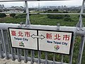 Border of Taipei and New Taipei.jpg 3,264 × 2,448; 2.41 MB
-
 Border cracks- approaching border security from a complexity theory and systems perspective (IA bordercracksppro1094527901).pdf 1,275 × 1,650, 154 pages; 1.71 MB
-
 Borders between fields, Kulluwal road, Sialkot.jpg 2,971 × 1,683; 1.56 MB
-

-
 Burns' popular songs - title frame.png 1,005 × 1,746; 278 KB
-
 BV042528096.tif 10,672 × 4,638; 76.65 MB
-
 Cabinda, R. Congo, D.R. Congo, Angola.png 380 × 370; 18 KB
-
 Cairn Northumberland and Durham.jpg 2,780 × 2,866; 1.67 MB
-
 Charles Crawford (2).jpg 4,000 × 3,000; 1.68 MB
-
 Charles Crawford (3).jpg 4,000 × 3,000; 4.73 MB
-
 Charles Crawford.jpg 4,000 × 3,000; 1.69 MB
-
 Civil Összefogás Fórum - Hegyeshalom, 2015.10.17 (4).JPG 4,320 × 3,240; 5.39 MB
-
 Closed, Ski Area Boundary, Not Patrolled Beyond This Point sign.jpg 1,536 × 2,560; 1.08 MB
-
 Coast Line and Remains of St. Helen's Church (7974373528).jpg 4,808 × 3,205; 1.82 MB
-
 Conflicto Limitrofe Yucatan Campeche Quintana Roo.PNG 1,471 × 1,188; 87 KB
-
 Countries By Land Border.png 2,560 × 1,312; 265 KB
-
 CRON laser wall.png 361 × 307; 241 KB
-
 Crossing the border (6054038361).jpg 4,000 × 3,000; 2.49 MB
-
 Cửa khẩu Quốc tế Hà Tiên.jpg 5,184 × 3,456; 8.1 MB
-
De-Grenze.ogg 1.6 s; 16 KB
-
 Denver Mountain Park Property; MFP.jpg 2,848 × 2,136; 1.91 MB
-
 DSC 1499-1 (14289951711).jpg 6,000 × 3,750; 17.98 MB
-
 DSC 1502-2 (14313471783).jpg 4,969 × 2,795; 8.15 MB
-
 DSC 1503-1 (14289941411).jpg 5,564 × 3,130; 13.81 MB
-
 DSC 1518-4 (14293273135).jpg 6,000 × 3,375; 15.12 MB
-
 DSC 1519-5 (14293266535).jpg 5,703 × 3,802; 11.84 MB
-
 Easternmost corner of Hungary - end of the road at the Ukrainian border.jpg 4,032 × 3,024; 12.12 MB
-
 Eckabrundung Schwebelweg Berlin-Spandau ALK Berlin 2014.tiff 220 × 205, 2 pages; 100 KB
-
 Eckabschrägung Bolteweg Berlin-Spandau ALK Berlin 2014.tif 220 × 205, 2 pages; 103 KB
-
 Eckabschrägung Neue Straße Berlin-Spandau ALK Berlin 2014.tif 278 × 260, 2 pages; 128 KB
-
 Elephant Butte, DMP boundary.jpg 2,848 × 2,136; 1.94 MB
-
 Entering CSM, Campus Boundaries sign.jpg 1,578 × 1,188; 410 KB
-
 European countries by population (2020-2023).png 680 × 520; 153 KB
-
 Feather border.jpg 800 × 101; 9 KB
-
 Forteresse frontalière.JPG 1,578 × 2,257; 1.57 MB
-
 Galashiels, November 2017 (3) - Flickr - daniel0685.jpg 4,608 × 3,072; 5.45 MB
-
 Gaza Border Wall.jpg 2,272 × 1,704; 893 KB
-
 Geographic Map of the Captaincy of Mato Grosso WDL910.png 1,192 × 1,024; 2.49 MB
-
 GermanEmpireProclamationWithBorders.png 800 × 592; 1.81 MB
-
 Granični prijelaz Brgat.JPG 1,024 × 768; 546 KB
-
 Granični prijelaz Ivanica.JPG 1,024 × 768; 553 KB
-
 Granični prijelaz na Brgatu.JPG 1,024 × 768; 552 KB
-
 Grensekilt.jpg 3,456 × 5,184; 9.32 MB
-
 Grenzzaun Platsch am Wanderweg gesperrt.jpg 4,056 × 2,704; 2.59 MB
-
 Grenzzaun Platsch gesperrt.jpg 4,056 × 2,704; 2.48 MB
-
 Groundwater at Galwan Ladakh.png 1,920 × 1,080; 2.71 MB
-
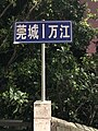 Guancheng-Wanjing border.jpg 3,024 × 4,032; 4.27 MB
-
 Hermann Stamm.jpg 1,127 × 751; 420 KB
-
 Hermanos..JPG 3,240 × 4,320; 5.13 MB
-
 Hutton's Unconformity (7974454926).jpg 4,547 × 3,032; 2.95 MB
-
 Iguaçu River.jpg 5,312 × 2,988; 2.71 MB
-
 Immigration borders-02.svg 512 × 410; 49 KB
-
 India-Pakistan border in Attari, Punjab, India.jpg 2,250 × 3,731; 2 MB
-
 Info.Tabule.Rozdelene.Svety.Sumava.jpg 4,608 × 3,456; 6.28 MB
-
 Johannes Grenzstein 02.jpg 3,024 × 4,032; 5.42 MB
-
 Juarez-Lincoln International Bridge.jpg 4,128 × 2,322; 922 KB
-
 Kampa La pass.JPG 3,216 × 2,136; 2.36 MB
-
 Khanjrab Top.jpg 6,000 × 4,000; 1.1 MB
-
 Kuwait and Neutral Zones CIA map 1991.jpg 1,940 × 1,664; 436 KB
-
 Land use boundary - geograph.org.uk - 1779966.jpg 640 × 480; 93 KB
-
 Leaderfoot Viaduct (26033973211).jpg 4,928 × 3,264; 2.92 MB
-
 Leaderfoot Viaduct (26100326275).jpg 4,928 × 2,464; 1.09 MB
-
 Lenin peak from Sary-mogol.jpg 2,048 × 1,536; 723 KB
-
 Lhakpa La pass-2 10.JPG 1,500 × 996; 610 KB
-
 Lichen rock map (7974375616).jpg 4,928 × 3,264; 3.78 MB
-
 Livingstone, Zambia (48597799226).jpg 4,608 × 3,456; 5.61 MB
-
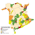 Local Governance Entities of New Brunswick by Municipal Status (2023).svg 1,052 × 1,052; 3.33 MB
-

-
 Map to show the Limits of Kuwait and Adjacent Country (1913).jpg 3,457 × 3,373; 1.13 MB
-
 Maschendrahtzaun - PhotoAtrt - Sascha Grosser.jpg 1,024 × 682; 976 KB
-
 Montagnes blanches.jpg 2,541 × 1,869; 841 KB
-
 Motor Coach 2937.jpg 3,264 × 2,448; 1.66 MB
-
 Nationalpark Kongernes Nordsjælland boundaries 2023.jpg 1,710 × 1,140; 1.41 MB
-
 Natural-man-made (7974361851).jpg 4,799 × 3,199; 1.91 MB
-
 NEPAL Route 2.JPG 1,500 × 1,072; 1,024 KB
-
 North Macedonia border barrier (border stone 59).jpg 1,080 × 607; 84 KB
-
 Norway and Sweden 22 Nov 2018 (45953492062).jpg 6,765 × 3,817; 4.91 MB
-
 Not sure what this is. a sea fan? (7974354749).jpg 4,928 × 3,264; 1.87 MB
-
 Nyalam gorges 10.JPG 2,136 × 3,216; 2.03 MB
-
 Nyalam gorges 12.JPG 3,216 × 2,136; 2.89 MB
-
 Old railway tracks (26100325615).jpg 4,928 × 3,264; 4.27 MB
-
 Ontario Manitoba Boundaries (1915).jpg 3,408 × 5,086; 6.2 MB
-
 Over the bridge (25827480990).jpg 4,928 × 3,264; 4.84 MB
-
 Pablo Martin Alonso (2).jpg 4,000 × 3,000; 3.73 MB
-
 Pablo Martin Alonso (3).jpg 4,000 × 3,000; 4.24 MB
-
 Pablo Martin Alonso (4).jpg 4,000 × 3,000; 3.9 MB
-
 Pablo Martin Alonso (5).jpg 4,000 × 3,000; 3.97 MB
-
 Pablo Martin Alonso.jpg 2,367 × 2,353; 664 KB
-
 Paisaje de frontera de País Xtina.png 567 × 567; 377 KB
-
 Palestine-Israel Historic Borders Over Time.png 4,849 × 2,156; 2.47 MB
-
 Panorámicas frontera Metepec-San Mateo 01.jpg 4,576 × 1,184; 997 KB
-
 Panorámicas frontera Metepec-San Mateo 02.jpg 4,576 × 1,152; 954 KB
-
 Panorámicas frontera Metepec-San Mateo 03.jpg 4,352 × 1,120; 1.16 MB
-
 Panorámicas frontera Metepec-San Mateo 04.jpg 4,576 × 1,184; 1.52 MB
-
 Panorámicas frontera Metepec-San Mateo 05.jpg 4,448 × 1,120; 1.31 MB
-
 Panorámicas frontera Metepec-San Mateo 06.jpg 4,576 × 1,184; 1.54 MB
-
 Panorámicas frontera Metepec-San Mateo 07.jpg 4,576 × 832; 1.1 MB
-
 Panorámicas frontera Metepec-San Mateo 08.jpg 4,544 × 1,184; 1.4 MB
-
 Pictorial Life of Christ-page border.png 1,719 × 2,730; 3.16 MB
-
 Pole Sotdae (229399635).jpeg 1,364 × 2,048; 1.3 MB
-
 Politisk asyl.jpg 354 × 246; 32 KB
-
 Pryvalka.jpg 4,000 × 3,000; 4.16 MB
-
 Przełęcz u Trzech Granic.jpg 2,296 × 4,080; 4.24 MB
-
 Radko Hokovský (3).jpg 4,000 × 3,000; 1.54 MB
-
 Reporter Sans Frontières - Reporter Without Borders Album is out ! (8401523057).jpg 2,592 × 2,592; 3.71 MB
-
 Republic - Plato (Jowett) - title page border.png 1,732 × 2,581; 1.09 MB
-
 Roadsign at the border between South Africa and Lesotho.jpg 4,000 × 3,000; 2.63 MB
-
 Ruins of St. Helen's Church (7974377877).jpg 4,928 × 3,264; 2.55 MB
-
 Russian military post at the administrative boundary line of Abkhazia, 2016.jpg 1,280 × 847; 262 KB
-

-
 Sign at Port Stephens - Newcastle Border.jpg 5,152 × 3,864; 7.08 MB
-
 Silver Comet border.jpg 1,536 × 2,048; 1.6 MB
-
 Skane-Halland boundary.jpg 3,648 × 2,736; 2.64 MB
-
 Stacheldrahtzaun - Grenze.jpg 1,024 × 682; 415 KB
-
 Technological University Taunggyi 02.jpg 864 × 1,536; 794 KB
-
 Thailand-Cambodia border and route 2407.jpg 4,080 × 3,072; 2.77 MB
-
 Thailand-Cambodia border at Sai Taku, Khang Lich.jpg 4,080 × 3,072; 2.58 MB
-
 The Melodist - Title frame.png 927 × 1,641; 147 KB
-
 The Musical Charmer - title page woodcut.jpg 966 × 1,630; 179 KB
-
 The Scots Dyke marking the Scottish English Border.jpg 3,000 × 4,000; 3.77 MB
-
 The Song Box - No 4 - title page border and ornament.png 909 × 1,645; 488 KB
-
 The Temple (2nd ed) - George Herbert (1633) - title page border.png 916 × 1,764; 577 KB
-
 Tollstastasjon.jpg 5,184 × 3,456; 4.97 MB
-
 Tussen Martina en Pfunds, grensrivier met Oostenrijk 2012-08-13 15.46.jpg 4,416 × 3,312; 9.55 MB
-
 U.S - Mexico Border Wall.jpg 4,032 × 3,024; 6.39 MB
-
 U.S - Mexico Border Walls.jpg 828 × 500; 173 KB
-
 Ukrainisch-moldawische Grenze am Dnister.JPG 3,648 × 2,736; 2.98 MB
-
 Ulaz u Republiku Hrvatsku.JPG 1,024 × 768; 527 KB
-
 Up through the woods (26007796522).jpg 3,264 × 4,928; 5.65 MB
-
 USPS-CanadaPostCustomsDeclaration.jpg 5,184 × 3,456; 3.14 MB
-
 Vinxtbach Informationstafel.JPG 3,264 × 2,448; 2.79 MB
-
 Vinxtbach Mündung.JPG 2,448 × 3,264; 3.64 MB
-
 Vinxtbach Weiheinschrift.JPG 3,264 × 2,448; 2.3 MB
-
 W Line, Dry Gulch, Lakewood-Denver line from Sheridan Station garage.jpg 3,264 × 1,836; 1.34 MB
-
 With view of the Torness Power Station (7974360299).jpg 4,928 × 3,264; 2.3 MB
-
 Yellow on green (7974379192).jpg 4,928 × 3,264; 2.44 MB
-
 Zangmu frontiere.JPG 1,500 × 1,049; 1.07 MB
-
 Пограничный переход.JPG 3,072 × 2,048; 2.66 MB
-
 东江支流,新塘和东莞的分界河.jpg 4,032 × 3,024; 1.41 MB
-
 大須商店街のライン.jpg 720 × 1,280; 451 KB


.jpg)
.jpg)
.jpg)


.jpg)


.jpg)
.jpg)
_26.08_2001_Tal_des_Arpa_%C3%87ay%C4%B1.jpg)
.jpg)


.jpg)
.jpg)

.JPG)

.jpg)


.jpg)


.jpg)
.jpg)
.jpg)
.jpg)
.jpg)


.png)

_-_Flickr_-_daniel0685.jpg)


.jpg)


.jpg)
.jpg)


.jpg)
.jpg)
.svg)

.jpg)


.jpg)

.jpg)
.jpg)
.jpg)


.jpg)
.jpg)
.jpg)
.jpg)
.jpg)
.jpg)
.jpg)


.jpeg)


.jpg)
.jpg)
_-_title_page_border.png)

.jpg)


_-_George_Herbert_(1633)_-_title_page_border.png)


.jpg)


.jpg)
.jpg)


