File:Mapa veg ultim glac.png
Jump to navigation
Jump to search
No higher resolution available.
Mapa_veg_ultim_glac.png (782 × 549 pixels, file size: 130 KB, MIME type: image/png)
Captions
Captions
Add a one-line explanation of what this file represents
Summary[edit]
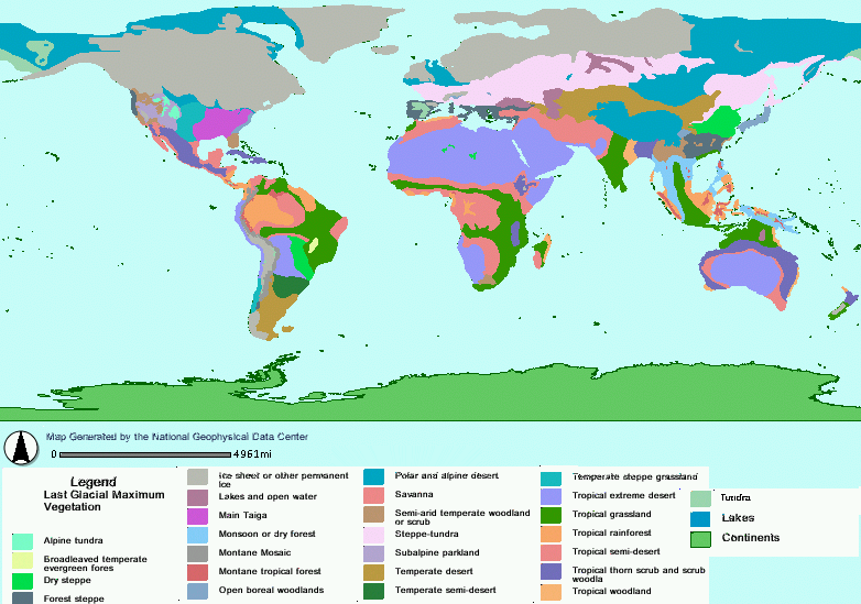
Mapa de vegetación en el pico de la última glaciación (18.000 BP) elaborado a partir de datos polínicos por la NOAA estadounidense.
Licensing[edit]
This image is in the public domain because it contains materials that originally came from the U.S. National Oceanic and Atmospheric Administration, taken or made as part of an employee's official duties.
|
File history
Click on a date/time to view the file as it appeared at that time.
| Date/Time | Thumbnail | Dimensions | User | Comment | |
|---|---|---|---|---|---|
| current | 03:29, 12 October 2005 | | 782 × 549 (130 KB) | Diotime (talk | contribs) | Mapa de vegetación en el pico de la última glaciación (18.000 BP) elaborado a partir de datos polínicos por la NOAA estadounidense. |
You cannot overwrite this file.
File usage on Commons
There are no pages that use this file.
File usage on other wikis
The following other wikis use this file:
- Usage on eo.wikipedia.org
- Usage on fi.wikipedia.org
- Usage on gl.wikipedia.org
- Usage on pt.wikipedia.org