File:Minami-jima Island Karst.JPG
Jump to navigation
Jump to search
Size of this preview: 800 × 561 pixels. Other resolutions: 320 × 224 pixels | 640 × 449 pixels | 1,024 × 718 pixels | 1,280 × 898 pixels | 2,560 × 1,795 pixels | 3,177 × 2,228 pixels.
Original file (3,177 × 2,228 pixels, file size: 3.89 MB, MIME type: image/jpeg)
Captions
Captions
Add a one-line explanation of what this file represents
Summary
[edit]
| Description |
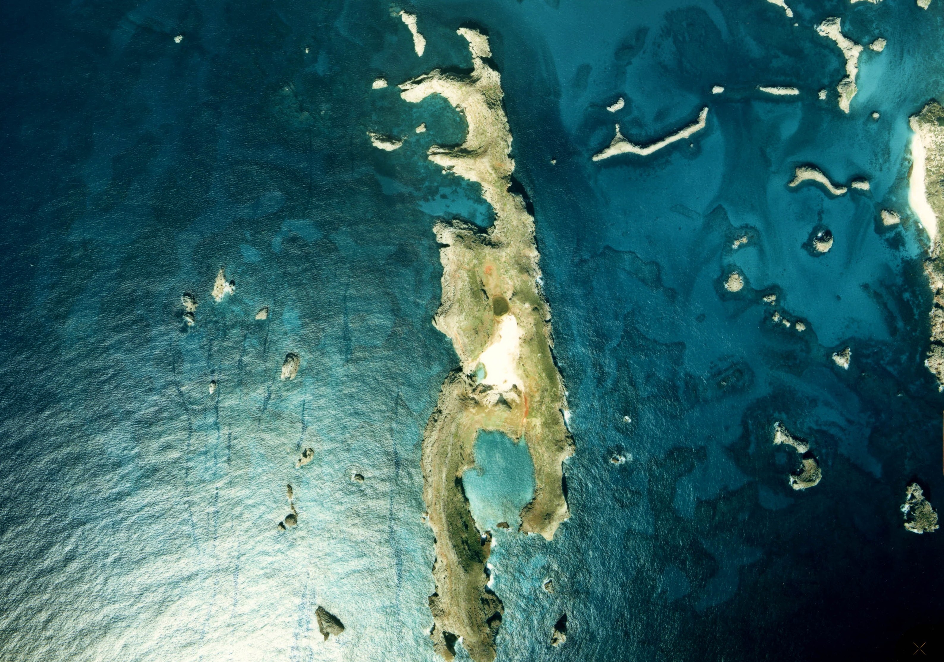
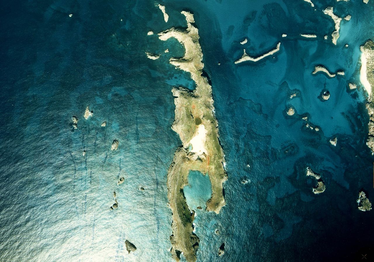
English: Aerial photograph of Minamijima in the Ogasawara Islands, Tokyo, Japan 日本語: 国指定天然記念物、小笠原諸島南島沈水カルスト地形の空中写真。ckt-78-4_c12_3を使用。 |
| Date | |
| Source |
English: National Land Image Information (Color Aerial Photographs) 日本語: 国土情報ウェブマッピングシステム |
| Author |
English: Ministry of Land, Infrastructure, Transport and Tourism of Japan 日本語: 国土交通省 |
Licensing
[edit]

|
The copyright holder of this file, the Ministry of Land, Infrastructure, Transport and Tourism of Japan, allows anyone to use it for any purpose, provided that the copyright holder is properly attributed. Redistribution, derivative work, commercial use, and all other use is permitted. |
Attribution:
Copyright © National Land Image Information (Color Aerial Photographs), Ministry of Land, Infrastructure, Transport and Tourism
|
 |
This image is copyrighted by the Ministry of Land, Infrastructure, Transport and Tourism of Japan. For terms of use, see the stipulation to use of National Land Information (in Japanese) and message from MLIT (in Japanese and English). When you display this image on an article, include the following phrase in the description: "Made based on National Land Image Information (Color Aerial Photographs), Ministry of Land, Infrastructure, Transport and Tourism".
|
File history
Click on a date/time to view the file as it appeared at that time.
| Date/Time | Thumbnail | Dimensions | User | Comment | |
|---|---|---|---|---|---|
| current | 04:31, 6 November 2010 | | 3,177 × 2,228 (3.89 MB) | さかおり (talk | contribs) | {{Information |Description={{en|1={{ja|1=小笠原諸島南島沈水カルスト地形の空中写真。ckt-78-4_c12_3を使用。}} }} {{ja|1=国指定天然記念物、小笠原南島の沈水カルスト地形}} |Source=国土情報ウェブマッピ� |
You cannot overwrite this file.
File usage on Commons
There are no pages that use this file.
File usage on other wikis
The following other wikis use this file:
- Usage on de.wikipedia.org
- Usage on ja.wikipedia.org
- Usage on th.wikipedia.org
- Usage on zh.wikipedia.org