File:Northern and Southern Ireland.png
Jump to navigation
Jump to search
No higher resolution available.
Northern_and_Southern_Ireland.png (415 × 541 pixels, file size: 14 KB, MIME type: image/png)
Captions
Captions
Add a one-line explanation of what this file represents

|
This historical map image could be re-created using vector graphics as an SVG file. This has several advantages; see Commons:Media for cleanup for more information. If an SVG form of this image is available, please upload it and afterwards replace this template with
{{vector version available|new image name}}.
It is recommended to name the SVG file “Northern and Southern Ireland.svg”—then the template Vector version available (or Vva) does not need the new image name parameter. |
Summary[edit]
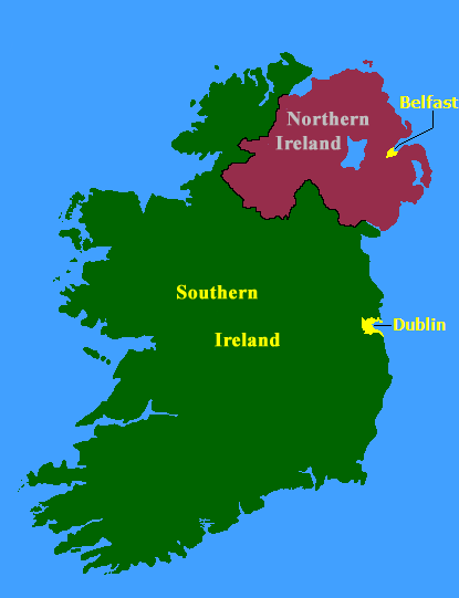
from english wikipedia(21:56, 15 August 2005 . . JW1805 . . 415x541 (14825 bytes)) Map of Northern Ireland and Southern Ireland, created by the Government of Ireland Act, 1920
Licensing[edit]

|
The copyright holder of this work allows anyone to use it for any purpose including unrestricted redistribution, commercial use, and modification.
Usage notes:
|
File history
Click on a date/time to view the file as it appeared at that time.
| Date/Time | Thumbnail | Dimensions | User | Comment | |
|---|---|---|---|---|---|
| current | 12:28, 26 December 2005 | | 415 × 541 (14 KB) | Ideru~commonswiki (talk | contribs) | from [http://en.wikipedia.org/wiki/Image:Northern_and_Southern_Ireland.pngenglish wikipedia](21:56, 15 August 2005 . . JW1805 . . 415x541 (14825 bytes)) Map of Northern Ireland and Southern Ireland, created by the Government of Ireland Act, 1920 |
You cannot overwrite this file.
File usage on Commons
The following 2 pages use this file:
File usage on other wikis
The following other wikis use this file:
- Usage on ar.wikipedia.org
- Usage on ca.wikipedia.org
- Usage on da.wikipedia.org
- Usage on en.wikipedia.org
- Usage on es.wikipedia.org
- Usage on fr.wikipedia.org
- Usage on id.wikipedia.org
- Usage on it.wikipedia.org
- Usage on ja.wikipedia.org
- Usage on ko.wikipedia.org
- Usage on no.wikipedia.org
- Usage on pl.wikipedia.org
- Usage on pt.wikipedia.org
- Usage on ro.wikipedia.org
- Usage on simple.wikipedia.org
- Usage on zh.wikipedia.org