File:Norway Counties Sogn og Fjordane Position.svg
Jump to navigation
Jump to search

Size of this PNG preview of this SVG file: 562 × 600 pixels. Other resolutions: 225 × 240 pixels | 450 × 480 pixels | 719 × 768 pixels | 959 × 1,024 pixels | 1,918 × 2,048 pixels | 740 × 790 pixels.
Original file (SVG file, nominally 740 × 790 pixels, file size: 67 KB)
Captions
Captions
Add a one-line explanation of what this file represents
| Description |
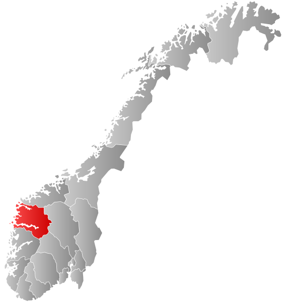
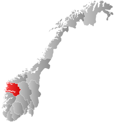
Autogenerated locator map of Norwegian county as named in filename. Exact copy needed at new filename for use in which automatically inserts maps and requires filename to match fylke name. |
| Date | (UTC) |
| Source | |
| Author |
|
| This is a retouched picture, which means that it has been digitally altered from its original version. The original can be viewed here: Norway Counties SognogFjordane Position.svg:
|
I, the copyright holder of this work, hereby publish it under the following license:
This file is licensed under the Creative Commons Attribution-Share Alike 2.5 Generic license.
- You are free:
- to share – to copy, distribute and transmit the work
- to remix – to adapt the work
- Under the following conditions:
- attribution – You must give appropriate credit, provide a link to the license, and indicate if changes were made. You may do so in any reasonable manner, but not in any way that suggests the licensor endorses you or your use.
- share alike – If you remix, transform, or build upon the material, you must distribute your contributions under the same or compatible license as the original.
Original upload log[edit]
This image is a derivative work of the following images:
- File:Norway_Counties_SognogFjordane_Position.svg licensed with Cc-by-sa-2.5
- 2007-09-21T21:28:39Z Marmelad 256x256 (84333 Bytes) {{Information |Description=Autogenerated locator map of norwegian county as named in filename. |Source=Based on [[:Image:Norway counties blank.svg]] |Date=2007-09-21 |Author=[[User:marmelad|Marmelad]] |Permission=Own work, sh
Uploaded with derivativeFX
File history
Click on a date/time to view the file as it appeared at that time.
| Date/Time | Thumbnail | Dimensions | User | Comment | |
|---|---|---|---|---|---|
| current | 08:25, 27 January 2019 | | 740 × 790 (67 KB) | Bjarkan (talk | contribs) | Border update (Rindal). |
| 03:06, 17 December 2017 |  | 740 × 790 (67 KB) | Bjarkan (talk | contribs) | Improved version. | |
| 11:45, 24 January 2016 |  | 740 × 790 (81 KB) | Fleinn (talk | contribs) | Reverted to version as of 13:11, 16 August 2010 (UTC) | |
| 02:03, 19 January 2016 |  | 512 × 512 (82 KB) | Kingsocarso (talk | contribs) | Reverted to version as of 03:46, 6 April 2009 (UTC) | |
| 13:11, 16 August 2010 |  | 740 × 790 (81 KB) | Fleinn (talk | contribs) | Added gradient. | |
| 03:46, 6 April 2009 |  | 512 × 512 (82 KB) | AjaxSmack (talk | contribs) | {{Information |Description=Autogenerated locator map of Norwegian county as named in filename. Exact copy needed at new filename for use in en:Template:Infobox Fylke which automatically inserts maps and requires filename to match ''fylke'' name. |Sour |
You cannot overwrite this file.
File usage on Commons
The following 15 pages use this file:
- Churches in Norway
- Fjords of Norway
- Maps of Norway
- Sogn og Fjordane
- Sognefjorden
- User:Marmelad/gallery/Map
- User:Martin
- File:Norway Counties Sogn og Fjordane Position.svg
- File:Norway Counties SognogFjordane Position.svg (file redirect)
- File:Sogn og Fjordane kart.png
- Category:Lighthouses in Sogn og Fjordane
- Category:Maps of Sogn og Fjordane
- Category:People of Sogn og Fjordane
- Category:Sogn og Fjordane
File usage on other wikis
The following other wikis use this file:
- Usage on af.wikipedia.org
- Usage on ang.wikipedia.org
- Usage on ar.wikipedia.org
- Usage on ast.wikipedia.org
- Usage on azb.wikipedia.org
- Usage on be.wikipedia.org
- Usage on bg.wikipedia.org
- Usage on bpy.wikipedia.org
- Usage on br.wikipedia.org
- Usage on bs.wikipedia.org
- Usage on ca.wikipedia.org
- Usage on da.wikipedia.org
- Usage on en.wikipedia.org
- Sogn og Fjordane
- Flora, Norway
- Balestrand
- Leikanger
- Gaular
- Jølster
- Førde
- Naustdal
- Vågsøy
- Selje
- Hornindal
- Florø
- Eid, Norway
- Borgund, Sogn og Fjordane
- Davik
- Hafslo
- Breim
- Kyrkjebø
- Sør-Vågsøy
- Nord-Vågsøy
- Jostedal
- Bru, Sogn og Fjordane
- Kinn (former municipality)
- Brekke
- Lavik
- Lavik og Brekke
- Vevring
- Eikefjord
- Innvik
- Sogn og Fjordane County Municipality
- Nordic Mining
- Usage on eo.wikipedia.org
- Usage on eu.wikipedia.org
- Usage on fa.wikipedia.org
View more global usage of this file.