File:Obcine Slovenija 2006 Tolmin.svg
Vai alla navigazione
Vai alla ricerca

Dimensioni di questa anteprima PNG per questo file SVG: 800 × 522 pixel. Altre risoluzioni: 320 × 209 pixel | 640 × 418 pixel | 1 024 × 668 pixel | 1 280 × 835 pixel | 2 560 × 1 670 pixel | 2 613 × 1 705 pixel.
File originale (file in formato SVG, dimensioni nominali 2 613 × 1 705 pixel, dimensione del file: 2,36 MB)
Didascalie
Didascalie
Aggiungi una brevissima spiegazione di ciò che questo file rappresenta
Dettagli[modifica]
| Descrizione |
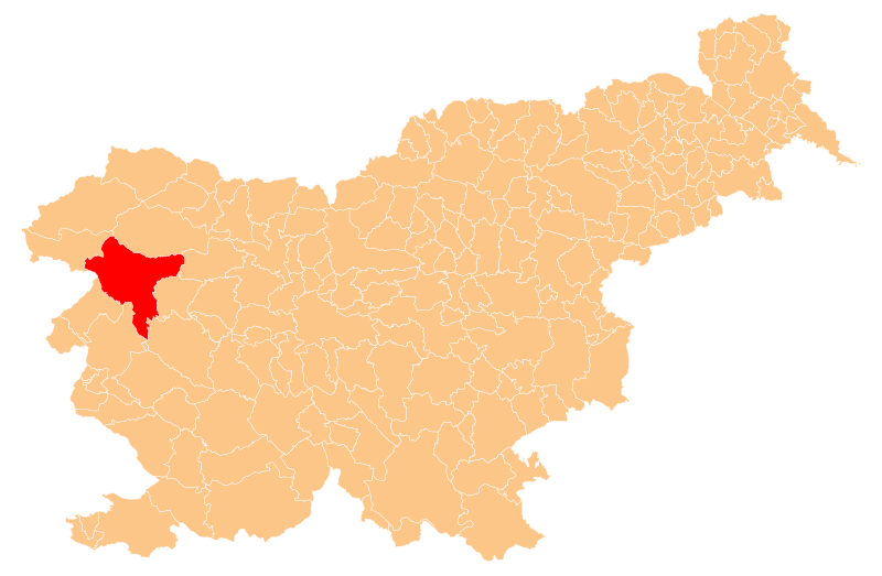
English: Občina Tolmin (marked red) on map of the municipalities (občine) of the Republic of Slovenia, as since May 2006 (210 units). |
| Data | |
| Fonte | Manipulated Image:Obcine Slovenija 2006.svg in text editor. |
| Autore | Source of the public data is GURS (Geodetska uprava Republike Slovenije or Surveying and Mapping Authority of the Republic of Slovenia). Converted from Shapefile to SVG with shp2svg and prepared for Wikipedia by romanm (talk). |
| Licenza (Riusare questo file) |
Public domain. See Image:Obcine Slovenija 2006.svg for an explanation. |
Licenza[modifica]
| Io, detentore del copyright su quest'opera, la rilascio nel pubblico dominio. Questa norma si applica in tutto il mondo. In alcuni paesi questo potrebbe non essere legalmente possibile. In tal caso: Garantisco a chiunque il diritto di utilizzare quest'opera per qualsiasi scopo, senza alcuna condizione, a meno che tali condizioni siano richieste dalla legge. |
Cronologia del file
Fare clic su un gruppo data/ora per vedere il file come si presentava nel momento indicato.
| Data/Ora | Miniatura | Dimensioni | Utente | Commento | |
|---|---|---|---|---|---|
| attuale | 21:07, 25 mag 2009 | | 2 613 × 1 705 (2,36 MB) | Romanm (discussione | contributi) | {{Information |Description={{en|1=''Občina Tolmin'' (marked red) on map of the municipalities (''občine'') of the Republic of Slovenia, as since May 2006 (210 units).}} |Source=Manipulated Image:Obcine Slovenija 2006.svg in text editor. |Author=Sou |
Impossibile sovrascrivere questo file.
Utilizzo del file
Le seguenti 2 pagine usano questo file:
Utilizzo globale del file
Anche i seguenti wiki usano questo file:
- Usato nelle seguenti pagine di bg.wikipedia.org:
- Шаблон:Община Толмин
- Бача при Модрею
- Бача при Подбърду
- Буковски връх
- Воларе
- Волчански Рути
- Волче (община Толмин)
- Габре (община Толмин)
- Горени Лог
- Гореня Требуша
- Горски връх
- Грант (община Толмин)
- Грахово об Бачи
- Грудница
- Дабер
- Доле
- Доленя Требуша
- Долги Лаз
- Дробочник
- Жабче
- Задлаз-Жабче
- Задлаз-Чадръг
- Закрай (община Толмин)
- Затолмин
- Знойле (община Толмин)
- Идрия при Бачи
- Толмин
- Кал (община Толмин)
- Камно
- Каналски Лом
- Клавже
- Кнежа (Словения)
- Кнешке Равне
- Козаршче
- Коритница (община Толмин)
- Козмерице
- Кук (селище)
- Лисец (община Толмин)
- Логаршче
- Лое
- Любин (Словения)
- Модрей
- Модрейце
- Мост на Сочи
- Облоке
- Петрово бърдо (Словения)
- Печине
- Подбърдо
- Подмелец
- Поле (община Толмин)
Visualizza l'utilizzo globale di questo file.