File:Official United Nations World Map - 20 February 2020.svg
跳转到导航
跳转到搜索

此SVG文件的PNG预览的大小:800 × 407像素。 其他分辨率:320 × 163像素 | 640 × 325像素 | 1,024 × 521像素 | 1,280 × 651像素 | 2,560 × 1,302像素 | 1,457 × 741像素。
原始文件 (SVG文件,尺寸为1,457 × 741像素,文件大小:3.12 MB)
说明
说明
添加一行文字以描述该文件所表现的内容
摘要
[编辑]| 描述 |
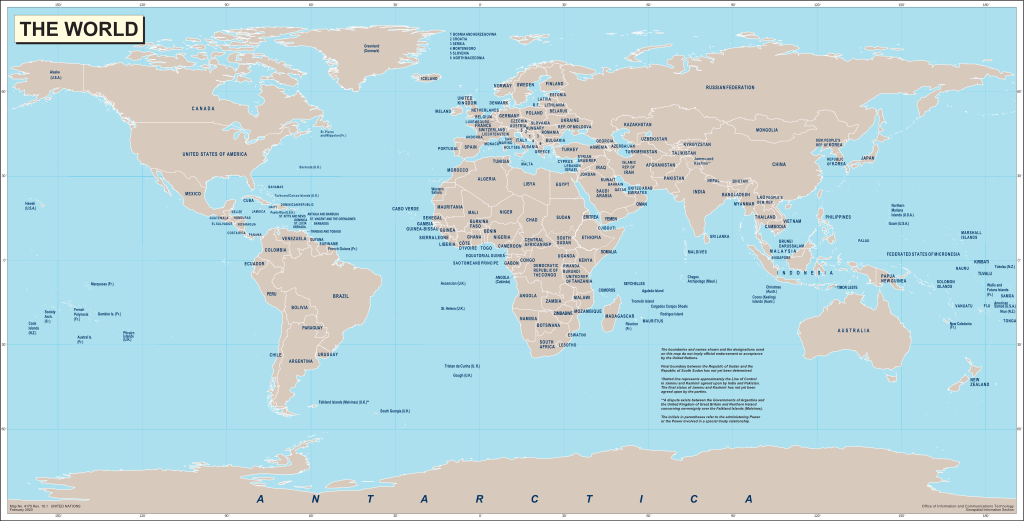
English: World map produced by the United Nations Geospatial Information Section (GIS, formerly Cartographic Section) and released on 20 February 2020.
Français : Carte du monde produite par la Section d'information géospatiale des Nations Unies (SIG, anciennement Section cartographique) et publiée le 20 Février 2020. |
|||
| 日期 | ||||
| 来源 |
English: World map from the United Nations Geospatial Information Section website. Map No. 4170 Rev. 18.1 UNITED NATIONS
February 2020 |
|||
| 作者 | United Nations | |||
| 授权 (二次使用本文件) |
|
|||
| 其他版本 |
|

.svg)
文件历史
点击某个日期/时间查看对应时刻的文件。
| 日期/时间 | 缩略图 | 大小 | 用户 | 备注 | |
|---|---|---|---|---|---|
| 当前 | 2020年7月6日 (一) 06:56 | | 1,457 × 741(3.12 MB) | Yash400(留言 | 贡献) | Converting everything to path, so that text scales properly. |
| 2020年7月3日 (五) 14:13 |  | 1,457 × 741(1.49 MB) | Chipmunkdavis(留言 | 贡献) | Plain svg | |
| 2020年7月3日 (五) 11:50 |  | 1,457 × 741(1.71 MB) | Yash400(留言 | 贡献) | Uploaded own work with UploadWizard |
您不可以覆盖此文件。
文件用途
全域文件用途
以下其他wiki使用此文件:
- en.wikipedia.org上的用途
- en.wiktionary.org上的用途
- zh.wiktionary.org上的用途