File:Operation bagration battle wizebsk 1944 june 22-27.png
Jump to navigation
Jump to search
Size of this preview: 576 × 599 pixels. Other resolutions: 231 × 240 pixels | 461 × 480 pixels | 738 × 768 pixels | 1,088 × 1,132 pixels.
Original file (1,088 × 1,132 pixels, file size: 1.01 MB, MIME type: image/png)
Captions
Captions
Add a one-line explanation of what this file represents
Summary[edit]
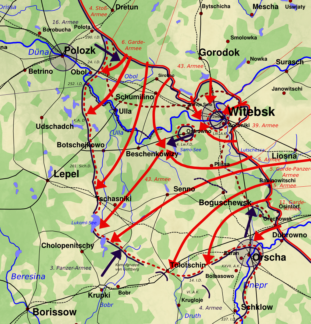
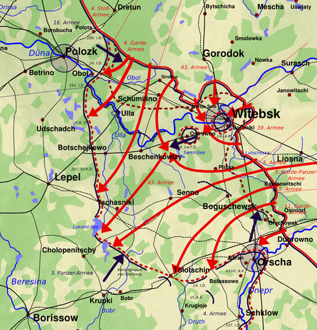
| Description | Operation Bagration: Battle of Witebsk, Development 22nd - 26th June 1944, 2200 |
| Date | |
| Source | Own work |
| Author | Kl833x9 |
The map has been created with the Generic Mapping Tools: https://www.generic-mapping-tools.org/ using one or more of these public-domain datasets for the relief:
|

|
Permission is granted to copy, distribute and/or modify this document under the terms of the GNU Free Documentation License, Version 1.2 or any later version published by the Free Software Foundation; with no Invariant Sections, no Front-Cover Texts, and no Back-Cover Texts. A copy of the license is included in the section entitled GNU Free Documentation License. |
The image is based on maps and data from the following sources:
- С.П. Кирюхин: 43 Армня в Витебской Операции. Военное Издательство Министерства Обороны Союза ССР, Москва 1961, p. 91: [1]
- François de Lannoy: La ruée de l'Armée Rouge, Heimdal-Verlag, Bayeux 2002, ISBN 2-84048-155-3, p. 65,66
- Walter S. Dunn jr.: Soviet Blitzkrieg: The Battle for White Russia, 1944. Lynne Rienner Publishers, 2000, ISBN 1-555-87880-6, p. 101, 130
- Karl-Heinz Frieser (Hrsg. i.A. des MGFA); Das Deutsche Reich und der Zweite Weltkrieg - Band 8: Karl-Heinz Frieser, Klaus Schmider, Klaus Schönherr, Gerhard Schreiber, Kristián Ungváry, Bernd Wegner; Die Ostfront 1943/44 - Der Krieg im Osten und an den Nebenfronten; Deutsche Verlags-Anstalt München 2007; ISBN 978-3-421-06235-2, p. 577
- David M. Glantz; Soviet Military Deception in the Second World War, Frank Cass, London, 1989; ISBN 0-7146-3347-X: p. 373, 375
- Атлас БССР / Академия наук БССР. Главное управление геодезии и картографии МВД СССР: Минск-Москва, 1958: geographical data of forests, p. 46
- Схемы автомобильных дорог СССР 1945 года, Воениздат НКО, 1945: [2]
![[1]](http://rkkaww2.armchairgeneral.com/maps/1944NW/1PF/43A_Kiryuikhin04_June24_27_44.jpg)
Licensing[edit]
I, the copyright holder of this work, hereby publish it under the following licenses:
|
|
Permission is granted to copy, distribute and/or modify this document under the terms of the GNU Free Documentation License, Version 1.2 or any later version published by the Free Software Foundation; with no Invariant Sections, no Front-Cover Texts, and no Back-Cover Texts. A copy of the license is included in the section entitled GNU Free Documentation License. |
This file is licensed under the Creative Commons Attribution-Share Alike 3.0 Unported, 2.5 Generic, 2.0 Generic and 1.0 Generic license.
- You are free:
- to share – to copy, distribute and transmit the work
- to remix – to adapt the work
- Under the following conditions:
- attribution – You must give appropriate credit, provide a link to the license, and indicate if changes were made. You may do so in any reasonable manner, but not in any way that suggests the licensor endorses you or your use.
- share alike – If you remix, transform, or build upon the material, you must distribute your contributions under the same or compatible license as the original.
You may select the license of your choice.
File history
Click on a date/time to view the file as it appeared at that time.
| Date/Time | Thumbnail | Dimensions | User | Comment | |
|---|---|---|---|---|---|
| current | 19:35, 14 August 2013 | | 1,088 × 1,132 (1.01 MB) | Ras67 (talk | contribs) | cropped |
| 17:23, 17 January 2010 |  | 1,096 × 1,140 (1.22 MB) | Kl833x9~commonswiki (talk | contribs) | redesigned map | |
| 18:04, 22 November 2008 |  | 947 × 1,265 (1 MB) | Kl833x9~commonswiki (talk | contribs) | {{Information |Description= |Source= |Date= |Author= |Permission= |other_versions= }} | |
| 09:18, 19 April 2008 |  | 958 × 1,278 (509 KB) | Kl833x9~commonswiki (talk | contribs) | new, more detailed version, {{Bild-GFDL-GMT}} | |
| 09:39, 5 April 2008 |  | 960 × 1,281 (600 KB) | Kl833x9~commonswiki (talk | contribs) | new version of map with caption {{Bild-GFDL-GMT}} {{self|GFDL|cc-by-sa-3.0,2.5,2.0,1.0}} | |
| 20:08, 30 March 2008 |  | 960 × 884 (469 KB) | Kl833x9~commonswiki (talk | contribs) | {{Information |Description=Operation Bagration: Battle of Wizebsk, Development 22th - 27th June 1944 |Source=self-made |Date=23.09.2007 |Author= Kl833x9 }} {{Bild-GFDL-GMT}} The image is based on maps and data from the following sources: | |
| 11:37, 23 September 2007 |  | 1,822 × 1,694 (2.76 MB) | Kl833x9~commonswiki (talk | contribs) | {{Information |Description=Operation Bagration: Battle of Wizebsk, Development 22th - 27th June 1944 |Source=self-made |Date=23.09.2007 |Author= Kl833x9 }} {{Image-GFDL-GMT}} |
You cannot overwrite this file.
File usage on Commons
The following 2 pages use this file:
File usage on other wikis
The following other wikis use this file:
- Usage on be.wikipedia.org
- Usage on cs.wikipedia.org
- Usage on de.wikipedia.org
- Usage on el.wikipedia.org
- Usage on en.wikipedia.org
- Operation Bagration
- Vitebsk–Orsha offensive
- 67th Guards Rifle Division
- 251st Rifle Division
- 371st Rifle Division
- 16th Guards Rifle Division
- 26th Guards Rifle Division
- 71st Guards Rifle Division
- 204th Rifle Division (Soviet Union)
- 97th Rifle Division
- 83rd Guards Rifle Division
- 84th Guards Rifle Division
- 91st Guards Rifle Division
- 235th Rifle Division
- Usage on fa.wikipedia.org
- Usage on fr.wikipedia.org
- Usage on hu.wikipedia.org
- Usage on la.wikipedia.org
- Usage on nl.wikipedia.org
- Usage on ru.wikipedia.org
- Usage on uk.wikipedia.org
- Usage on vi.wikipedia.org
- Usage on www.wikidata.org
- Usage on zh.wikipedia.org