File:Outline Map of Ingushetia.svg
Jump to navigation
Jump to search

Size of this PNG preview of this SVG file: 438 × 599 pixels. Other resolutions: 175 × 240 pixels | 351 × 480 pixels | 562 × 768 pixels | 749 × 1,024 pixels | 1,498 × 2,048 pixels | 512 × 700 pixels.
Original file (SVG file, nominally 512 × 700 pixels, file size: 186 KB)
Captions
Captions
Add a one-line explanation of what this file represents
Summary[edit]
| Description |
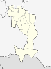
Русский: Позиционная карта Республики Ингушетия
|top = 43.7 |bottom = 42.5 |left = 44.3 |right = 45.5 |
|||||||
| Date | ||||||||
| Source |
Own work This W3C-unspecified vector image was created with Inkscape .
|
|||||||
| Author | ||||||||
| Other versions |
[]
|
|||||||
| SVG development |


.svg)

Licensing[edit]
| I, the copyright holder of this work, release this work into the public domain. This applies worldwide. In some countries this may not be legally possible; if so: I grant anyone the right to use this work for any purpose, without any conditions, unless such conditions are required by law. |
File history
Click on a date/time to view the file as it appeared at that time.
| Date/Time | Thumbnail | Dimensions | User | Comment | |
|---|---|---|---|---|---|
| current | 19:58, 24 August 2023 | | 512 × 700 (186 KB) | Takhirgeran Umar (talk | contribs) | Reverted to version as of 16:05, 17 March 2023 (UTC) |
| 20:58, 26 March 2023 |  | 512 × 700 (62 KB) | Targimhoï (talk | contribs) | Reverted to version as of 16:43, 8 September 2010 (UTC) | |
| 16:05, 17 March 2023 |  | 512 × 700 (186 KB) | Нох88 (talk | contribs) | Reverted to version as of 08:02, 11 January 2020 (UTC) | |
| 02:13, 1 February 2023 |  | 512 × 700 (62 KB) | Niyskho (talk | contribs) | Reverted to version as of 16:43, 8 September 2010 (UTC) | |
| 08:02, 11 January 2020 |  | 512 × 700 (186 KB) | Takhirgeran Umar (talk | contribs) | Карта без рек | |
| 16:43, 8 September 2010 |  | 512 × 700 (62 KB) | Виктор В (talk | contribs) | Очередная версия, на этот раз, на основе СТП. | |
| 15:46, 7 September 2010 |  | 512 × 700 (45 KB) | Виктор В (talk | contribs) | исправления на основе maps.rosreestr.ru | |
| 07:35, 5 September 2010 |  | 512 × 700 (48 KB) | Виктор В (talk | contribs) | == {{int:filedesc}} == {{Information |Description={{ru|1=Позиционная карта Республики Ингушетия *Проекция — равноугольная. *Стандартная параллель — 43°00′00″с.ш. *Па� |
You cannot overwrite this file.
File usage on Commons
The following 5 pages use this file:
.svg)
File usage on other wikis
The following other wikis use this file:
- Usage on af.wikipedia.org
- Usage on ar.wikipedia.org
- Usage on azb.wikipedia.org
- Usage on bg.wikipedia.org
- Usage on ceb.wikipedia.org
- Usage on da.wikipedia.org
- Usage on de.wikipedia.org
- Magas (Inguschetien)
- Nasran
- Malgobek
- Karabulak (Russland)
- Sunscha (Inguschetien)
- Vorlage:Positionskarte Russland Republik Inguschetien
- Ekaschewo
- Kantyschewo
- Nesterowskaja
- Ali-Jurt
- Benutzer:Amga/Info ISO-3166-2:RU
- Galaschki
- Troizkaja (Inguschetien)
- Plijewo
- Surchachi
- Barsuki (Inguschetien)
- Sagopschi
- Dscheirach
- Usage on en.wikipedia.org
- Magas
- Nazran
- Sagopshi
- Tkhaba-Yerdy Church
- Sunzha
- Malgobek
- Karabulak, Republic of Ingushetia
- Module:Location map/data/Russia Ingushetia/doc
- North Caucasian Federal District
- Galashki
- Nesterovskaya, Republic of Ingushetia
- 2014 Winter Olympics torch relay
- Dzheyrakh
- Tamariani
- Furtoug
- Beyni
- Alby-Yerdy Temple
- Module:Location map/data/Russia Ingushetia
- Oktyabrskoye, Prigorodny District, North Ossetia–Alania
- Troitskaya, Republic of Ingushetia
- Gazi-Yurt
- Tarskoye
- Tyarsh
- Tsori
View more global usage of this file.