File:Port of Dover - view from the White Cliffs-4101-03.jpg
跳转到导航
跳转到搜索
本预览的尺寸:800 × 314像素。 其他分辨率:320 × 125像素 | 640 × 251像素 | 1,024 × 401像素 | 1,280 × 502像素 | 2,560 × 1,003像素 | 7,785 × 3,051像素。
原始文件 (7,785 × 3,051像素,文件大小:3.14 MB,MIME类型:image/jpeg)
说明
说明
添加一行文字以描述该文件所表现的内容
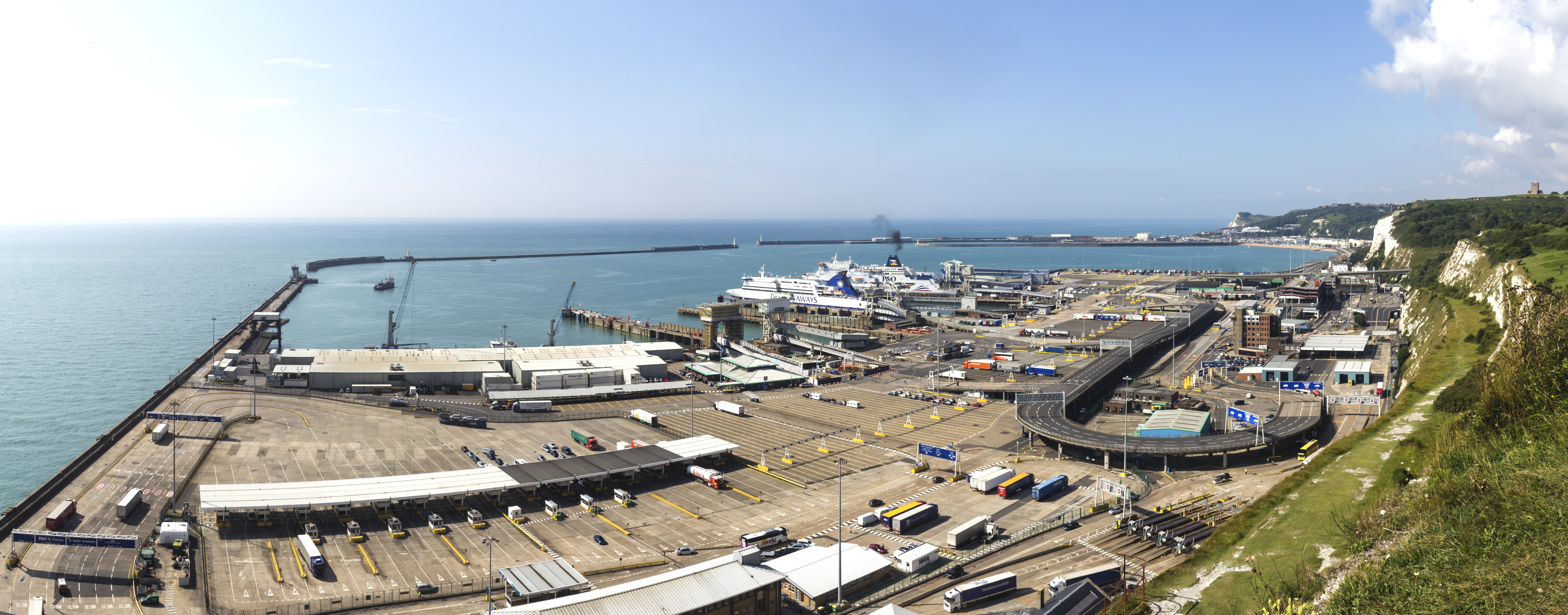
Port of Dover - view from the White Cliffs
摘要
[编辑]| 描述 |
English: Port of Dover - view from the White Cliffs Deutsch: Hafen von Dover. Blick herab von den weißen Klippen von Dover |
|||||||||||||||||
| 日期 | ||||||||||||||||||
| 来源 | 自己的作品 | |||||||||||||||||
| 作者 |
|
|||||||||||||||||
| 其他版本 |
|
|||||||||||||||||
| 署名 (由许可协议要求) | © Raimond Spekking / | |||||||||||||||||


| 相机位置 | | 在以下服务上查看本图像和附近其他图像: OpenStreetMap |
|---|

|
注意:这是一张全景图,使用PanoramaStudio将3张图片拼接而成。所以该图片经过了某些数字化的操作。这些操作可能包括混合,模糊,克隆,以及颜色和角度的调整。由于这些调整,图片在接缝处可能和真实照片有一些差异。这些操作往往会带来镜头,透视和视差方面的失真。
|
许可协议
[编辑]
I have published this image as author under the Creative-Commons-Licence CC BY-SA 4.0.. This means that free online usage outside of Wikimedia projects under the following terms of licence is possible:
- The image is credited with "© Raimond Spekking / CC BY-SA 4.0 (via Wikimedia Commons)"
For all other kind of usages (books, journales, flyers, etc.) click on the following button. You will get all information needed.
I would be happy to receive a specimen copy or the URL of the website where the image is used.
Please write an email to raimond.spekking@gmail.com (GPG encrypted emails are welcome: Key-ID: 0xB12BE7A6), if you
- need the image in a higher resolution
- need my postal address for sending a specimen copy
- have further questions to the terms of licence
我,本作品著作权人,特此采用以下许可协议发表本作品:
本文件采用知识共享署名-相同方式共享 4.0 国际许可协议授权。
署名: © Raimond Spekking / CC BY-SA 4.0 (via Wikimedia Commons)
- 您可以自由地:
- 共享 – 复制、发行并传播本作品
- 修改 – 改编作品
- 惟须遵守下列条件:
- 署名 – 您必须对作品进行署名,提供授权条款的链接,并说明是否对原始内容进行了更改。您可以用任何合理的方式来署名,但不得以任何方式表明许可人认可您或您的使用。
- 相同方式共享 – 如果您再混合、转换或者基于本作品进行创作,您必须以与原先许可协议相同或相兼容的许可协议分发您贡献的作品。
| 注解 | 该图片含有注解:在维基媒体共享资源上查看注解 |
文件历史
点击某个日期/时间查看对应时刻的文件。
| 日期/时间 | 缩略图 | 大小 | 用户 | 备注 | |
|---|---|---|---|---|---|
| 当前 | 2014年11月6日 (四) 19:04 | 7,785 × 3,051(3.14 MB) | Raymond(留言 | 贡献) | User created page with UploadWizard |
您不可以覆盖此文件。
文件用途
以下3个页面使用本文件:
全域文件用途
以下其他wiki使用此文件:
- bn.wikipedia.org上的用途
- ceb.wikipedia.org上的用途
- de.wikipedia.org上的用途
- de.wiktionary.org上的用途
- en.wikipedia.org上的用途
- eu.wikipedia.org上的用途
- fi.wikipedia.org上的用途
- fr.wikipedia.org上的用途
- gv.wikipedia.org上的用途
- hak.wikipedia.org上的用途
- he.wikipedia.org上的用途
- hi.wikipedia.org上的用途
- lt.wikipedia.org上的用途
- no.wikipedia.org上的用途
- pt.wiktionary.org上的用途
- sr.wikipedia.org上的用途
- ta.wikipedia.org上的用途
- www.wikidata.org上的用途
- yi.wikipedia.org上的用途
- zh.wikipedia.org上的用途
- zh.wiktionary.org上的用途