File:Puebla en México.svg
Jump to navigation
Jump to search

Size of this PNG preview of this SVG file: 800 × 536 pixels. Other resolutions: 320 × 215 pixels | 640 × 429 pixels | 1,024 × 686 pixels | 1,280 × 858 pixels | 2,560 × 1,716 pixels | 2,497 × 1,674 pixels.
Original file (SVG file, nominally 2,497 × 1,674 pixels, file size: 321 KB)
Captions
Captions
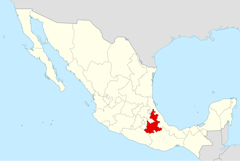
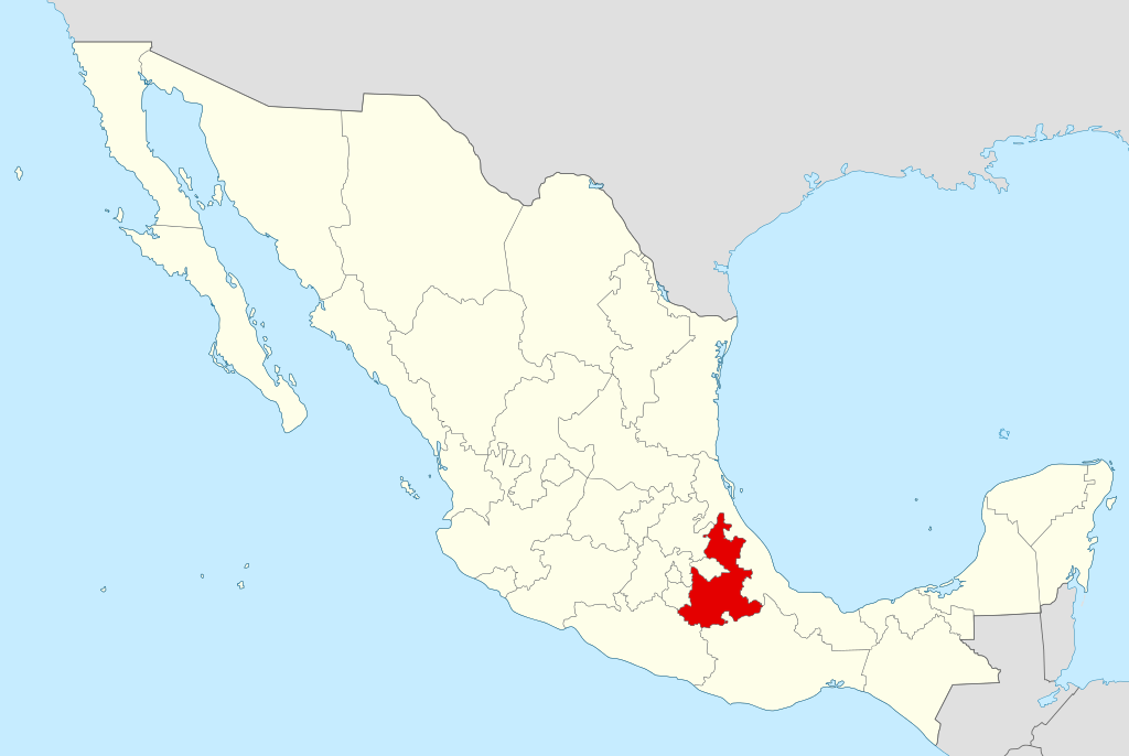
Map showing where is the State of Puebla in Mexico.
| Description |
Español: Ubicación del estado de Puebla en la República Mexicana |
||
| Date | |||
| Source | Own work | ||
| Author | Yavidaxiu | ||
| Permission (Reusing this file) |
|
File history
Click on a date/time to view the file as it appeared at that time.
| Date/Time | Thumbnail | Dimensions | User | Comment | |
|---|---|---|---|---|---|
| current | 13:09, 12 May 2013 | | 2,497 × 1,674 (321 KB) | El Comandante (talk | contribs) | Reverted to version as of 20:53, 12 January 2011 : color normalisation (cf. the other maps of the Category:SVG_maps_of_Mexico, such as File:Map of Mexico BCN.svg |
| 21:06, 9 May 2013 |  | 974 × 653 (218 KB) | Giggette (talk | contribs) | Reverted to version as of 00:33, 21 April 2007 | |
| 21:04, 9 May 2013 |  | 974 × 653 (262 KB) | Giggette (talk | contribs) | Reverted to version as of 00:52, 21 April 2007 estilo y forma como los demás | |
| 20:53, 12 January 2011 |  | 2,497 × 1,674 (321 KB) | Yavidaxiu (talk | contribs) | Líneas sobrantes | |
| 20:38, 12 January 2011 |  | 2,500 × 1,677 (321 KB) | Yavidaxiu (talk | contribs) | Normalización de colores | |
| 14:49, 29 September 2010 |  | 974 × 653 (276 KB) | Yavidaxiu (talk | contribs) | Color y bordes | |
| 00:52, 21 April 2007 |  | 974 × 653 (262 KB) | Yavidaxiu (talk | contribs) | ||
| 00:33, 21 April 2007 |  | 974 × 653 (218 KB) | Yavidaxiu (talk | contribs) | ||
| 00:30, 21 April 2007 |  | 974 × 653 (218 KB) | Yavidaxiu (talk | contribs) | {{Information |Description={{es|Ubicación del estado de Puebla en la República Mexicana}} |Source= Trabajo propio |Date= 20 de abril de 2007 |Author= Yavidaxiu |Permission= {{PD-self}} |other_versions= }} Category:Maps of Puebla [[Category:Maps of |
You cannot overwrite this file.
File usage on Commons
The following 2 pages use this file:
File usage on other wikis
The following other wikis use this file:
- Usage on af.wikipedia.org
- Usage on an.wikipedia.org
- Usage on cy.wikipedia.org
- Usage on el.wikipedia.org
- Usage on en.wikipedia.org
- Popocatépetl
- Cholula, Puebla
- Puebla
- Pico de Orizaba
- Atlixco
- Tehuacán
- Santo Tomás Hueyotlipan
- Malinche (volcano)
- San Gabriel Chilac
- Aljojuca
- Morelos Cañada
- Chinantla
- Acatlán de Osorio
- Ahuacatlán Municipality, Puebla
- Amozoc de Mota
- San Martín Texmelucan
- Izúcar de Matamoros
- La Mixteca
- Tetela de Ocampo
- Huaquechula
- Template:Puebla-geo-stub
- San Bernardo, Puebla
- San Bernardino Lagunas
- Wikipedia:WikiProject Mexico/State templates
- Template:Puebla
- Guadalupe Victoria, Puebla
- Vicente Guerrero, Puebla
- La Malinche National Park
- Chiautla de Tapia
- Ajalpan
- Acajete Municipality, Puebla
- Ciudad Serdán
- Acateno
- Acatzingo
- Acteopan
- Ahuatlán
- Ahuazotepec
- Ahuehuetitla
- Ajalpan Municipality
- Albino Zertuche
- Altepexi
- Amixtlán
- Amozoc Municipality
- Aquixtla
- Atempan
- Atexcal
View more global usage of this file.