File:Qeila west of Hebron.jpg
File originale (981 × 605 pixel, dimensione del file: 1 022 KB, tipo MIME: image/jpeg)
Didascalie
Didascalie
Dettagli[modifica]
| Descrizione |
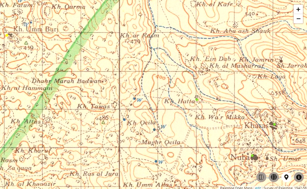
English: Biblical settlement of Keilah (Khirbet Qila), west of Hebron |
||||||
| Data | |||||||
| Fonte |
|
||||||
| Autore |
The British Survey of Western Palestine - 1940s-1950s Copyright for the Survey of Palestine and PEF Survey maps:
|


Licenza[modifica]
- Tu sei libero:
- di condividere – di copiare, distribuire e trasmettere quest'opera
- di modificare – di adattare l'opera
- Alle seguenti condizioni:
- attribuzione – Devi fornire i crediti appropriati, un collegamento alla licenza e indicare se sono state apportate modifiche. Puoi farlo in qualsiasi modo ragionevole, ma non in alcun modo che suggerisca che il licenziante approvi te o il tuo uso.
- condividi allo stesso modo – Se remixi, trasformi o sviluppi il materiale, devi distribuire i tuoi contributi in base alla stessa licenza o compatibile all'originale.
Cronologia del file
Fare clic su un gruppo data/ora per vedere il file come si presentava nel momento indicato.
| Data/Ora | Miniatura | Dimensioni | Utente | Commento | |
|---|---|---|---|---|---|
| attuale | 12:09, 4 ott 2020 | | 981 × 605 (1 022 KB) | Davidbena (discussione | contributi) | Uploaded a work by The British Survey of Western Palestine - 1940s-1950s Copyright for the Survey of Palestine and PEF Survey maps: {{PD-UKGov}} {{PD-IsraelGov}} HMSO has declared that the expiry of Crown Copyrights applies worldwide. Applies to a photograph taken prior to 1 June 1957 - This work was created or ordered by the State of Israel, and is in the public domain because it satisfies one of the conditions stipulated in Israel's copyright statute from 2007 (translation) regarding the St... |
Impossibile sovrascrivere questo file.
Utilizzo del file
Nessuna pagina utilizza questo file.
Utilizzo globale del file
Anche i seguenti wiki usano questo file: