File:Romania Galati Location map.jpg
Jump to navigation
Jump to search
Size of this preview: 527 × 599 pixels. Other resolutions: 211 × 240 pixels | 422 × 480 pixels | 640 × 728 pixels.
Original file (640 × 728 pixels, file size: 77 KB, MIME type: image/jpeg)
Captions
Captions
Add a one-line explanation of what this file represents

|
This map image could be re-created using vector graphics as an SVG file. This has several advantages; see Commons:Media for cleanup for more information. If an SVG form of this image is available, please upload it and afterwards replace this template with
{{vector version available|new image name}}.
It is recommended to name the SVG file “Romania Galati Location map.svg”—then the template Vector version available (or Vva) does not need the new image name parameter. |


Summary
[edit]
| Description |
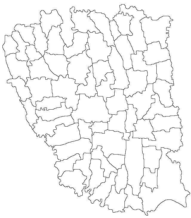
English: Map of Galati County with limits of communes |
| Date | |
| Source | Derivative of file Harta jud Galati.png |
| Author | Radufan |
Licensing
[edit]
This file is licensed under the Creative Commons Attribution-Share Alike 3.0 Unported license.
- You are free:
- to share – to copy, distribute and transmit the work
- to remix – to adapt the work
- Under the following conditions:
- attribution – You must give appropriate credit, provide a link to the license, and indicate if changes were made. You may do so in any reasonable manner, but not in any way that suggests the licensor endorses you or your use.
- share alike – If you remix, transform, or build upon the material, you must distribute your contributions under the same or compatible license as the original.
File history
Click on a date/time to view the file as it appeared at that time.
| Date/Time | Thumbnail | Dimensions | User | Comment | |
|---|---|---|---|---|---|
| current | 02:06, 30 April 2013 | | 640 × 728 (77 KB) | Afil (talk | contribs) | Updated limits of communes. Derivative of existing map on Wikicommons |
| 23:07, 15 November 2011 |  | 640 × 728 (75 KB) | Afil (talk | contribs) |
You cannot overwrite this file.
File usage on Commons
The following 2 pages use this file:
File usage on other wikis
The following other wikis use this file:
- Usage on ar.wikipedia.org
- Usage on ceb.wikipedia.org
- Usage on en.wikipedia.org
- Usage on fr.wikipedia.org
- Usage on he.wikipedia.org
- Usage on kn.wikipedia.org
- Usage on pl.wikipedia.org
- Gałacz
- Tecuci
- Târgu Bujor
- Berești
- Stadion Oțelul
- Moduł:Mapa/dane/Gałacz
- Moduł:Mapa/dane/RO-GL
- Galați (stacja kolejowa)
- Barcea
- Podoleni
- Bălăbănești (okręg Gałacz)
- Burscucani
- Lungești (okręg Gałacz)
- Zimbru (okręg Gałacz)
- Bălășești (okręg Gałacz)
- Ciurești (okręg Gałacz)
- Ciureștii Noi
- Pupezeni
- Băleni (okręg Gałacz)
- Băneasa (okręg Gałacz)
- Roșcani (okręg Gałacz)
- Berești-Meria
- Aldești (okręg Gałacz)
- Balintești
- Onciu
- Pleșa (okręg Gałacz)
- Prodănești (okręg Gałacz)
- Puricani
- Săseni (okręg Gałacz)
- Slivna (okręg Gałacz)
- Șipote (okręg Gałacz)
- Brăhășești
- Corcioveni
- Cosițeni (okręg Gałacz)
- Toflea
- Braniștea (okręg Gałacz)
- Lozova (okręg Gałacz)
- Traian (okręg Gałacz)
- Vasile Alecsandri (okręg Gałacz)
- Buciumeni (okręg Gałacz)
View more global usage of this file.