File:Russian Empire 1745 General Map (HQ).jpg
Jump to navigation
Jump to search

Size of this preview: 800 × 463 pixels. Other resolutions: 320 × 185 pixels | 640 × 370 pixels | 1,024 × 592 pixels | 1,280 × 740 pixels | 2,560 × 1,480 pixels | 10,404 × 6,015 pixels.
Original file (10,404 × 6,015 pixels, file size: 17.02 MB, MIME type: image/jpeg)
Captions
Captions
Add a one-line explanation of what this file represents
| Warning | The original file is very high-resolution. It might not load properly or could cause your browser to freeze when opened at full size. |
|---|
Summary
[edit]| Description |
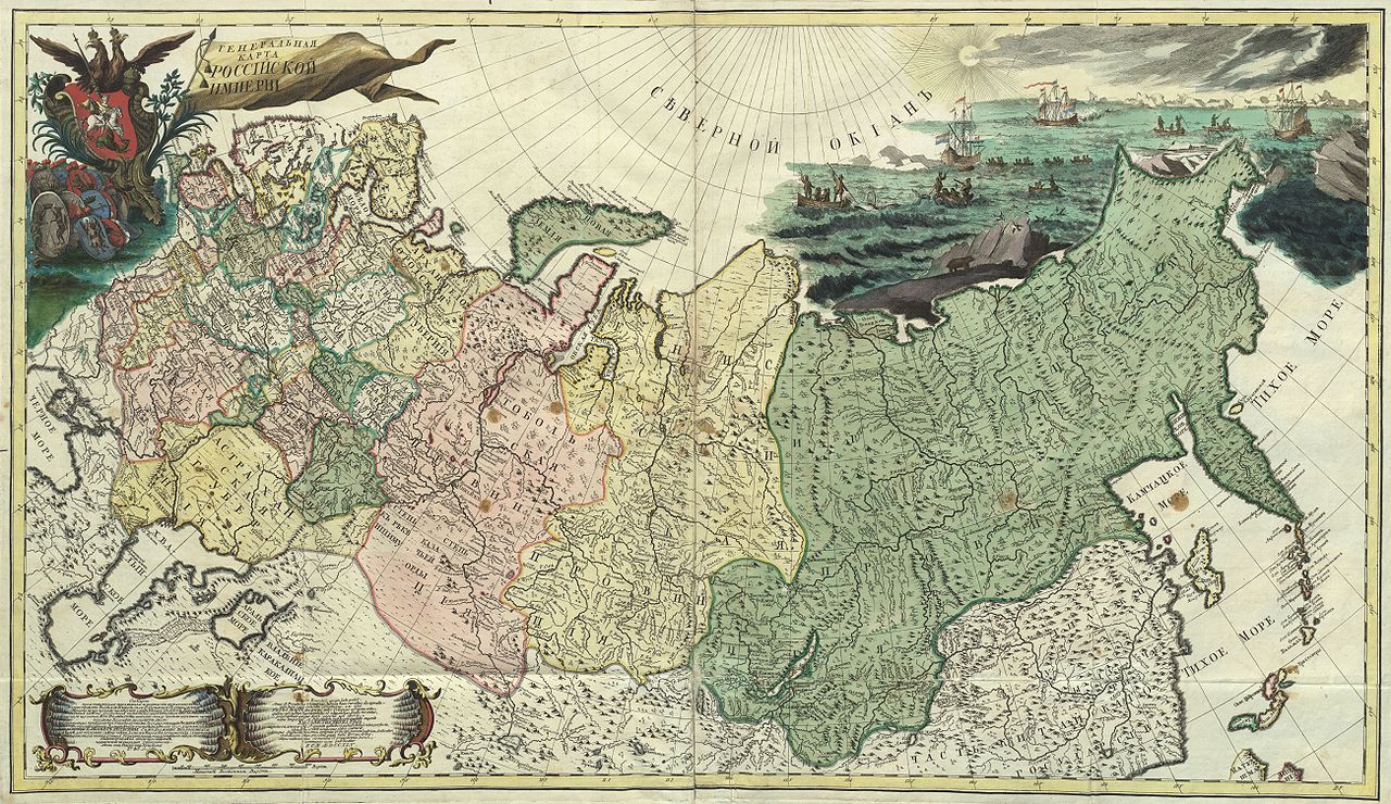
Русский: Генеральная карта Российской Империи из первого официального атласа Российской империи (1745).
English: First official geographic atlas of the Russian Empire (1745). General Map of the Russian Empire. |
| Date | |
| Source |
Русский: Атлас Российский (1745), цифровая копия сделана Российской государственной библиотекой (http://www.rsl.ru)
English: Geographic atlas of the Russian Empire (1745), digital copy made by Russian State Library (http://www.rsl.ru/en) |
| Author | РАН (Russian Academy of Science) |
| Other versions |
|
.jpg)

.jpg&flash=no)
.jpg)
.jpg&action=edit§ion=1)
Licensing
[edit].jpg&action=edit§ion=2)
|
This work is in the public domain in its country of origin and other countries and areas where the copyright term is the author's life plus 100 years or fewer. This work is in the public domain in the United States because it was published (or registered with the U.S. Copyright Office) before January 1, 1929. | |
| This file has been identified as being free of known restrictions under copyright law, including all related and neighboring rights. | |
File history
Click on a date/time to view the file as it appeared at that time.
| Date/Time | Thumbnail | Dimensions | User | Comment | |
|---|---|---|---|---|---|
| current | 20:14, 5 November 2009 | | 10,404 × 6,015 (17.02 MB) | Transcend (rus) (talk | contribs) | == {{int:filedesc}} == {{Information |Description={{ru|1=Генеральная карта Российской Империи из первого официального атласа Российской империи (1745).}} {{en|1= First official g |
You cannot overwrite this file.
File usage on Commons
The following 2 pages use this file:
File usage on other wikis
The following other wikis use this file:
- Usage on cs.wikipedia.org
- Usage on et.wikipedia.org
- Usage on lt.wikipedia.org
- Usage on ru.wikipedia.org
- Usage on uk.wikipedia.org
.jpg&oldid=821976951)