File:Saint Jorioz vu de la Cochette.jpg
Jump to navigation
Jump to search

Size of this preview: 800 × 530 pixels. Other resolutions: 320 × 212 pixels | 640 × 424 pixels | 1,024 × 678 pixels | 1,280 × 848 pixels | 3,038 × 2,012 pixels.
Original file (3,038 × 2,012 pixels, file size: 3.86 MB, MIME type: image/jpeg)
Captions
Captions
Add a one-line explanation of what this file represents
Summary
[edit]
| Description |
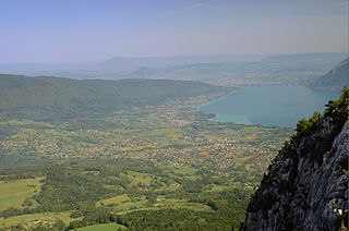
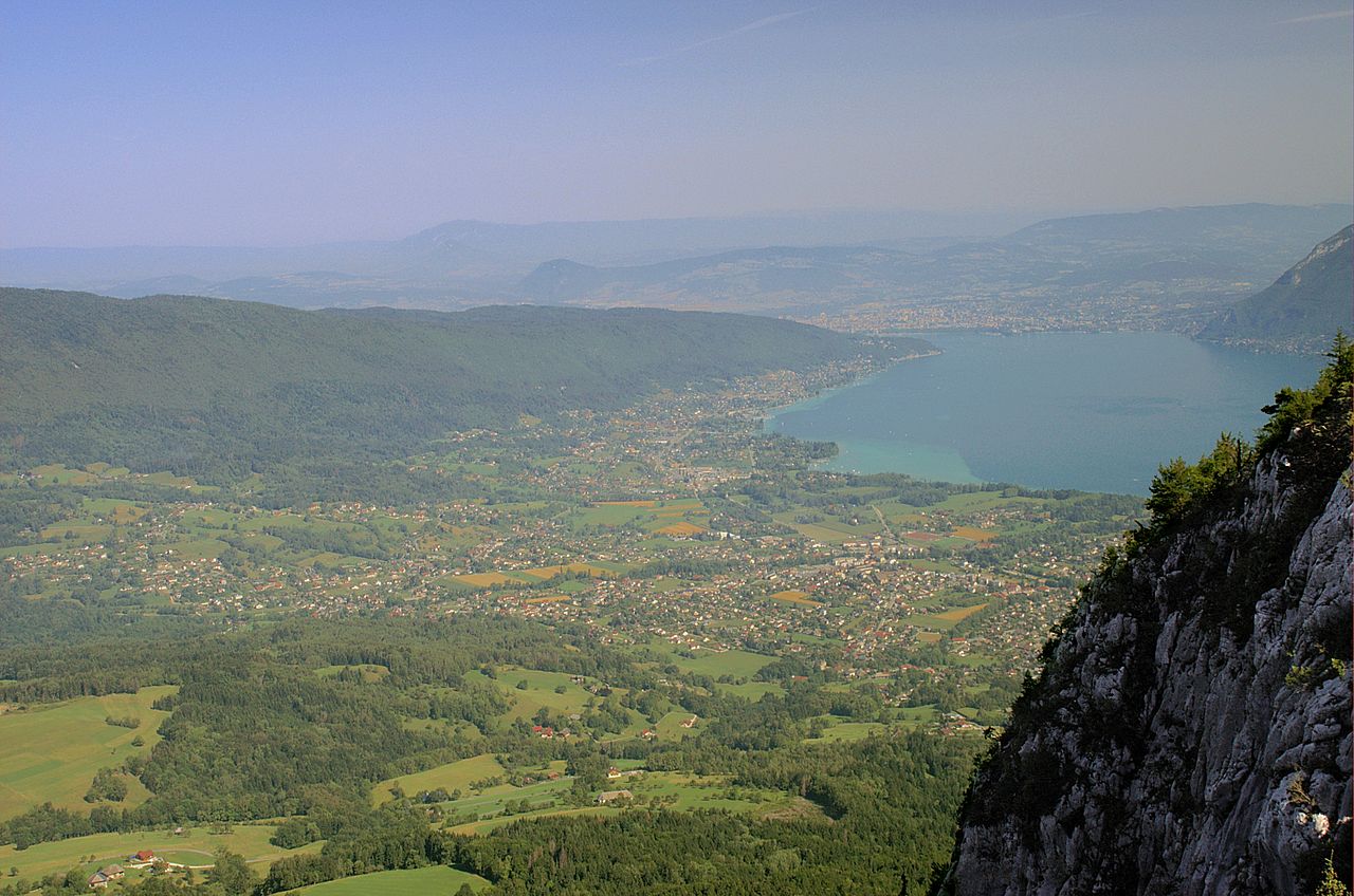
Français : L'agglomération saint-jorienne vue depuis les hauteurs du Roc des Bœufs. On distingue plus loin Sevrier puis Annecy. |
| Date | 24 August 2005 (original upload date) |
| Source | Transferred from fr.wikipedia to Commons. |
| Author | ²°¹°° at French Wikipedia |
Licensing
[edit]
| This work has been released into the public domain by its author, ²°¹°° at French Wikipedia. This applies worldwide. In some countries this may not be legally possible; if so: ²°¹°° grants anyone the right to use this work for any purpose, without any conditions, unless such conditions are required by law. |
Original upload log
[edit]
The original description page was here. All following user names refer to fr.wikipedia.
- 2005-08-24 20:01 ²°¹°° 3038×2012×8 (1699385 bytes) L'agglomération saint-jorienne vue depuis les hauteurs du Roc des Bœufs. On distingue plus loin Sevrier puis Annecy. {{DomainePublic}}
| Annotations | This image is annotated: View the annotations at Commons |
File history
Click on a date/time to view the file as it appeared at that time.
| Date/Time | Thumbnail | Dimensions | User | Comment | |
|---|---|---|---|---|---|
| current | 15:54, 10 April 2013 | | 3,038 × 2,012 (3.86 MB) | Emmanuel.boutet (talk | contribs) | Enhanced by the french wikigraphistes |
| 06:08, 6 September 2007 |  | 3,038 × 2,012 (1.62 MB) | Poulos~commonswiki (talk | contribs) | {{Information |Description={{fr|L'agglomération saint-jorienne vue depuis les hauteurs du Roc des Bœufs. On distingue plus loin Sevrier puis Annecy.}} |Source=Originally from [http://fr.wikipedia.org f |
You cannot overwrite this file.
File usage on Commons
The following 3 pages use this file:
File usage on other wikis
The following other wikis use this file:
- Usage on ast.wikipedia.org
- Usage on ca.wikipedia.org
- Usage on ceb.wikipedia.org
- Usage on ce.wikipedia.org
- Usage on de.wikipedia.org
- Usage on diq.wikipedia.org
- Usage on el.wikipedia.org
- Usage on en.wikipedia.org
- Usage on es.wikipedia.org
- Usage on eu.wikipedia.org
- Usage on fr.wikipedia.org
- Usage on hu.wikipedia.org
- Usage on it.wikipedia.org
- Usage on la.wikipedia.org
- Usage on lld.wikipedia.org
- Usage on lmo.wikipedia.org
- Usage on ms.wikipedia.org
- Usage on oc.wikipedia.org
- Usage on pl.wikipedia.org
- Usage on ro.wikipedia.org
- Usage on sk.wikipedia.org
- Usage on uk.wikipedia.org
- Usage on ur.wikipedia.org
- Usage on uz.wikipedia.org
- Usage on vec.wikipedia.org
- Usage on vi.wikipedia.org
- Usage on www.wikidata.org
- Usage on zh-min-nan.wikipedia.org
- Usage on zh.wikipedia.org