File:Satellite View of Japan 1999.jpg
Jump to navigation
Jump to search
Size of this preview: 469 × 599 pixels. Other resolutions: 188 × 240 pixels | 376 × 480 pixels | 601 × 768 pixels | 802 × 1,024 pixels | 1,638 × 2,092 pixels.
Original file (1,638 × 2,092 pixels, file size: 1.04 MB, MIME type: image/jpeg)
Captions
Captions
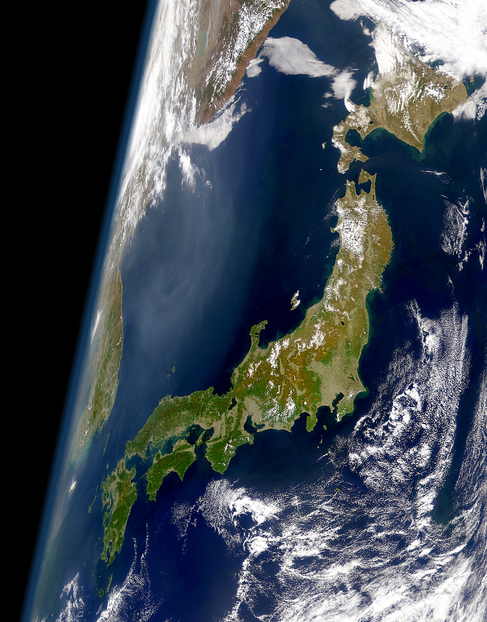
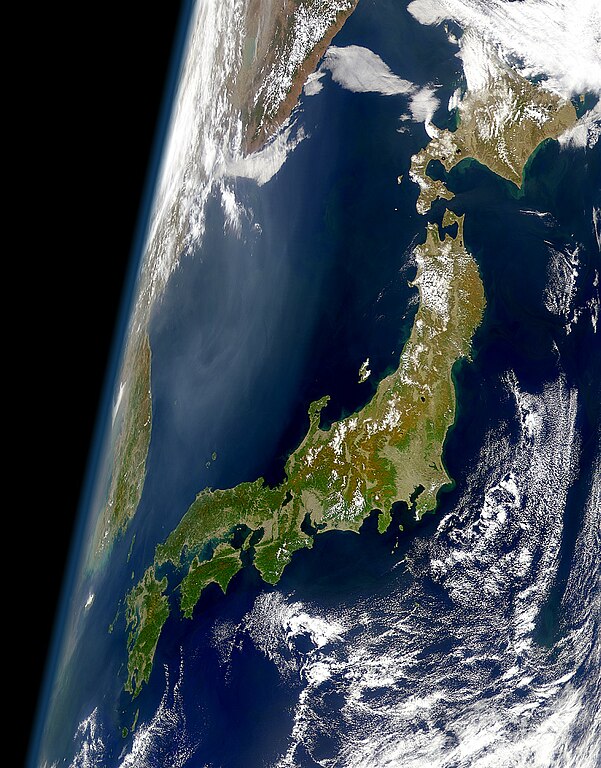
Satellite image of the Japanese archipelago.
Summary[edit]
| Description |
English: View of Japan taken from a satellite (1999)
日本語: 衛星から見た日本(1999年) |
| Date | |
| Source | Cropped version of the high resolution variation of image found at: https://visibleearth.nasa.gov/images/52957/clear-view-of-japan |
| Author | SeaWiFS Project, NASA/Goddard Space Flight Center, and ORBIMAGE |
Licensing[edit]
| This image is from the Sea-viewing Wide Field-of-view Sensor (SeaWiFS) Project and more than 5 years old.
Satellite data captured by the SeaWIFS sensor are released into the public domain 5 years after capture. Data less than five years old can be re-used only for educational or scientific purposes; any commercial use of such images must be coordinated with GeoEye. [1] |
| This work has been released into the public domain by its copyright holder, GeoEye. This applies worldwide. In some countries this may not be legally possible; if so: GeoEye grants anyone the right to use this work for any purpose, without any conditions, unless such conditions are required by law.
|
File history
Click on a date/time to view the file as it appeared at that time.
| Date/Time | Thumbnail | Dimensions | User | Comment | |
|---|---|---|---|---|---|
| current | 01:11, 26 January 2008 | | 1,638 × 2,092 (1.04 MB) | Satelite of Love (talk | contribs) | {{Information |Description=View of Japan take from a satellite (1999) |Source=Cropped version of the high resolution variation of image found at: http://visibleearth.nasa.gov/cgi-bin/viewrecord?10466 |Date=Jan. 24, 2008 |Author= [[User:Satelite of Love|Sa |
You cannot overwrite this file.
File usage on Commons
The following 6 pages use this file:
File usage on other wikis
The following other wikis use this file:
- Usage on af.wikipedia.org
- Usage on am.wikipedia.org
- Usage on ar.wikipedia.org
- Usage on ast.wikipedia.org
- Usage on azb.wikipedia.org
- Usage on bat-smg.wikipedia.org
- Usage on be-tarask.wikipedia.org
- Usage on be.wikipedia.org
- Usage on bg.wikipedia.org
- Usage on bm.wikipedia.org
- Usage on bn.wikipedia.org
- Usage on bo.wikipedia.org
- Usage on br.wiktionary.org
- Usage on bs.wikipedia.org
- Usage on ca.wikipedia.org
- Usage on ca.wikinews.org
- Usage on cs.wikipedia.org
- Usage on da.wikipedia.org
- Usage on de.wikipedia.org
- Usage on el.wikipedia.org
- Usage on en.wikipedia.org
- Usage on en.wikibooks.org
- Usage on en.wikiquote.org
- Usage on eo.wikipedia.org
- Usage on es.wikipedia.org
- Usage on et.wikipedia.org
- Usage on fa.wikipedia.org
- Usage on fi.wikipedia.org
- Usage on fr.wikipedia.org
- Usage on gl.wikipedia.org
- Usage on hi.wikipedia.org
- Usage on hr.wikipedia.org
- Usage on hy.wikipedia.org
- Usage on id.wikipedia.org
View more global usage of this file.