File:Seymour-chilhowee-mtn-tn1.jpg
Jump to navigation
Jump to search
Size of this preview: 800 × 532 pixels. Other resolutions: 320 × 213 pixels | 640 × 426 pixels | 1,024 × 681 pixels | 1,280 × 851 pixels | 2,560 × 1,702 pixels | 4,000 × 2,660 pixels.
Original file (4,000 × 2,660 pixels, file size: 3.22 MB, MIME type: image/jpeg)
Captions
Captions
Add a one-line explanation of what this file represents
Summary[edit]
| Description |
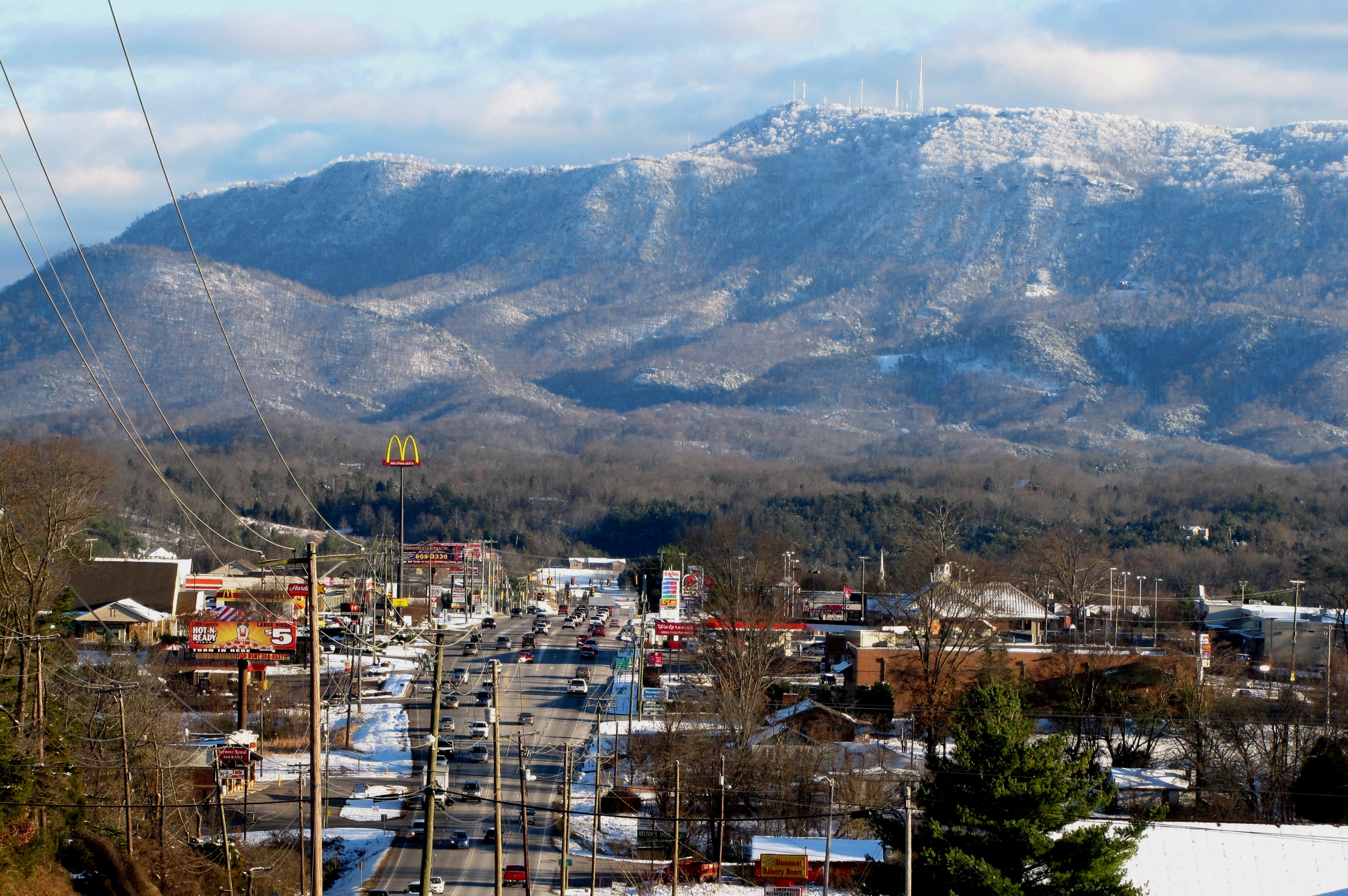
English: Chapman Highway (US-441) traversing Seymour, Tennessee, USA, with Bluff Mountain (part of the Foothills of the Great Smoky Mountains) rising in the distance. The towers toward the top-center stand atop the Bluff summit known as "Greentop," which rises to 3,069ft./935m. |
| Date | |
| Source | Own work |
| Author | Brian Stansberry |
Licensing[edit]
I, the copyright holder of this work, hereby publish it under the following license:
This file is licensed under the Creative Commons Attribution 3.0 Unported license.
- You are free:
- to share – to copy, distribute and transmit the work
- to remix – to adapt the work
- Under the following conditions:
- attribution – You must give appropriate credit, provide a link to the license, and indicate if changes were made. You may do so in any reasonable manner, but not in any way that suggests the licensor endorses you or your use.
File history
Click on a date/time to view the file as it appeared at that time.
| Date/Time | Thumbnail | Dimensions | User | Comment | |
|---|---|---|---|---|---|
| current | 00:19, 30 December 2010 | | 4,000 × 2,660 (3.22 MB) | BrineStans (talk | contribs) | darken |
| 23:15, 29 December 2010 |  | 4,000 × 2,660 (3.24 MB) | BrineStans (talk | contribs) | {{Information |Description={{en|1=Chapman Highway (US-441) traversing Seymour, Tennessee, USA, with Bluff Mountain (part of the Foothills of the Great Smoky Mountains) rising in the distance. The towers toward the top-center stand atop the Bluff summit |
You cannot overwrite this file.
File usage on Commons
There are no pages that use this file.
File usage on other wikis
The following other wikis use this file:
- Usage on ar.wikipedia.org
- Usage on arz.wikipedia.org
- Usage on azb.wikipedia.org
- Usage on ca.wikipedia.org
- Usage on ceb.wikipedia.org
- Usage on ce.wikipedia.org
- Usage on de.wikipedia.org
- Usage on en.wikipedia.org
- Usage on en.wiktionary.org
- Usage on es.wikipedia.org
- Usage on fa.wikipedia.org
- Usage on it.wikipedia.org
- Usage on kk.wikipedia.org
- Usage on lld.wikipedia.org
- Usage on pl.wikipedia.org
- Usage on pt.wikipedia.org
- Usage on sh.wikipedia.org
- Usage on sr.wikipedia.org
- Usage on sv.wikipedia.org
- Usage on tt.wikipedia.org
- Usage on uk.wikipedia.org
- Usage on www.wikidata.org
- Usage on zh-min-nan.wikipedia.org