File:Skapiškio-Suvainiškio siaurukas.png
Jump to navigation
Jump to search

Size of this preview: 246 × 599 pixels. Other resolutions: 98 × 240 pixels | 197 × 480 pixels | 315 × 768 pixels | 420 × 1,024 pixels | 2,136 × 5,199 pixels.
Original file (2,136 × 5,199 pixels, file size: 5.29 MB, MIME type: image/png)
Captions
Captions
Add a one-line explanation of what this file represents
Summary[edit]
| Description |
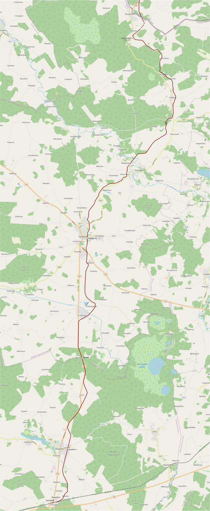
English: Historic route of narrow gauge railway Skapiškis–Suvainiškis in Lithuania. The route is presented on OpenStreetMap according to Soviet topographic maps of 1950–1951.
Lietuvių: Skapiškio–Suvainiškio siaurojo geležinkelio trasa su stotimis ir stotelėmis šiuolaikiniame OpenStreetMap žemėlapyje. Sudaryta pagal TSRS topografinius 1950–1951 m. žemėlapius. |
| Date | |
| Source | Own work; background: OpenStreetMap (© OpenStreetMap contributors) |
| Author | Obivan Kenobi |
Licensing[edit]
This file is licensed under the Creative Commons Attribution-Share Alike 3.0 Unported license.
- You are free:
- to share – to copy, distribute and transmit the work
- to remix – to adapt the work
- Under the following conditions:
- attribution – You must give appropriate credit, provide a link to the license, and indicate if changes were made. You may do so in any reasonable manner, but not in any way that suggests the licensor endorses you or your use.
- share alike – If you remix, transform, or build upon the material, you must distribute your contributions under the same or compatible license as the original.
File history
Click on a date/time to view the file as it appeared at that time.
| Date/Time | Thumbnail | Dimensions | User | Comment | |
|---|---|---|---|---|---|
| current | 19:31, 14 June 2020 | 2,136 × 5,199 (5.29 MB) | Obivan Kenobi (talk | contribs) | Skapiškio–Suvainiškio siaurojo geležinkelio trasa su stotimis ir stotelėmis šiuolaikiniame OpenStreetMap (© OpenStreetMap contributors) žemėlapyje. Sudaryta pagal TSRS topografinius 1950–1951 m. žemėlapius. |
You cannot overwrite this file.
File usage on Commons
There are no pages that use this file.
File usage on other wikis
The following other wikis use this file:
- Usage on lt.wikipedia.org
- Usage on lv.wikipedia.org