File:TerraNova2.png
Jump to navigation
Jump to search
Size of this preview: 505 × 600 pixels. Other resolutions: 202 × 240 pixels | 404 × 480 pixels | 851 × 1,011 pixels.
Original file (851 × 1,011 pixels, file size: 165 KB, MIME type: image/png)
Captions
Captions
Add a one-line explanation of what this file represents
Summary[edit]
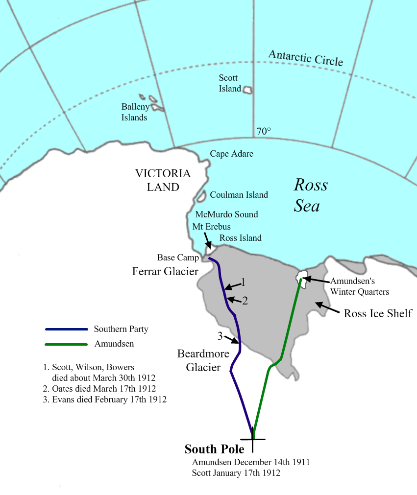
| Description | Map of The Ross Sector with details of Terra Nova and Amundsen's expeditions to the South Pole |
| Date | |
| Source | self-made (adapted from map in Scott's Journals ISBN 019929752-5) |
| Author | Yomangani |
| Permission (Reusing this file) |
PD |
| Other versions |
Derivative works of this file: TerraNova2 ESP.png
TerraNova.png |
Licensing[edit]
| I, the copyright holder of this work, release this work into the public domain. This applies worldwide. In some countries this may not be legally possible; if so: I grant anyone the right to use this work for any purpose, without any conditions, unless such conditions are required by law. |
File history
Click on a date/time to view the file as it appeared at that time.
| Date/Time | Thumbnail | Dimensions | User | Comment | |
|---|---|---|---|---|---|
| current | 01:23, 21 February 2008 | | 851 × 1,011 (165 KB) | Yomangani (talk | contribs) | == Summary == {{Information |Description=Map of The Ross Sector with details of Terra Nova and Amundsen's expeditions to the South Pole |Source=self-made (adapted from map in Scott's Journals ISBN 019929752-5) |Date=2008 |Author= [[User:Yomangani|Yomangan |
You cannot overwrite this file.
File usage on Commons
The following 2 pages use this file:
File usage on other wikis
The following other wikis use this file:
- Usage on ca.wikipedia.org
- Usage on de.wikipedia.org
- Usage on es.wikipedia.org
- Usage on fr.wikipedia.org
- Usage on fy.wikipedia.org
- Usage on nl.wikipedia.org
- Usage on oc.wikipedia.org
- Usage on uk.wikipedia.org