File:USACE Strom Thurmond Dam spillway.jpg
Jump to navigation
Jump to search

Size of this preview: 800 × 533 pixels. Other resolutions: 320 × 213 pixels | 640 × 427 pixels | 1,024 × 683 pixels | 1,500 × 1,000 pixels.
Original file (1,500 × 1,000 pixels, file size: 476 KB, MIME type: image/jpeg)
Captions
Captions
Add a one-line explanation of what this file represents
| Description |
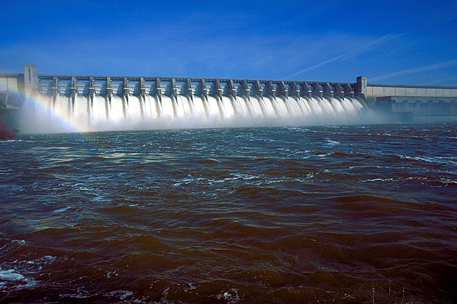
English: J. Strom Thurmond Dam on the Savannah River. The dam spans the border between Edgefield County, South Carolina and Columbia County, Georgia, USA. The U.S. Army Corps of Engineers constructed the dam for flood control on the Savannah River.
Coordinates: 33°39′40.36″N 82°11′57.79″W / 33.6612111°N 82.1993861°W |
|||
| Location | Edgefield County, South Carolina and Columbia County, Georgia, USA | |||
| Date | (Caveat: Dates provided by U.S. Army Corps of Engineers Digital Visual Library are not reliable and are often wrong.) | |||
| Source |
U.S. Army Corps of Engineers Digital Visual Library Image page Image description page Digital Visual Library home page |
|||
| Author | Jonas N. Jordan, U.S. Army Corps of Engineers | |||
| Permission (Reusing this file) |
|
File history
Click on a date/time to view the file as it appeared at that time.
| Date/Time | Thumbnail | Dimensions | User | Comment | |
|---|---|---|---|---|---|
| current | 01:08, 26 April 2007 | | 1,500 × 1,000 (476 KB) | DanMS (talk | contribs) | {{Information | Description = {{en|J. Strom Thurmond Dam on the Savannah River. The dam spans the border between Edgefield County, South Carolina and Columbia County, Georgia, USA. The U.S. Army Corps of Engineers constructed the dam for flood control |
You cannot overwrite this file.
File usage on Commons
There are no pages that use this file.
File usage on other wikis
The following other wikis use this file:
- Usage on en.wikipedia.org
- Usage on fi.wikipedia.org