File:Ug-map-it.png
Jump to navigation
Jump to search
Size of this preview: 558 × 599 pixels. Other resolutions: 223 × 240 pixels | 447 × 480 pixels | 689 × 740 pixels.
Original file (689 × 740 pixels, file size: 245 KB, MIME type: image/png)
Captions
Captions
Add a one-line explanation of what this file represents
Summary
[edit]
| Description |
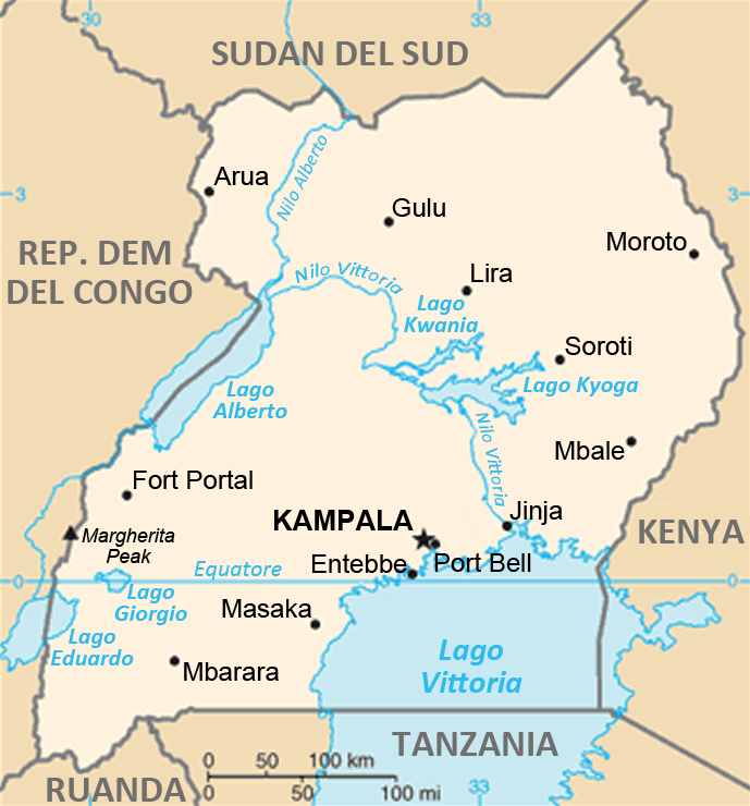
English: Uganda map from CIA World Factbook, converted from original GIF format (July 2011 version showing South Sudan) in italian. |
| Date | |
| Source | Based on the English version from the CIA World Fact Book. |
| Author | CIA World Fact Book. Translations by Yiyi |
| Permission (Reusing this file) |
Public Domain (see below) |
| Other versions | File:Ug-map.png (Original English version) |
Licensing
[edit]
This image is in the public domain because it contains materials that originally came from the United States Central Intelligence Agency's World Factbook.
|
 |
File history
Click on a date/time to view the file as it appeared at that time.
| Date/Time | Thumbnail | Dimensions | User | Comment | |
|---|---|---|---|---|---|
| current | 18:44, 24 January 2022 | | 689 × 740 (245 KB) | Lojwe (talk | contribs) | Cropped 2 % horizontally, 1 % vertically using CropTool with precise mode. |
| 18:25, 29 December 2012 |  | 700 × 751 (246 KB) | Yiyi (talk | contribs) | {{Information |Description ={{en|1=Uganda map from CIA World Factbook, converted from original GIF format (July 2011 version showing South Sudan) in italian.}} |Source = Based on the English version from the CIA World Fa... |
You cannot overwrite this file.
File usage on Commons
The following page uses this file:
File usage on other wikis
The following other wikis use this file:
- Usage on ca.wikipedia.org
- Usage on es.wikipedia.org
- Usage on it.wikipedia.org
- Usage on www.wikidata.org