File:Uganda Distrikte Kitgum.svg
Jump to navigation
Jump to search

Size of this PNG preview of this SVG file: 550 × 350 pixels. Other resolutions: 320 × 204 pixels | 640 × 407 pixels | 1,024 × 652 pixels | 1,280 × 815 pixels | 2,560 × 1,629 pixels.
Original file (SVG file, nominally 550 × 350 pixels, file size: 815 KB)
Captions
Captions
Add a one-line explanation of what this file represents
| Description |
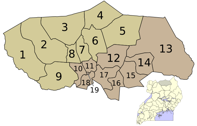
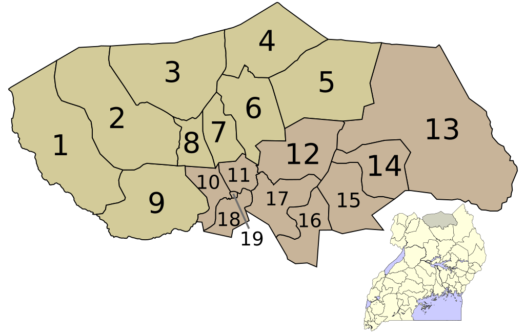
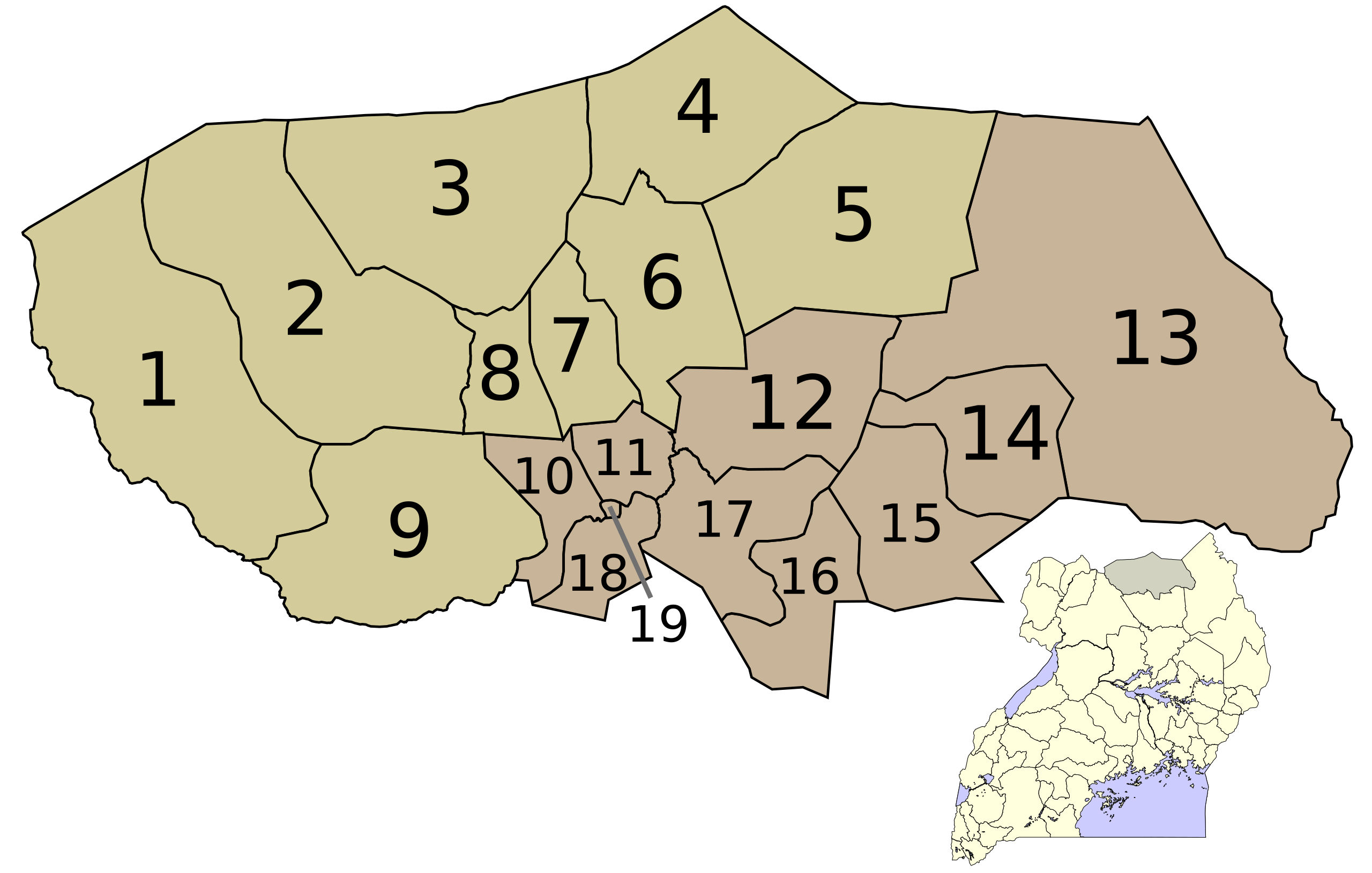
English: Locator map of the municipalities in the Kitgum District.
Plattdüütsch: Koort vun’n Distrikt Kitgum. |
| Source | based on data from Uganda Bureau of Statistics |
| Author | Slomox |
| Permission (Reusing this file) |
This file is licensed under the Creative Commons Attribution-Share Alike 1.0 Generic license.
|
File history
Click on a date/time to view the file as it appeared at that time.
| Date/Time | Thumbnail | Dimensions | User | Comment | |
|---|---|---|---|---|---|
| current | 04:04, 14 March 2008 | | 550 × 350 (815 KB) | Slomox (talk | contribs) | {{Information |Description= {{nds|Koort vun’n Distrikt Kitgum.}} |Source=based on data from Uganda Bureau of Statistics |Date= |Author=Slomox |Permission= {{CC-BY-SA}} }} Category:Maps of Uganda |
You cannot overwrite this file.
File usage on Commons
There are no pages that use this file.
File usage on other wikis
The following other wikis use this file:
- Usage on ja.wikipedia.org
- Usage on nds.wikipedia.org