File:Wandkarte von Süd-West-Deutschland.jpg
둘러보기로 이동
검색으로 이동

미리 보기 크기: 800 × 594 픽셀 다른 해상도: 320 × 238 픽셀 | 640 × 475 픽셀 | 1,024 × 760 픽셀 | 1,280 × 950 픽셀 | 2,560 × 1,900 픽셀 | 9,379 × 6,962 픽셀
원본 파일 (9,379 × 6,962 픽셀, 파일 크기: 99.79 MB, MIME 종류: image/jpeg)
캡션
설명
이 파일이 나타내는 바에 대한 한 줄 설명을 추가합니다
| 주의 | 이 그림은 크기가 상당히 크며, 일부 브라우저의 경우 그림을 실제 크기로 표시할 때 프로그램이 멈출 수 있습니다. 이 경우, '최대 해상도' 링크 위에서 마우스 오른쪽 버튼을 눌러서 컴퓨터 파일로 저장한 다음, 포토샵이나 GIMP 같은 편집기를 이용해서 파일을 열어 주세요. |
|---|
| 설명 |
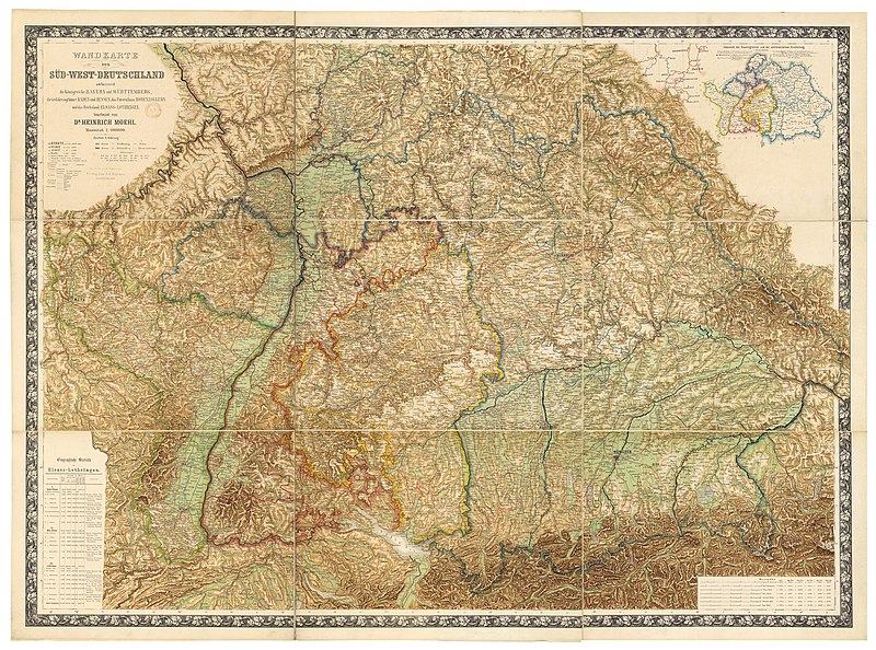
Deutsch: Wandkarte von Süd-West-Deutschland umfassend die Königreiche Bayern und Württemberg, die Grossherzogthümer Baden und Hessen, das Fürstenthum Hohenzollern und das Reichsland Elsass-Lothringen / bearbeitet von Dr. Heinrich Moehl.
English: Wall map of Southwestern Germany, which includes the Kingdom of Bavaria, Kingdom of Württemberg, the Grand Duchies of Baden and Hessen, the Principality of Hohenzollern, and the Imperial territory of Alsace-Lorraine, 1875. Edited by Dr Heinrich Moehl. |
||||
| 날짜 | |||||
| 출처 | Wandkarte von Süd-West-Deutschland umfassend die Königreiche Bayern und Wörttembergidie Grossherzogthümer Baden und Hessen, das Fürstenthum Hohenzollern und das Reichsland Elsass-Lothringen / bearbeitet von Dr Heinrich Moehl | ||||
| 저자 | Moehl, Heinrich (18..-19..?). Auteur du texte ; Verlag von J.J. Tascher (Kaiserslautern) | ||||
| 저작권 (이 파일을 인용하기) |
|
|
이 이미지는 2012년 8월 25일의 오늘의 이미지로 선정되었습니다. 이미지 설명은 다음과 같습니다. English: Wall map of Southwestern Germany, which includes the Kingdom of Bavaria, Württemberg Principalities of Baden and Hessen, the Principality of Hohenzollern, and the Imperial territory of Alsace-Lorraine, 1875. Restored by Dr Heinrich Moehl. 다른 언어들:
Deutsch: Wandkarte von Süd-West-Deutschland umfassend die Königreiche Bayern und Württemberg, die Grossherzogthümer Baden und Hessen, das Fürstenthum Hohenzollern und das Reichsland Elsass-Lothringen / bearbeitet von Dr. Heinrich Moehl English: Wall map of Southwestern Germany, which includes the Kingdom of Bavaria, Württemberg Principalities of Baden and Hessen, the Principality of Hohenzollern, and the Imperial territory of Alsace-Lorraine, 1875. Restored by Dr Heinrich Moehl. Italiano: Mappa della Germania sud-occidentale con il Regno di Baviera, il Granducato di Baden, l'Hohenzollern-Hechingen e l'Alsazia-Lorena, a cura del dr. Dr Heinrich Moeh, 1875 Magyar: Délnyugat-Németország egy 1875-ös fali térképen Nederlands: Wandkaart van het zuidwesten van Duitsland met inbegrip van de koninkrijk van Beieren, Groothertogdom Baden, Groothertogdom Hessen, vorstendom Hohenzollern en het Reichsland Elzas-Lotharingen, onder de redactie van Heinrich Moehl. Русский: Настенная карта юго-западной Германии, 1875 中文: 德国西南部1875年地图,包括巴伐利亚、巴登、黑森和阿尔萨斯-洛林。 |
파일 역사
날짜/시간 링크를 클릭하면 해당 시간의 파일을 볼 수 있습니다.
| 날짜/시간 | 섬네일 | 크기 | 사용자 | 설명 | |
|---|---|---|---|---|---|
| 현재 | 2012년 7월 14일 (토) 18:40 | | 9,379 × 6,962 (99.79 MB) | ComputerHotline (토론 | 기여) | {{Information |Description={{LargeImage}}{{de|Wandkarte von Süd-West-Deutschland umfassend die Königreiche Bayern und Wörttembergidie Grossherzogthümer Baden und Hessen, das Fürstenthum Hohenzollern und das Reichsland Elsass-Lothringen / bearbeite... |
이 파일을 덮어쓸 수 없습니다.
이 파일을 사용하는 문서
다음 문서 25개가 이 파일을 사용하고 있습니다:
- User:ComputerHotline/Archive 11
- User:Ö/Best/2012
- Commons:Featured picture candidates/File:Wandkarte von Süd-West-Deutschland.jpg
- Commons:Featured picture candidates/Log/July 2012
- Commons:Featured pictures/Non-photographic media/Maps
- Commons:Featured pictures/chronological/2012-B
- Commons:Picture of the Year/2012/Galleries/2012-B
- Commons:Picture of the Year/2012/Galleries/ALL
- Commons:Picture of the Year/2012/Galleries/Index/11
- Commons:Picture of the Year/2012/Galleries/JUL
- Commons:Picture of the Year/2012/Galleries/Maps
- Commons:Picture of the Year/2012/R1/Wandkarte von Süd-West-Deutschland.jpg
- Commons:Picture of the Year/2012/Results/R1/ALL
- Commons:Picture of the Year/2012/Results/R1/ALL/gallery
- Commons:Picture of the Year/2012/Results/R1/ALL/thumbnailtable
- Commons:Picture of the Year/2012/Results/R1/Maps
- Template:Potd/2012-08
- Template:Potd/2012-08-25
- Template:Potd/2012-08-25 (de)
- Template:Potd/2012-08-25 (en)
- Template:Potd/2012-08-25 (it)
- Template:Potd/2012-08-25 (ka)
- Template:Potd/2012-08-25 (nl)
- Template:Potd/2012-08-25 (zh-hans)
- Template:Potd/2012-08 (zh-hans)
이 파일을 사용하고 있는 모든 위키의 문서 목록
다음 위키에서 이 파일을 사용하고 있습니다:
- be-tarask.wikipedia.org에서 이 파일을 사용하고 있는 문서 목록
- bn.wikipedia.org에서 이 파일을 사용하고 있는 문서 목록
- crh.wikipedia.org에서 이 파일을 사용하고 있는 문서 목록
- cv.wikipedia.org에서 이 파일을 사용하고 있는 문서 목록
- fr.wikipedia.org에서 이 파일을 사용하고 있는 문서 목록
- hu.wikipedia.org에서 이 파일을 사용하고 있는 문서 목록
- ka.wikipedia.org에서 이 파일을 사용하고 있는 문서 목록
- kk.wikipedia.org에서 이 파일을 사용하고 있는 문서 목록
- ko.wikipedia.org에서 이 파일을 사용하고 있는 문서 목록
- krc.wikipedia.org에서 이 파일을 사용하고 있는 문서 목록
- lbe.wikipedia.org에서 이 파일을 사용하고 있는 문서 목록
- os.wikipedia.org에서 이 파일을 사용하고 있는 문서 목록
- pt.wikipedia.org에서 이 파일을 사용하고 있는 문서 목록
- ru.wikipedia.org에서 이 파일을 사용하고 있는 문서 목록
- ru.wikinews.org에서 이 파일을 사용하고 있는 문서 목록
- sah.wikipedia.org에서 이 파일을 사용하고 있는 문서 목록
- uk.wikipedia.org에서 이 파일을 사용하고 있는 문서 목록
- xal.wikipedia.org에서 이 파일을 사용하고 있는 문서 목록
- zh.wikipedia.org에서 이 파일을 사용하고 있는 문서 목록