File:YOSE-Flood-Closure-20230427.jpg
Jump to navigation
Jump to search

Size of this preview: 800 × 552 pixels. Other resolutions: 320 × 221 pixels | 640 × 442 pixels | 1,024 × 707 pixels | 1,280 × 883 pixels | 1,600 × 1,104 pixels.
Original file (1,600 × 1,104 pixels, file size: 300 KB, MIME type: image/jpeg)
Captions
Captions
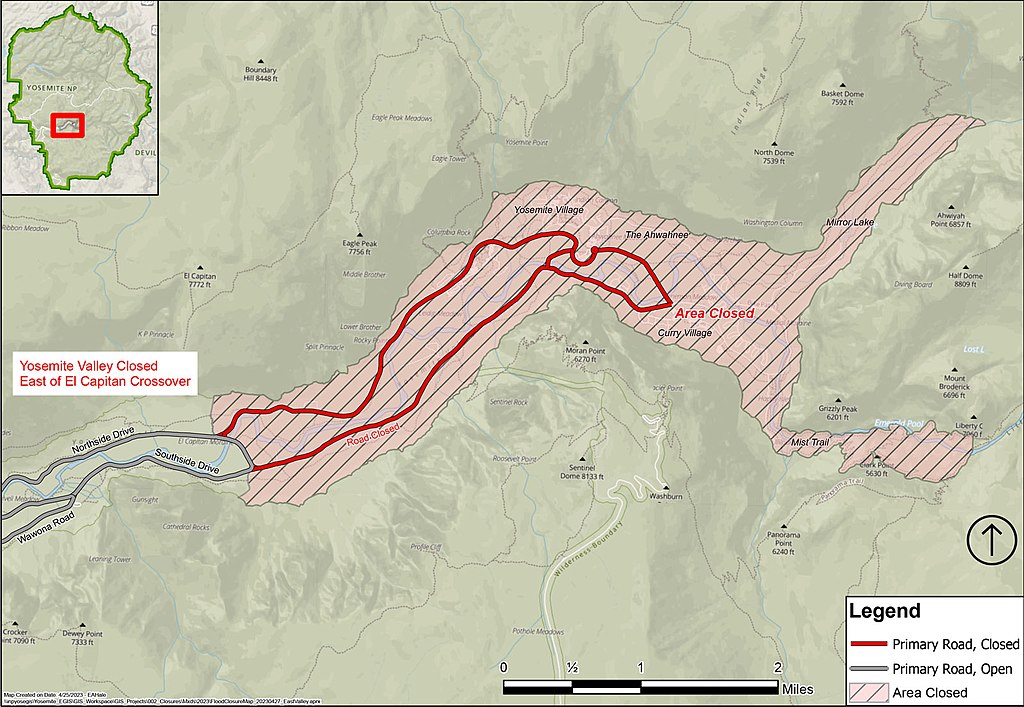
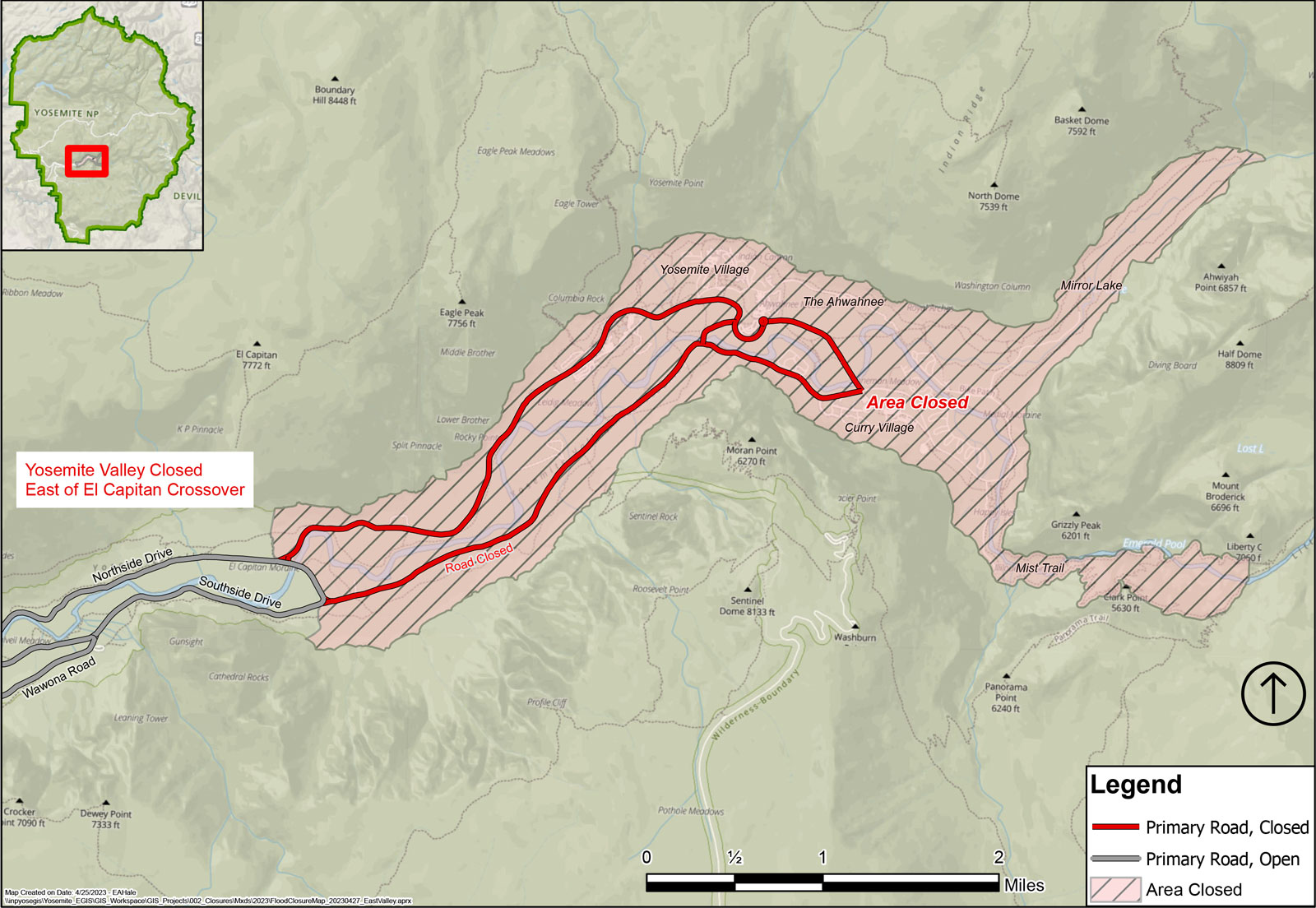
Map of 2023 closures in [[Yosemite National Park]]
Summary[edit]
| Description |
English: The NPS announced parts of Yosemite National Park would be closed beginning on 28 April 2023 and produced this map of the closures. |
| Date | |
| Source | https://www.nps.gov/yose/planyourvisit/images/YOSE-Flood-Closure-20230427.jpg |
| Author | National Park Service |
Licensing[edit]
| This image or media file contains material based on a work of a National Park Service employee, created as part of that person's official duties. As a work of the U.S. federal government, such work is in the public domain in the United States. See the NPS website and NPS copyright policy for more information. |
File history
Click on a date/time to view the file as it appeared at that time.
| Date/Time | Thumbnail | Dimensions | User | Comment | |
|---|---|---|---|---|---|
| current | 13:25, 26 April 2023 | | 1,600 × 1,104 (300 KB) | SVTCobra (talk | contribs) | Uploaded a work by National Park Service from https://www.nps.gov/yose/planyourvisit/images/YOSE-Flood-Closure-20230427.jpg with UploadWizard |
You cannot overwrite this file.
File usage on Commons
The following 2 pages use this file:
File usage on other wikis
The following other wikis use this file: