File:Yeonpyeong-myeon map.png
Jump to navigation
Jump to search

Size of this preview: 507 × 600 pixels. Other resolutions: 203 × 240 pixels | 406 × 480 pixels | 649 × 768 pixels | 1,200 × 1,420 pixels.
Original file (1,200 × 1,420 pixels, file size: 106 KB, MIME type: image/png)
Captions
Captions
Add a one-line explanation of what this file represents
| Description |
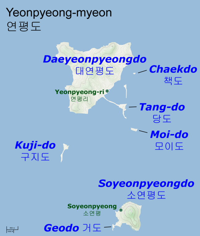
English: Map of Yeonpyeong Islands, Ongjin County, Incheon, South Korea Kanuri: 대한민국 인천광역시 옹진군 연평도 지도. |
||
| Date | |||
| Source | Base map from OpenStreetMap (Cycle Map layer), names and locations from National Geospatial-Intelligence Agency database | ||
| Author | Prioryman (talk) | ||
| Permission (Reusing this file) |
|
File history
Click on a date/time to view the file as it appeared at that time.
| Date/Time | Thumbnail | Dimensions | User | Comment | |
|---|---|---|---|---|---|
| current | 21:30, 24 November 2010 | | 1,200 × 1,420 (106 KB) | Prioryman (talk | contribs) | {{Information |Description=Map of Yeonpyeong Islands, Ongjin County, Incheon, South Korea |Source=Base map from OpenStreetMap (Cycle Map layer), names and locations from National Geospatial-Intelligence Agency database |Date=2010-11-24 |Author= ~~~ |Permi |
You cannot overwrite this file.
File usage on Commons
The following page uses this file:
File usage on other wikis
The following other wikis use this file:
- Usage on az.wikipedia.org
- Usage on ca.wikipedia.org
- Usage on da.wikipedia.org
- Usage on de.wikipedia.org
- Usage on en.wikipedia.org
- Usage on en.wikinews.org
- Usage on et.wikipedia.org
- Usage on eu.wikipedia.org
- Usage on fa.wikipedia.org
- Usage on fi.wikipedia.org
- Usage on it.wikipedia.org
- Usage on ko.wikipedia.org
- Usage on ms.wikipedia.org
- Usage on no.wikipedia.org
- Usage on oc.wikipedia.org
- Usage on ru.wikipedia.org
- Usage on sr.wikipedia.org
- Usage on tl.wikipedia.org
- Usage on tr.wikipedia.org
- Usage on uk.wikipedia.org
- Usage on www.wikidata.org