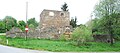
Category:Bürgerspital Döllersheim
Jump to navigation
Jump to search
| This category shows the protected monument with the number 76447 in Austria. (Commons, de, Wikidata) |
| Object location | | View all coordinates using: OpenStreetMap |
|---|
 | |||||
| Upload media | |||||
| Instance of | |||||
|---|---|---|---|---|---|
| Location | Pölla, Zwettl District, Lower Austria, Austria | ||||
| Heritage designation | |||||
 | |||||
Media in category "Bürgerspital Döllersheim"
The following 4 files are in this category, out of 4 total.
-
 Bürgerspital Döllersheim 01 2016-04.jpg 4,800 × 3,200; 7.12 MB
-
 Bürgerspital Döllersheim 02 2016-04.jpg 4,800 × 3,200; 7.63 MB
-
 GuentherZ 2011-03-19 0097 Doellersheim Ruine Spital.jpg 1,800 × 976; 1.37 MB
-
 GuentherZ 2011-05-14 0138 Doellersheim Buergerspital.jpg 1,800 × 788; 1,000 KB


