Category:Blatten
Jump to navigation
Jump to search
municipality in the canton of Valais in Switzerland .jpg)   | |||||
| Upload media | |||||
| Instance of | |||||
|---|---|---|---|---|---|
| Location | Westlich Raron District, Valais, Switzerland | ||||
| Located in or next to body of water | |||||
| Population |
| ||||
| Area |
| ||||
| Elevation above sea level |
| ||||
| official website | |||||
 | |||||
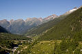
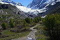
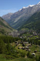
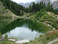
English: Blatten is a village and municipality in the Lötschental valley in the canton of Valais in Switzerland.
Subcategories
This category has the following 9 subcategories, out of 9 total.
A
- Anenhütte (2 F)
B
F
G
- Grundsee (Blatten) (2 F)
H
- Hollandiahütte (5 F)
L
- Langgletscher (1 P, 13 F)
S
- Schwarzsee (Blatten) (7 F)
Media in category "Blatten"
The following 48 files are in this category, out of 48 total.
-
 1974 Bietschhorn.JPG 1,517 × 2,199; 891 KB
-
 1974 Blatten 01.JPG 2,213 × 1,503; 842 KB
-
 1974 Blatten 02.JPG 2,175 × 1,517; 786 KB
-
 1974 Blatten 03.JPG 2,173 × 1,491; 874 KB
-
 1974 Blatten 05.JPG 1,512 × 2,088; 771 KB
-
 1974 Blatten.JPG 2,218 × 1,494; 666 KB
-
 Autumn tint and Briethorn - panoramio.jpg 1,872 × 2,808; 2.19 MB
-
 Bellwald timber houses - panoramio.jpg 3,072 × 2,304; 1.38 MB
-
 Birghorn.jpg 4,032 × 3,024; 2.5 MB
-
 CHE Blatten COA.svg 500 × 600; 11 KB
-
 Wappen Blatten VS.svg 510 × 560; 18 KB
-
 Blatten (komprimiert).jpg 3,632 × 2,057; 1.36 MB
-
 Blatten - panoramio - Carsten Wiehe.jpg 3,072 × 2,304; 1.4 MB
-
 Blatten - panoramio.jpg 3,063 × 2,040; 1.26 MB
-
 Blatten-blazon.svg 209 × 245; 12 KB
-
 Chapel in Kuhmatt and Breithorn of Lotchental - panoramio.jpg 2,808 × 1,872; 1.84 MB
-
 CHE Blatten Flag.svg 750 × 750; 136 KB
-
 CHE Blatten Logo.svg 251 × 104; 32 KB
-
 ETH-BIB-Blatten, von Nordost-Dia 247-13513.tif 3,658 × 2,828; 29.71 MB
-
 ETH-BIB-Holzkännel Bisse ab Blatten, abwärts-Dia 247-13514.tif 3,140 × 3,422; 30.86 MB
-
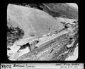 ETH-BIB-Rotlaui, Lonza-Dia 247-02058.tif 3,431 × 2,806; 9.28 MB
-
 Flag of Blatten.gif 216 × 216; 6 KB
-
 Gipfel des Elwertätsch.jpg 4,032 × 3,024; 2.56 MB
-
 Gletscher hike - panoramio.jpg 3,063 × 2,040; 1.22 MB
-
 Gletschertor - panoramio.jpg 3,264 × 2,448; 1.15 MB
-
 Karte Gemeinde Blatten 2007.png 1,181 × 1,363; 334 KB
-
 Karte Gemeinde Blatten 2009.png 1,476 × 1,707; 556 KB
-
 Karte Gemeinde Blatten.png 826 × 952; 159 KB
-
 Langgletscher - panoramio.jpg 3,872 × 2,592; 5.97 MB
-
 Loetchenluecke.JPG 3,216 × 2,136; 3.6 MB
-
 Loetschental-2007.jpg 1,200 × 800; 270 KB
-
 Lotschental in autumn,switzerland - panoramio.jpg 2,808 × 1,872; 1.45 MB
-
 Lötschenlücke und Langgletscher - panoramio.jpg 3,872 × 2,592; 5.09 MB
-
 Lötschenlücke von der Anenhütte aus - panoramio.jpg 3,872 × 2,592; 3.93 MB
-
 Lötschental Lötschenlücke 2+.jpg 2,592 × 1,944; 513 KB
-
 Milka cows - panoramio.jpg 1,152 × 864; 295 KB
-
 Nestgletscher - panoramio.jpg 3,872 × 2,592; 8.43 MB
-
 Nästbach unterhalb des Nestgletschers - panoramio.jpg 3,872 × 2,592; 4.22 MB
-
 Picswiss VS-01-02.jpg 300 × 450; 51 KB
-
 Schafbärg (3.240 m) - panoramio.jpg 3,872 × 2,592; 4.59 MB
-
 Schafbärg (3.240 m) und Kleines Nesthorn (3.336 m) - panoramio.jpg 3,872 × 2,592; 4.1 MB
-
 Schafbärg (3.240 m) und Nestgletscher - panoramio.jpg 3,872 × 2,592; 3.42 MB
-
 Schwarzsee - panoramio (1).jpg 2,048 × 1,536; 1.35 MB
-
 Tschaggata.jpg 400 × 590; 79 KB
-
 Tschaggatta Lochstental.jpg 1,960 × 4,032; 2.25 MB
-
 VSBlattenLonza.jpg 3,254 × 2,122; 1.49 MB
-
 Wanderweg zur Bietschhornhütte - panoramio.jpg 3,872 × 2,592; 4.03 MB
-
 Weissenried Loetschental.jpg 3,389 × 2,128; 1.53 MB


_-_panoramio.jpg)
_und_Kleines_Nesthorn_(3.336_m)_-_panoramio.jpg)
_und_Nestgletscher_-_panoramio.jpg)
.jpg)


