Category:Casa dels Barons (Prullans)
Jump to navigation
Jump to search
| Object location | | View all coordinates using: OpenStreetMap |
|---|
cultural property in Prullans, Spain .jpg) | |||||
| Upload media | |||||
| Instance of | |||||
|---|---|---|---|---|---|
| Location | Prullans, Lower Cerdanya, Alt Pirineu, Catalonia | ||||
| Street address |
| ||||
| Heritage designation | |||||
| Inception |
| ||||
| Elevation above sea level |
| ||||
 | |||||
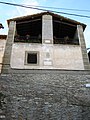
Català: Casa dels Barons. (Prullans)
This is a category about a monument indexed in the Catalan heritage register of Béns Culturals d'Interès Nacional and the Spanish heritage register of Bienes de Interés Cultural under the reference RI-51-0006449. |
Media in category "Casa dels Barons (Prullans)"
This category contains only the following file.
-
 Casa dels Barons (Prullans).jpg 600 × 800; 183 KB