Category:Christuskirche Wels
Jump to navigation
Jump to search
| Object location | | View all coordinates using: OpenStreetMap |
|---|
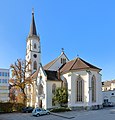
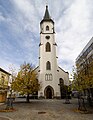
church building in Wels, Austria  | |||||
| Upload media | |||||
| Instance of | |||||
|---|---|---|---|---|---|
| Named after | |||||
| Location | Wels, Upper Austria, Austria | ||||
| Street address |
| ||||
| Heritage designation | |||||
 | |||||
Subcategories
This category has only the following subcategory.
C
- Christuskirche Wels - interior (15 F)
Media in category "Christuskirche Wels"
The following 12 files are in this category, out of 12 total.
-
 Christuskirche Wels.jpg 1,200 × 1,536; 200 KB
-
 Wels - Christuskirche.JPG 3,400 × 3,539; 9.78 MB
-
 Wels - Innere Stadt - Christuskirche - 2023 11 02-1.jpg 5,418 × 3,612; 3.81 MB
-
 Wels - Innere Stadt - Christuskirche - 2023 11 02-18.jpg 4,504 × 6,756; 4.21 MB
-
 Wels - Innere Stadt - Christuskirche - 2023 11 02-19.jpg 4,474 × 6,664; 5.3 MB
-
 Wels - Innere Stadt - Christuskirche - 2023 11 02-2.jpg 3,904 × 5,856; 5.11 MB
-
 Wels - Innere Stadt - Christuskirche - 2023 11 02-20.jpg 4,388 × 6,583; 5.81 MB
-
 Wels - Innere Stadt - Christuskirche - 2023 11 02-21.jpg 4,530 × 6,795; 4.21 MB
-
 Wels - Innere Stadt - Christuskirche - 2023 11 02-3.jpg 4,339 × 5,616; 4.25 MB
-
 Wels - Innere Stadt - Christuskirche - 2023 11 02-4.jpg 5,907 × 3,938; 6.57 MB
-
 Wels Evangelische Kirche Bahnhofstraße-7788.jpg 3,445 × 5,178; 9.44 MB
-
 Wels Stadt und Thalheim bei Wels.jpg 4,752 × 3,168; 4.32 MB


Categories:
- Churches in Wels
- Gothic Revival churches in Upper Austria
- Christ churches in Austria
- Lutheran churches in Upper Austria
- Parish churches in Upper Austria
- Churches in Austria built in 1852
- Churches by Carl Alexander Heideloff
- Cultural heritage monuments in Wels
- Carl Alexander Heideloff
- Built in Upper Austria in 1852
- Martin-Luther-Platz (Wels)