Category:Dorfkirche Henzendorf
Jump to navigation
Jump to search
| Object location | | View all coordinates using: OpenStreetMap |
|---|
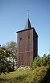
church building in Oder-Spree district, Brandenburg state, Germany | |||||
| Upload media | |||||
| Instance of | |||||
|---|---|---|---|---|---|
| Location | Henzendorf, Neuzelle, Oder-Spree District, Brandenburg, Germany | ||||
 | |||||
This is the category of the Brandenburger Baudenkmal (cultural heritage monument) with the ID 09115023 (Wikidata)
|
Media in category "Dorfkirche Henzendorf"
The following 2 files are in this category, out of 2 total.
-
 Henzendorf Kirche.jpg 2,480 × 3,588; 5.92 MB
-
 Henzendorf Kirchturm.jpg 2,124 × 3,548; 5.41 MB

