Category:Gaggl-Hube, Wernberg
Jump to navigation
Jump to search
| Object location | | View all coordinates using: OpenStreetMap |
|---|
human settlement in Austria  | |||||
| Upload media | |||||
| Instance of | |||||
|---|---|---|---|---|---|
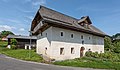
| Location | Wernberg, Villach-Land District, Carinthia, Austria | ||||
| Street address |
| ||||
| Heritage designation | |||||
 | |||||
Media in category "Gaggl-Hube, Wernberg"
The following 50 files are in this category, out of 50 total.
-
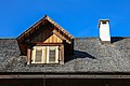
 AT-39486 Bauernhaus, Gaggl-Hube, Trabenig 01.jpg 3,840 × 5,760; 3.79 MB
-
 AT-39486 Bauernhaus, Gaggl-Hube, Trabenig 02.jpg 5,760 × 3,840; 8.4 MB
-
 AT-39486 Bauernhaus, Gaggl-Hube, Trabenig 03.jpg 3,840 × 5,760; 4.96 MB
-
 AT-39486 Bauernhaus, Gaggl-Hube, Trabenig 04.jpg 3,840 × 5,760; 7.52 MB
-
 AT-39486 Bauernhaus, Gaggl-Hube, Trabenig 05.jpg 3,840 × 5,760; 5.7 MB
-
 AT-39486 Bauernhaus, Gaggl-Hube, Trabenig 06.jpg 3,840 × 5,760; 4.27 MB
-
 AT-39486 Bauernhaus, Gaggl-Hube, Trabenig 07.jpg 4,935 × 3,290; 3.27 MB
-
 AT-39486 Bauernhaus, Gaggl-Hube, Trabenig 08.jpg 3,840 × 5,760; 4.04 MB
-
 AT-39486 Bauernhaus, Gaggl-Hube, Trabenig 09.jpg 3,840 × 5,760; 2.76 MB
-
 AT-39486 Bauernhaus, Gaggl-Hube, Trabenig 10.jpg 5,760 × 3,840; 2.96 MB
-
 AT-39486 Bauernhaus, Gaggl-Hube, Trabenig 11.jpg 5,760 × 3,840; 2.89 MB
-
 AT-39486 Bauernhaus, Gaggl-Hube, Trabenig 12.jpg 3,083 × 4,625; 1.65 MB
-
 AT-39486 Bauernhaus, Gaggl-Hube, Trabenig 13.jpg 5,347 × 3,565; 2.55 MB
-
 AT-39486 Bauernhaus, Gaggl-Hube, Trabenig 14.jpg 5,760 × 3,840; 3.55 MB
-
 AT-39486 Bauernhaus, Gaggl-Hube, Trabenig 15.jpg 5,760 × 3,840; 3.75 MB
-
 AT-39486 Bauernhaus, Gaggl-Hube, Trabenig 16.jpg 5,760 × 3,840; 5.16 MB
-
 AT-39486 Bauernhaus, Gaggl-Hube, Trabenig 17.jpg 5,760 × 3,840; 4.44 MB
-
 AT-39486 Bauernhaus, Gaggl-Hube, Trabenig 18.jpg 3,840 × 5,760; 6.35 MB
-
 AT-39486 Bauernhaus, Gaggl-Hube, Trabenig 19.jpg 3,840 × 5,760; 6.92 MB
-
 AT-39486 Bauernhaus, Gaggl-Hube, Trabenig 20.jpg 3,840 × 5,760; 4.48 MB
-
 AT-39486 Bauernhaus, Gaggl-Hube, Trabenig 21.jpg 3,651 × 5,477; 2.74 MB
-
 AT-39486 Bauernhaus, Gaggl-Hube, Trabenig 22.jpg 3,840 × 5,760; 4.05 MB
-
 AT-39486 Bauernhaus, Gaggl-Hube, Trabenig 23.jpg 5,297 × 3,531; 2.8 MB
-
 AT-39486 Bauernhaus, Gaggl-Hube, Trabenig 24.jpg 5,760 × 3,840; 5.33 MB
-
 AT-39486 Bauernhaus, Gaggl-Hube, Trabenig 25.jpg 3,840 × 5,760; 8.3 MB
-
 AT-39486 Bauernhaus, Gaggl-Hube, Trabenig 26.jpg 3,840 × 5,760; 7.26 MB
-
 AT-39486 Bauernhaus, Gaggl-Hube, Trabenig 27.jpg 3,840 × 5,760; 5.62 MB
-
 AT-39486 Bauernhaus, Gaggl-Hube, Trabenig 28.jpg 5,760 × 3,840; 4.02 MB
-
 AT-39486 Bauernhaus, Gaggl-Hube, Trabenig 29.jpg 3,840 × 5,760; 5.85 MB
-
 AT-39486 Bauernhaus, Gaggl-Hube, Trabenig 30.jpg 3,840 × 5,760; 7.31 MB
-
 AT-39486 Bauernhaus, Gaggl-Hube, Trabenig 31.jpg 5,760 × 3,840; 4.74 MB
-
 AT-39486 Bauernhaus, Gaggl-Hube, Trabenig 32.jpg 5,760 × 3,840; 3.93 MB
-
 AT-39486 Bauernhaus, Gaggl-Hube, Trabenig 33.jpg 5,760 × 3,840; 4.83 MB
-
 AT-39486 Bauernhaus, Gaggl-Hube, Trabenig 34.jpg 3,840 × 5,760; 5.32 MB
-
 AT-39486 Bauernhaus, Gaggl-Hube, Trabenig 35.jpg 3,840 × 5,760; 6.39 MB
-
 AT-39486 Bauernhaus, Gaggl-Hube, Trabenig 36.jpg 5,760 × 3,840; 6.01 MB
-
 AT-39486 Bauernhaus, Gaggl-Hube, Trabenig 37.jpg 2,885 × 4,328; 2.71 MB
-
 AT-39486 Bauernhaus, Gaggl-Hube, Trabenig 38.jpg 3,456 × 5,184; 3.36 MB
-
 AT-39486 Bauernhaus, Gaggl-Hube, Trabenig 39.jpg 5,184 × 3,456; 3 MB
-
 AT-39486 Bauernhaus, Gaggl-Hube, Trabenig 40.jpg 3,456 × 5,184; 2.83 MB
-
 AT-39486 Bauernhaus, Gaggl-Hube, Trabenig 41.jpg 3,188 × 4,782; 2.76 MB
-
 AT-39486 Bauernhaus, Gaggl-Hube, Trabenig 42.jpg 3,456 × 5,184; 3.71 MB
-
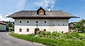 Wernberg Terlach Terlacher Strasse 64 Gaggl-Hube 30052018 3530.jpg 7,022 × 3,813; 19.22 MB
-
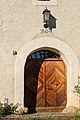
 Wernberg Terlach Terlacher Strasse 64 Gaggl-Hube N-Seite Portal 30052018 3535.jpg 7,360 × 4,711; 24.08 MB
-
 Wernberg Terlach Terlacher Strasse 64 Gaggl-Hube NW-Ansicht 30052018 3525.jpg 7,360 × 4,912; 23.85 MB
-
 Wernberg Terlach Terlacher Strasse 64 Gaggl-Hube SW-Ansicht 30052018 3528.jpg 7,043 × 4,114; 16.28 MB
-
 Wernberg Terlach Terlacher Strasse 64 Gaggl-Hube W-Ansicht 30052018 3533.jpg 6,196 × 4,496; 16.8 MB
-
 Wernberg Terlacher Strasse 64 Gaggl-Hube 13052011 884.jpg 4,256 × 2,117; 1.67 MB
-
 Wernberg Terlacher Strasse 64 Gaggl-Hube 13052011 888.jpg 4,288 × 2,848; 1.81 MB
-
 Wernberg Terlacher Strasse 64 Gaggl-Hube Portalseite 13052011 885.jpg 4,207 × 2,794; 1.54 MB


