Category:Kamenica Castle
Jump to navigation
Jump to search
| Object location | | View all coordinates using: OpenStreetMap |
|---|
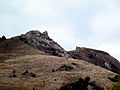
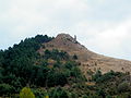
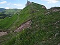
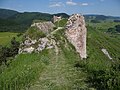
| This category shows the protected monument with the number 708-304/0 (other) in the Slovak Republic. |
 Hrad Kamenica | |||||
| Upload media | |||||
| Instance of | |||||
|---|---|---|---|---|---|
| Located in protected area | |||||
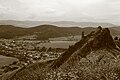
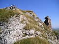
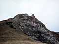
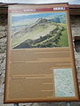
| Location | Kamenica, Sabinov District, Prešov Region, Slovakia | ||||
| Architectural style | |||||
| Heritage designation |
| ||||
| Inception |
| ||||
| Dissolved, abolished or demolished date |
| ||||
| Elevation above sea level |
| ||||
 | |||||
Media in category "Kamenica Castle"
The following 20 files are in this category, out of 20 total.
-
 Hrad Kamenický.jpg 5,184 × 3,456; 5.39 MB
-
 Kamenica07.JPG 2,048 × 1,536; 659 KB
-
 Kamenica13Slovakia1.JPG 2,560 × 1,920; 1.08 MB
-
 Kamenica13Slovakia12.JPG 1,920 × 2,560; 1,008 KB
-
 Kamenica13Slovakia13.JPG 1,578 × 1,992; 810 KB
-
 Kamenica13Slovakia20.JPG 2,560 × 1,920; 1.28 MB
-
 Kamenica13Slovakia3.JPG 2,560 × 1,920; 1.22 MB
-
 Kamenica15.JPG 2,048 × 1,536; 669 KB
-
 Kamenický hrad 001.jpg 4,608 × 3,456; 5.97 MB
-
 Kamenický hrad 2S1.jpg 2,493 × 1,870; 1.68 MB
-
 Kamenický hrad 3S1.jpg 2,592 × 1,944; 1.99 MB
-
 Kamenický hrad 4S1.jpg 2,592 × 1,944; 1.86 MB
-
 Kamenický hrad 5S1.jpg 2,400 × 1,800; 1.71 MB
-
 Kamenický hrad 6S1.jpg 2,400 × 1,800; 1.79 MB
-
 Kamenický hrad S1.jpg 2,400 × 1,800; 1.75 MB
-
 Ruiny Kamenického hradu.jpg 5,184 × 3,456; 6.39 MB
-
 Slovakia Kamenica 1.JPG 3,072 × 2,304; 1.16 MB
-
 Slovakia Kamenica 15.JPG 3,072 × 2,304; 1.43 MB
-
 Slovakia Kamenica 17.JPG 3,072 × 2,304; 1.37 MB
-
 Slovakia Kamenica 3.JPG 3,072 × 2,304; 1.09 MB


