Category:Mariensäule (Raabs an der Thaya)
Jump to navigation
Jump to search
| Object location | | View all coordinates using: OpenStreetMap |
|---|
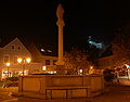
building in Raabs an der Thaya, Austria  | |||||
| Upload media | |||||
| Instance of | |||||
|---|---|---|---|---|---|
| Location | Raabs an der Thaya, Waidhofen an der Thaya District, Lower Austria, Austria | ||||
| Street address |
| ||||
| Heritage designation | |||||
 | |||||
Media in category "Mariensäule (Raabs an der Thaya)"
The following 5 files are in this category, out of 5 total.
-
 2018-10-22 (602) Mariensäule at Raabs an der Thaya, Austria.jpg 4,000 × 3,000; 2.99 MB
-
 GuentherZ 2011-10-17 0140 Raabs Hauptplatz Brunnen mit Mariensaeule.jpg 1,502 × 1,800; 1.5 MB
-
 GuentherZ 2011-10-17 0143 Raabs Hauptplatz Brunnen mit Mariensaeule Detail.jpg 1,268 × 1,800; 1.09 MB
-
 Raabs 1045.jpg 3,456 × 5,184; 1.47 MB
-
 Raabs Hauptplatz 02.jpg 1,679 × 1,315; 470 KB
_Mariens%C3%A4ule_at_Raabs_an_der_Thaya,_Austria.jpg)


