Category:Mayaguana, Bahamas
Jump to navigation
Jump to search
island in the Bahamas | |||||
| Upload media | |||||
| Instance of | |||||
|---|---|---|---|---|---|
| Part of | |||||
| Location | The Bahamas | ||||
| Located in or next to body of water | |||||
| Width |
| ||||
| Length |
| ||||
| Population |
| ||||
| Area |
| ||||
| Elevation above sea level |
| ||||
| Said to be the same as | Mayaguana District | ||||
 | |||||
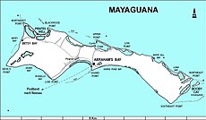
Mayaguana is the easternmost island and district of the Bahamas.
Media in category "Mayaguana, Bahamas"
The following 7 files are in this category, out of 7 total.
-
Mayagua.JPG 2,121 × 1,232; 500 KB
-
Mayaguana District.png 456 × 359; 20 KB
-
Mayaguana IMGP0335.jpg 2,816 × 2,112; 384 KB
-
Mayaguana in Bahamas (+glow).svg 1,559 × 1,124; 701 KB
-
Mayaguana in Bahamas (zoom).svg 1,559 × 1,124; 735 KB
-
Mayaguana in Bahamas.svg 1,559 × 1,124; 699 KB
-
Yellow water white flat mangrove. Mayaguana (38154454884).jpg 1,500 × 974; 179 KB


