Category:Newcastle, County Down
Aller à la navigation
Aller à la recherche
localité britannique  | |||||
| Téléverser des médias | |||||
| Nature de l’élément | |||||
|---|---|---|---|---|---|
| Lieu | comté de Down, Irlande du Nord | ||||
 | |||||
Sous-catégories
Cette catégorie comprend 19 sous-catégories, dont les 19 ci-dessous.
2
- 2022 Eats and Beats Festival (14 F)
B
C
D
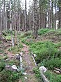
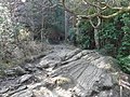
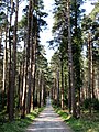
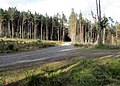
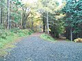
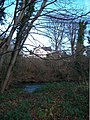
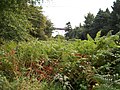
- Donard Forest (40 F)
H
M
- Mourne Coastal Path (11 F)
- Mourneview Caravan Park (4 F)
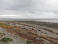
- Murlough Beach (68 F)
- Murlough National Nature Reserve (48 F)
N
- Newcastle Beach, County Down (21 F)
P
R
- Royal County Down Golf Club (5 F)
S
- Signs in Newcastle, County Down (22 F)
T
- Tyrella (12 F)
Média dans la catégorie « Newcastle, County Down »
Cette catégorie comprend 1 891 fichiers, dont les 200 ci-dessous.
(page précédente) (page suivante)-
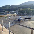
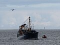
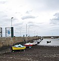
 "Eileen Rose" at Newcastle Harbour - geograph.org.uk - 5237717.jpg 3 819 × 2 865 ; 2,28 Mio
-
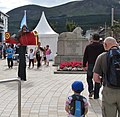
 "God is Love" on Newcastle Beach - geograph.org.uk - 2541954.jpg 1 024 × 768 ; 306 kio
-
 'The Bus' of the Newline Bus Ministries on Newcastle Promenade - geograph.org.uk - 4448392.jpg 1 600 × 1 340 ; 455 kio
-
 11kV power lines in Donard Park - geograph.org.uk - 4651907.jpg 1 600 × 1 200 ; 315 kio
-
 A 95^ Waning Gibbous Moon at first light - geograph.org.uk - 4774692.jpg 1 600 × 1 200 ; 158 kio
-
-

-
 A bogie formerly used on the Bogie Line - geograph.org.uk - 2075209.jpg 1 024 × 767 ; 322 kio
-
 A bogie on the Granite Trail - geograph.org.uk - 5178074.jpg 4 000 × 3 000 ; 3,48 Mio
-
 A busy Newcastle Promenade on Easter Sunday - geograph.org.uk - 3941124.jpg 1 024 × 767 ; 227 kio
-
 A carpet of blue in the woodland - geograph.org.uk - 2932308.jpg 1 024 × 768 ; 380 kio
-
 A carpet of flowers in Tipperary Wood - geograph.org.uk - 4963738.jpg 1 600 × 1 200 ; 898 kio
-
 A carpet of green algae on a landing slip at Newcastle Harbour - geograph.org.uk - 5793681.jpg 3 761 × 2 509 ; 7,37 Mio
-

-
 A clear fell section of Donard Wood - geograph.org.uk - 2387131.jpg 1 024 × 768 ; 323 kio
-

-
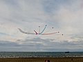
 A climbing Hunter jet above Newcastle beach - geograph.org.uk - 3077225.jpg 680 × 1 024 ; 75 kio
-

-
 A cormorant and a mallard hen in Castle Park Boating Lake - geograph.org.uk - 4813088.jpg 1 600 × 1 200 ; 655 kio
-
 A Crowded Central Promenade at Newcastle - geograph.org.uk - 3077127.jpg 1 024 × 612 ; 125 kio
-
 A crowded promenade at Newcastle - geograph.org.uk - 2541839.jpg 1 024 × 768 ; 191 kio
-
 A December dawn in Marguerite Avenue, Newcastle - geograph.org.uk - 3261533.jpg 1 024 × 768 ; 101 kio
-
 A delivery of O'Reilly's Sweets on the Central Promenade - geograph.org.uk - 1888803.jpg 1 024 × 749 ; 160 kio
-
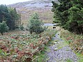
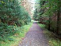 A Donard Forest Trail east of the Granite Trail - geograph.org.uk - 2075231.jpg 1 024 × 768 ; 281 kio
-
 A drinking den deep in the Donard Forest - geograph.org.uk - 4025205.jpg 768 × 1 024 ; 286 kio
-
 A fine beech hedge on Bryansford Road, Newcastle - geograph.org.uk - 5309193.jpg 4 000 × 3 000 ; 2,81 Mio
-
 A gentler section of Amy's River - geograph.org.uk - 4799861.jpg 1 200 × 1 600 ; 626 kio
-
 A Georgian house on the Central Promenade - geograph.org.uk - 2183244.jpg 1 024 × 669 ; 161 kio
-

-

-
-
 A grey heron on its rocky perch on the South Promenade - geograph.org.uk - 5676364.jpg 2 668 × 2 000 ; 3,97 Mio
-
 A heavy shower descending down the Glen Valley - geograph.org.uk - 5397808.jpg 2 128 × 2 133 ; 859 kio
-
 A heron fishing near Newcastle Harbour - geograph.org.uk - 1983939.jpg 1 024 × 768 ; 156 kio
-
 A lone swan on Castle Park Boating Lake - geograph.org.uk - 4884071.jpg 1 600 × 1 163 ; 433 kio
-
 A Mute Swan on the Shimna - geograph.org.uk - 5268239.jpg 2 112 × 1 780 ; 632 kio
-
 A November morning on Newcastle Strand - geograph.org.uk - 2161733.jpg 1 024 × 756 ; 170 kio
-
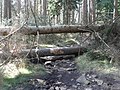
 A path foot bridge in the Donard Forest - geograph.org.uk - 4025164.jpg 768 × 1 024 ; 329 kio
-
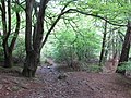
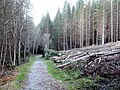
 A path in Donard Forest, Newcastle - geograph.org.uk - 1848916.jpg 640 × 480 ; 138 kio
-
-
 A pillbox at the Ladies' Bathing Place - geograph.org.uk - 1983934.jpg 1 024 × 635 ; 147 kio
-
 A placid Shimna River - geograph.org.uk - 1888882.jpg 1 024 × 768 ; 256 kio
-
 A placid Shimna River above the New Bridge - geograph.org.uk - 4435362.jpg 1 600 × 1 200 ; 801 kio
-
 A poster for yet another Northern Ireland Assembly election - geograph.org.uk - 5266179.jpg 4 000 × 3 000 ; 2,35 Mio
-
 A rapid on the Glen River viewed from the Donard Trail - geograph.org.uk - 3867027.jpg 1 024 × 768 ; 329 kio
-
 A reach in the Shimna River - geograph.org.uk - 4435383.jpg 1 600 × 1 200 ; 772 kio
-

-

-
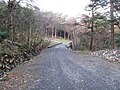
 A road blocked in Donard Forest Park - geograph.org.uk - 1849474.jpg 2 560 × 1 920 ; 2,31 Mio
-

-
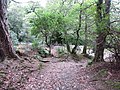
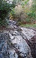 A rocky section of the Donard Trail - geograph.org.uk - 3867044.jpg 631 × 1 024 ; 282 kio
-
-
-
 A speckled wood butterfly on the Bogie Line - geograph.org.uk - 4426676.jpg 1 600 × 1 198 ; 598 kio
-
 A star burst above the beach at Newcastle - geograph.org.uk - 2542019.jpg 1 024 × 765 ; 67 kio
-

-
 A swollen sheugh in Island's Park - geograph.org.uk - 3834189.jpg 1 024 × 768 ; 265 kio
-

-
 A thunderstorm approaches Newcastle Harbour - geograph.org.uk - 1474115.jpg 640 × 480 ; 55 kio
-
 A Tornado above Donard Wood - geograph.org.uk - 4604297.jpg 1 197 × 1 600 ; 214 kio
-
-
 A waterfall over a rock bar - geograph.org.uk - 1983211.jpg 1 024 × 768 ; 259 kio
-

-
 A weir on the Shimna River at Islands Park - geograph.org.uk - 2307241.jpg 1 024 × 768 ; 327 kio
-
 A weir on the swollen Shimna at Islands Park - geograph.org.uk - 3207740.jpg 1 024 × 768 ; 297 kio
-
 A wild start to 2018 on Newcastle's Promenade - geograph.org.uk - 5641377.jpg 4 000 × 3 000 ; 2,49 Mio
-
 A Wildfire on Millstone Mountain, Newcastle - geograph.org.uk - 2386425.jpg 1 024 × 767 ; 109 kio
-
 A windy September day on the beach at Newcastle - geograph.org.uk - 2067475.jpg 1 024 × 645 ; 116 kio
-
-
 Acrobat on Newcastle Promenade - geograph.org.uk - 4117639.jpg 768 × 1 024 ; 174 kio
-

-
-
-
 Aircraft contrails above the Waterfoot Complex - geograph.org.uk - 2842928.jpg 738 × 1 024 ; 65 kio
-
 Alliance Party Westminster Election Poster on Shimna Road - geograph.org.uk - 5397591.jpg 1 877 × 3 559 ; 1,05 Mio
-
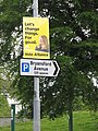 Alliance Westminster Election Poster in Bryansford Avenue - geograph.org.uk - 5397585.jpg 3 000 × 4 000 ; 3,84 Mio
-
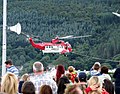
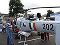 Alouette 202, formerly of the Irish Air Corps - geograph.org.uk - 4119550.jpg 1 024 × 768 ; 184 kio
-
 Amusement arcade on the Central Promenade - geograph.org.uk - 4325696.jpg 1 600 × 1 200 ; 409 kio
-

-
 Amy's River descending through Donard Wood - geograph.org.uk - 5239950.jpg 2 819 × 3 759 ; 2,67 Mio
-
 An April evening at Newcastle Harbour - geograph.org.uk - 6138550.jpg 2 669 × 2 658 ; 4,13 Mio
-
 An arch in the former Annesley's Estate Wall - geograph.org.uk - 5237949.jpg 4 000 × 3 000 ; 4,35 Mio
-
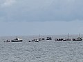 An armada of small boats off Newcastle Strand - geograph.org.uk - 2541846.jpg 1 024 × 767 ; 102 kio
-
 An avenue of stately trees in Donard Wood - geograph.org.uk - 2387143.jpg 768 × 1 024 ; 337 kio
-
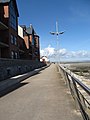 An empty North Promenade at Newcastle - geograph.org.uk - 4455296.jpg 1 200 × 1 600 ; 409 kio
-
-
 Anchor Bar in Bryansford Road, Newcastle - geograph.org.uk - 5324292.jpg 4 000 × 3 000 ; 2,56 Mio
-
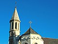
 Annesley armorial at St John's, Newcastle.jpg 640 × 431 ; 110 kio
-
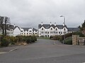
 Annesley Hall on the South Promenade - geograph.org.uk - 5399541.jpg 3 032 × 2 079 ; 1,11 Mio
-
 Annesley Memorial Hall from the A2 - geograph.org.uk - 2183112.jpg 1 024 × 662 ; 186 kio
-
 Annesley picnic grotto in Donard Wood - geograph.org.uk - 5239927.jpg 4 000 × 3 000 ; 4,46 Mio
-

-
 Apartment blocks above the Central Promenade - geograph.org.uk - 2183116.jpg 1 024 × 785 ; 169 kio
-
 Apartment buildings above the South Promenade, Newcastle - geograph.org.uk - 2315887.jpg 1 024 × 768 ; 164 kio
-
 Apartment buildings in Brooklands Grove, Newcastle - geograph.org.uk - 4859297.jpg 1 600 × 1 200 ; 642 kio
-
 Apartment Buildings off Bryansford Road, Newcastle - geograph.org.uk - 2468053.jpg 1 024 × 768 ; 158 kio
-
 Apartments at Annesley Court, The Rock - geograph.org.uk - 4664666.jpg 1 600 × 1 188 ; 373 kio
-
 Apartments in Brooklands Grove off Shimna Road - geograph.org.uk - 5325771.jpg 4 000 × 3 000 ; 3,27 Mio
-
 Apartments in the Shimna Mile Development - geograph.org.uk - 1974420.jpg 1 024 × 767 ; 157 kio
-
 Apartments on Dundrum Road, Newcastle - geograph.org.uk - 5366143.jpg 3 401 × 2 563 ; 883 kio
-
 Apartments on Main Street, Newcastle - geograph.org.uk - 4762822.jpg 1 600 × 1 484 ; 359 kio
-
 Apartments on the north bank of The Shimna - geograph.org.uk - 4762818.jpg 1 488 × 1 600 ; 399 kio
-
 Apartments on the northern side of the Shimna - geograph.org.uk - 4762839.jpg 1 600 × 1 425 ; 356 kio
-
 Apartments on the South Promenade - geograph.org.uk - 5179335.jpg 4 000 × 3 000 ; 2,71 Mio
-
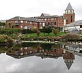
 Apartments overlooking Castle Park Boating Lake - geograph.org.uk - 4542456.jpg 1 067 × 1 425 ; 760 kio
-
 Apartments overlooking Donard Park - geograph.org.uk - 3269292.jpg 1 024 × 768 ; 150 kio
-
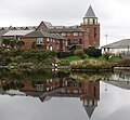
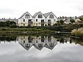 Apartments reflected in the waters of Castle Lake - geograph.org.uk - 4708706.jpg 1 600 × 1 200 ; 264 kio
-
 Approaching Castle Bridge along Newcastle's Main Street - geograph.org.uk - 4939004.jpg 1 600 × 1 130 ; 365 kio
-
 Approaching Craiganore Bridge from the south - geograph.org.uk - 4773114.jpg 1 600 × 1 200 ; 727 kio
-
 Approaching Donard Bridge - geograph.org.uk - 4651904.jpg 1 600 × 1 200 ; 773 kio
-
 Approaching Low Water at Newcastle, Co Down - geograph.org.uk - 6041477.jpg 4 000 × 3 000 ; 2,5 Mio
-
 Approaching St Colman's CoI graveyard along Tullybrannigan Road - geograph.org.uk - 4963381.jpg 1 600 × 1 200 ; 551 kio
-
 Approaching the Annesley Grotto in Donard Wood - geograph.org.uk - 5239939.jpg 4 000 × 3 000 ; 4,84 Mio
-
 Approaching the Celtic Harvester off Newcastle - geograph.org.uk - 4787057.jpg 1 372 × 1 029 ; 277 kio
-
 Approaching the HEP site at Craignagore Bridge - geograph.org.uk - 3144807.jpg 1 024 × 767 ; 274 kio
-
 Approaching the Picnic Grotto in Donard Wood from the north - geograph.org.uk - 4773454.jpg 1 600 × 1 200 ; 637 kio
-
 Approaching the top of the Granite Trail incline - geograph.org.uk - 2075279.jpg 1 024 × 767 ; 302 kio
-

-

-
 Ascending forest road in Donard Wood - geograph.org.uk - 5056626.jpg 4 000 × 3 000 ; 3,65 Mio
-
 Ashleigh House, Newcastle - geograph.org.uk - 3270698.jpg 1 024 × 768 ; 400 kio
-
 At the end of the Rainbow in Donard Park - geograph.org.uk - 2075007.jpg 1 024 × 768 ; 164 kio
-
 August Bank Holiday traffic at Newcastle - geograph.org.uk - 3100788.jpg 1 024 × 768 ; 171 kio
-
-
 Autumn colour in Islands Park - geograph.org.uk - 5178788.jpg 3 889 × 1 921 ; 1,61 Mio
-
 Autumn colour on the Footgolf course at Islands Park - geograph.org.uk - 5178784.jpg 4 000 × 3 000 ; 2,77 Mio
-
 Autumn colours in Donard Park - geograph.org.uk - 4761315.jpg 1 600 × 835 ; 342 kio
-
 Autumn colours in Islands Park - geograph.org.uk - 4762178.jpg 1 600 × 1 200 ; 525 kio
-
 Autumn colours on the Shimna Mile - geograph.org.uk - 4761275.jpg 1 600 × 1 196 ; 394 kio
-
 Autumn gale in Dundrum Bay - geograph.org.uk - 2895984.jpg 1 024 × 768 ; 115 kio
-
 Autumnal scene in Islands Park - geograph.org.uk - 5179305.jpg 3 626 × 2 158 ; 1,21 Mio
-
 Avro Lancaster Bomber over Newcastle - geograph.org.uk - 5492213.jpg 2 977 × 2 820 ; 1,44 Mio
-

-
 Back lane linking Donard Street and Main Street, Newcastle - geograph.org.uk - 5324488.jpg 4 000 × 3 000 ; 2,96 Mio
-
 Ballylone Flute Concert Band at Newcastle - geograph.org.uk - 3583524.jpg 1 024 × 733 ; 198 kio
-
 Bank Holiday visitors to Donard Park, Newcastle - geograph.org.uk - 1979091.jpg 1 024 × 768 ; 278 kio
-
 Banks of radiation fog in the Shimna and Carrigs Valleys - geograph.org.uk - 5309140.jpg 3 195 × 2 296 ; 1,22 Mio
-
 Bath Lane off the South Promenade - geograph.org.uk - 4651174.jpg 1 600 × 1 200 ; 500 kio
-
-
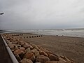
 Beach at Newcastle - geograph.org.uk - 3682058.jpg 3 807 × 2 857 ; 3,95 Mio
-
 Beach at Newcastle - geograph.org.uk - 5160224.jpg 5 376 × 3 024 ; 2,17 Mio
-
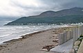
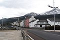
 Beach at Newcastle and the Mourne Mountains - geograph.org.uk - 3682054.jpg 3 857 × 2 892 ; 2,71 Mio
-
 Beach Avenue, Newcastle - geograph.org.uk - 1132435.jpg 640 × 408 ; 94 kio
-
 Beach below the WWII Pill-Box on Newcastle's Central Promenade - geograph.org.uk - 6042144.jpg 2 019 × 1 190 ; 1,47 Mio
-
-
 Beechfield Park, Newcastle - geograph.org.uk - 4490153.jpg 1 600 × 1 198 ; 239 kio
-
 Belfast bus, Donard forest - geograph.org.uk - 1348878.jpg 640 × 411 ; 89 kio
-
 Belfast Harley Davidson trading stand in Castle Park, Newcastle - geograph.org.uk - 5492206.jpg 3 349 × 2 693 ; 1,69 Mio
-
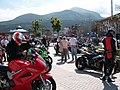
 Belfast Harley Owners' Group riding through Newcastle - geograph.org.uk - 5296831.jpg 2 695 × 1 632 ; 885 kio
-
 Belfast Metro bus at the Park and Ride terminus at Newcastle - geograph.org.uk - 4502370.jpg 1 600 × 1 188 ; 426 kio
-
 Belfast Metro buses in Newcastle - geograph.org.uk - 4502353.jpg 1 600 × 1 198 ; 215 kio
-
 Belfry, former St Mary's, Newcastle - geograph.org.uk - 1132538.jpg 640 × 485 ; 40 kio
-
 Bend in a forest road at Donard Wood - geograph.org.uk - 3867213.jpg 1 024 × 736 ; 252 kio
-
 Bend in the forest track at Donard Wood - geograph.org.uk - 2387087.jpg 1 024 × 768 ; 352 kio
-
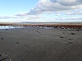
 Berms on the foreshore at Newcastle - geograph.org.uk - 5267106.jpg 4 000 × 3 000 ; 3,46 Mio
-
 Bifurcation of forestry track in Donard Wood - geograph.org.uk - 4762146.jpg 1 600 × 1 200 ; 538 kio
-
 Bikers on the Central Promenade - geograph.org.uk - 3543856.jpg 1 024 × 768 ; 232 kio
-
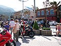 Bikers outside the Newcastle Centre - geograph.org.uk - 3543863.jpg 1 024 × 768 ; 241 kio
-
 Birches and Bluebells in Tipperary Wood - geograph.org.uk - 2931167.jpg 768 × 1 024 ; 311 kio
-
 Birds feeding at low tide - geograph.org.uk - 2896002.jpg 1 024 × 768 ; 181 kio
-
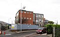 Block B of the disused SE Regional College at Newcastle - geograph.org.uk - 5267961.jpg 3 661 × 2 261 ; 1,55 Mio
-
-
 Blue skies and crashing waves at the Rock Pool Baths - geograph.org.uk - 2172449.jpg 1 024 × 768 ; 164 kio
-
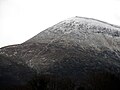
 Blue Skies over Slieve Donard - geograph.org.uk - 3388025.jpg 1 024 × 768 ; 149 kio
-
 Bluebells in Tipperary Wood - geograph.org.uk - 2932044.jpg 1 024 × 630 ; 260 kio
-
 Bluebells in Tipperary Wood - geograph.org.uk - 4491963.jpg 1 200 × 1 600 ; 1 000 kio
-
 Bluebells in Tipperary Woods - geograph.org.uk - 1985116.jpg 1 024 × 768 ; 242 kio
-
 Bluebells in Tipperary Woods - geograph.org.uk - 2930297.jpg 1 024 × 768 ; 330 kio
-
 Bluebells in Tipperary Woods - geograph.org.uk - 3983226.jpg 1 024 × 798 ; 398 kio
-
 Boarded-up villa above the Shimna River - geograph.org.uk - 3835177.jpg 765 × 1 024 ; 291 kio
-
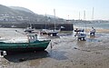
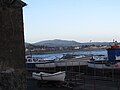
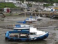 Boats at low water at Newcastle Harbour - geograph.org.uk - 5399059.jpg 4 000 × 3 000 ; 3,47 Mio
-
 Boats at Newcastle Harbour - geograph.org.uk - 6138558.jpg 3 188 × 2 000 ; 3,39 Mio
-
 Boats laid up for winter at Newcastle Harbour - geograph.org.uk - 4759244.jpg 1 600 × 1 200 ; 530 kio
-
 Boats laid up on the harbour wall at Newcastle - geograph.org.uk - 4759360.jpg 1 600 × 1 200 ; 239 kio
-
 Boats moored at Newcastle Harbour - geograph.org.uk - 2943951.jpg 988 × 1 024 ; 162 kio
-
 Bonney's Caravan Park, Newcastle - geograph.org.uk - 4249204.jpg 1 600 × 1 200 ; 685 kio
-
-
-
-
 Bracken in a clearing in Tipperary Wood - geograph.org.uk - 4435373.jpg 1 600 × 1 200 ; 883 kio
-
 Bracken infestation alongside the Granite Trail - geograph.org.uk - 2075252.jpg 1 024 × 768 ; 302 kio
-
 Breaking waves at the estuary of the Shimna - geograph.org.uk - 2895991.jpg 1 024 × 754 ; 137 kio
-

-
 Bridge carrying the A2 over the Glen River at Newcastle - geograph.org.uk - 3390541.jpg 1 024 × 682 ; 116 kio
-
 Bridge over the Glen River, Newcastle - geograph.org.uk - 1348751.jpg 640 × 392 ; 98 kio
-
 Bridge over the Shimna River in Bryansford Road - geograph.org.uk - 1974407.jpg 1 024 × 712 ; 233 kio
-
 Bridge, Donard forest, Newcastle - geograph.org.uk - 2218987.jpg 620 × 360 ; 114 kio
-
 Brooklands Grove Apartments on Shimna Road - geograph.org.uk - 5325765.jpg 4 000 × 3 000 ; 2,43 Mio
-
 Bryansford Avenue approaching the junction with Bryansford Road - geograph.org.uk - 4455304.jpg 1 600 × 1 197 ; 474 kio
-
 Bryansford Avenue at the cross roads with Shimna Road - geograph.org.uk - 4564561.jpg 1 600 × 1 146 ; 333 kio
-
 Bryansford GAA Ground, Newcastle - geograph.org.uk - 3323252.jpg 955 × 1 024 ; 157 kio
-
 Bryansford Road at the approach to the New Bridge - geograph.org.uk - 3866212.jpg 1 024 × 767 ; 139 kio
-
 Bryansford Road near its junction with Tollymore Road - geograph.org.uk - 1970917.jpg 1 024 × 768 ; 211 kio
-
 Building blocks on Site B of the demolished SERC college - geograph.org.uk - 5324485.jpg 4 000 × 3 000 ; 2,99 Mio
-
 Building site behind the Ashleigh Estate - geograph.org.uk - 1970928.jpg 1 024 × 768 ; 190 kio
-
 Buildings at the southern end of the Shimna Bridge - geograph.org.uk - 1974522.jpg 1 024 × 770 ; 178 kio
-
-
 Built on firm foundations - the Newcastle Pill-Box - geograph.org.uk - 2942668.jpg 1 024 × 671 ; 122 kio
-
 Burger stand at the Elim Gospel Hall - geograph.org.uk - 2542096.jpg 768 × 1 024 ; 204 kio
-
 Burren Park Estate, Newcastle - geograph.org.uk - 3594120.jpg 1 024 × 539 ; 105 kio


_(14786691863).jpg)