Category:Noth
Jump to navigation
Jump to search
commune in Creuse, France   | |||||
| Upload media | |||||
| Instance of | |||||
|---|---|---|---|---|---|
| Location |
| ||||
| Street address |
| ||||
| Population |
| ||||
| Area |
| ||||
| Elevation above sea level |
| ||||
| official website | |||||
 | |||||
Subcategories
This category has the following 6 subcategories, out of 6 total.
Media in category "Noth"
The following 14 files are in this category, out of 14 total.
-
 Cazine Noth Masgelat amont.jpg 3,264 × 2,448; 2.92 MB
-
 Cazine Noth Masgelat aval.jpg 3,264 × 2,448; 3.56 MB
-
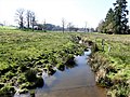
 Cazine Noth Masgelat vallée amont.jpg 3,264 × 2,448; 2.12 MB
-
 Cazine Noth Masgelat vallée aval.jpg 3,264 × 2,448; 3.08 MB
-
 Cazine Noth moulin de la Cazine aval.jpg 3,179 × 2,385; 3.03 MB
-
 Noth bourg depuis ouest.jpg 3,098 × 2,323; 1.93 MB
-
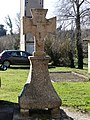 Noth croix devant église (1).jpg 2,190 × 2,921; 2.78 MB
-
 Noth croix devant église (2).jpg 2,336 × 3,115; 2.25 MB
-
 Noth la Fot croix 01.jpg 2,393 × 3,191; 1.16 MB
-
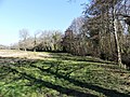
 Noth la Fot manoir.jpg 3,151 × 2,363; 1.87 MB
-
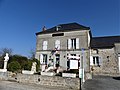 Noth mairie.jpg 3,179 × 2,385; 1.4 MB
-
 Noth oratoire ND Bon-Espoir (1).jpg 2,448 × 3,264; 2.09 MB
-
 Noth oratoire ND Bon-Espoir (2).jpg 2,314 × 3,086; 1.45 MB
-
 Population - Municipality code 23143.svg 475 × 355; 13 KB


.jpg)
.jpg)


.jpg)
.jpg)
