Category:Pfarrkirche Rohrbach an der Gölsen
Jump to navigation
Jump to search
| Object location | | View all coordinates using: OpenStreetMap |
|---|
church building in Rohrbach an der Gölsen, Austria   | |||||
| Upload media | |||||
| Instance of | |||||
|---|---|---|---|---|---|
| Location | Rohrbach an der Gölsen, Lilienfeld District, Lower Austria, Austria | ||||
| Heritage designation | |||||
 | |||||
Media in category "Pfarrkirche Rohrbach an der Gölsen"
The following 8 files are in this category, out of 8 total.
-
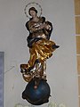
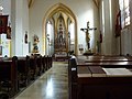 Rohrbach Gölsen Pfarrkirche innen.jpg 3,648 × 2,736; 4.02 MB
-
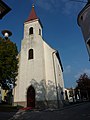 Rohrbach Gölsen Pfarrkirche.jpg 2,736 × 3,648; 3.64 MB
-
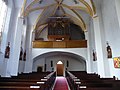
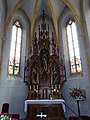 Rohrbach Gölsen Pfarrkirche02.jpg 3,000 × 4,000; 3.97 MB
-
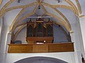
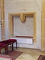 Rohrbach Gölsen Pfarrkirche03.jpg 3,000 × 4,000; 4.04 MB
-
 Rohrbach Gölsen Pfarrkirche04.jpg 3,000 × 4,000; 3.83 MB
-
 Rohrbach Gölsen Pfarrkirche05.jpg 3,000 × 4,000; 4.03 MB
-
 Rohrbach Gölsen Pfarrkirche06.jpg 4,000 × 3,000; 4.8 MB
-
 Rohrbach Gölsen Pfarrkirche07.jpg 4,000 × 3,000; 4.69 MB


