Category:Protestant Church (Pillgram)
Jump to navigation
Jump to search
| Object location | | View all coordinates using: OpenStreetMap |
|---|
church building in Brandenburg state, Germany  | |||||
| Upload media | |||||
| Instance of | |||||
|---|---|---|---|---|---|
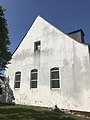
| Location | Jacobsdorf, Oder-Spree District, Brandenburg, Germany | ||||
| Heritage designation | |||||
 | |||||
This is the category of the Brandenburger Baudenkmal (cultural heritage monument) with the ID 09115448 (Wikidata)
|
Media in category "Protestant Church (Pillgram)"
The following 14 files are in this category, out of 14 total.
-
 Dorfkirche Pillgram Anbau Ostansicht.jpg 3,024 × 4,032; 2.41 MB
-
 Dorfkirche Pillgram Blick ins Kirchenschiff.jpg 4,032 × 3,024; 1.33 MB
-
 Dorfkirche Pillgram Denkmal Gefallene der Weltkriege.jpg 4,032 × 3,024; 3.69 MB
-
 Dorfkirche Pillgram Kirchenschiff Nordansicht.jpg 4,032 × 3,024; 2.47 MB
-
 Dorfkirche Pillgram Ostansicht.jpg 3,024 × 4,032; 2.27 MB
-
 Dorfkirche Pillgram Südansicht.jpg 4,032 × 3,024; 2.65 MB
-
 Dorfkirche Pillgram Südostansicht.jpg 4,032 × 3,024; 3.1 MB
-
 Dorfkirche Pillgram Südwestansicht.jpg 3,024 × 4,032; 3.01 MB
-
 Dorfkirche Pillgram Westansicht.jpg 3,024 × 4,032; 2.54 MB
-
 Dorfkirche Pillgram Westturm Nordansicht.jpg 3,024 × 4,032; 1.71 MB
-
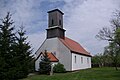 Jacobsdorf Pillgram Kirche.jpg 3,872 × 2,592; 1.11 MB
-
 Kirche Pillgram.jpg 1,200 × 1,600; 261 KB
-
 Pillgram - Dorfkirche - panoramio.jpg 480 × 640; 70 KB
-
 Pillgram Portal.jpg 300 × 400; 25 KB


