Category:Ringlestone
Aller à la navigation
Aller à la recherche
English: Ringlestone (, as spelled) is a hamlet between Wormshill and Harrietsham in the Maidstone district of Kent, England, falling within the civil parish of Wormshill, it is not to be confused with the Ringlestone suburb of Maidstone.
établissement humain au Royaume-Uni  | |||||
| Téléverser des médias | |||||
| Nature de l’élément | |||||
|---|---|---|---|---|---|
| Lieu | Wormshill, Maidstone, Kent, Angleterre du Sud-Est, Angleterre | ||||
 | |||||
Sous-catégories
Cette catégorie comprend seulement la sous-catégorie ci-dessous.
I
- Ringlestone Inn (6 F)
Média dans la catégorie « Ringlestone »
Cette catégorie comprend 25 fichiers, dont les 25 ci-dessous.
-
 Hogbarn Holiday Village - geograph.org.uk - 326813.jpg 640 × 482 ; 96 kio
-
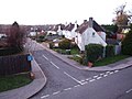 Ringlestone Crescent, Ringlestone - geograph.org.uk - 1584468.jpg 640 × 480 ; 62 kio
-
 River Medway 01.jpg 5 152 × 3 864 ; 4,39 Mio
-
 River Medway 04.jpg 5 152 × 3 864 ; 4,43 Mio
-
 Ash Tree on Ringlestone Road - geograph.org.uk - 230773.jpg 480 × 640 ; 127 kio
-
 Bluebells - geograph.org.uk - 6175.jpg 640 × 480 ; 131 kio
-
 Bracket fungus - geograph.org.uk - 327339.jpg 640 × 480 ; 147 kio
-
 Burchells Wood Road - geograph.org.uk - 326818.jpg 480 × 640 ; 105 kio
-
 Cottages near Harrietsham Manor - geograph.org.uk - 326816.jpg 640 × 480 ; 119 kio
-
 Drake Lane - closed for refurbishment - geograph.org.uk - 326485.jpg 640 × 478 ; 118 kio
-
 Footpath through Stedehill Wood - geograph.org.uk - 327332.jpg 480 × 640 ; 148 kio
-
 Footpath to Hogbarn - geograph.org.uk - 326824.jpg 482 × 640 ; 128 kio
-
 Footpath to Wormshill - geograph.org.uk - 326514.jpg 483 × 640 ; 111 kio
-
 Lone tree, Stede Hill, Harrietsham, Kent - geograph.org.uk - 62735.jpg 600 × 450 ; 291 kio
-
 Merlewood Farm - geograph.org.uk - 326526.jpg 640 × 480 ; 88 kio
-
 Mushrooms on Drake Lane - geograph.org.uk - 230517.jpg 640 × 480 ; 166 kio
-
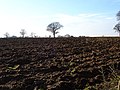 Ploughed field - geograph.org.uk - 326829.jpg 640 × 478 ; 94 kio
-
 Small conifer plantation - geograph.org.uk - 326819.jpg 483 × 640 ; 109 kio
-
 Snowdrops (Galanthus nivalis) - geograph.org.uk - 327337.jpg 640 × 480 ; 149 kio
-
 Stede Hill near Merlewood Farm - geograph.org.uk - 326521.jpg 480 × 640 ; 159 kio
-
 Stedehill Wood - geograph.org.uk - 326827.jpg 557 × 640 ; 126 kio
-
 Stedehill Wood - geograph.org.uk - 326851.jpg 640 × 480 ; 160 kio
-
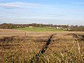
 The top of the downs - geograph.org.uk - 327335.jpg 640 × 480 ; 75 kio
-
 Track in Stedehill Wood - geograph.org.uk - 326850.jpg 640 × 482 ; 131 kio
-
 Track through chestnut coppice - geograph.org.uk - 326529.jpg 480 × 640 ; 155 kio


_-_geograph.org.uk_-_327337.jpg)


