Category:Wormshill
Jump to navigation
Jump to search
English:
Main Wikipedia article: Wormshill.
village and civil parish in Kent, UK  | |||||
| Upload media | |||||
| Instance of | |||||
|---|---|---|---|---|---|
| Location | Maidstone, Kent, South East England, England | ||||
| Population |
| ||||
 | |||||
Subcategories
This category has the following 4 subcategories, out of 4 total.
Media in category "Wormshill"
The following 144 files are in this category, out of 144 total.
-
 A crossing of the ways - geograph.org.uk - 141623.jpg 640 × 480; 141 KB
-
 Abandoned Quarry - geograph.org.uk - 1155248.jpg 640 × 481; 82 KB
-
 Barn, Bedmonton Manor Farm - geograph.org.uk - 2051737.jpg 1,496 × 1,122; 738 KB
-
 Barrier Wood on footpath - geograph.org.uk - 1155224.jpg 640 × 481; 100 KB
-
 Bedmonton Lane, Wormshill - geograph.org.uk - 5026069.jpg 3,264 × 2,448; 2.37 MB
-
 Bedmonton Lane, Wormshill - geograph.org.uk - 5026072.jpg 3,264 × 2,448; 2.56 MB
-
 Blacksmith Arms sign - geograph.org.uk - 2346027.jpg 480 × 640; 71 KB
-
 Blacksmith's Arms at Wormshill - geograph.org.uk - 3055404.jpg 3,929 × 2,609; 6.29 MB
-
 Blacksmith's Cottage at Wormshill - geograph.org.uk - 3055628.jpg 3,161 × 2,071; 786 KB
-
 Blacksmiths Arms Wormshill.JPG 1,280 × 960; 361 KB
-
 Blacksmiths Arms, Wormshill - geograph.org.uk - 2346026.jpg 640 × 480; 87 KB
-
 Blacksmiths Arms, Wormshill - geograph.org.uk - 5016919.jpg 3,264 × 2,448; 2.1 MB
-
 Blacksmiths Arms, Wormshill - geograph.org.uk - 6189.jpg 640 × 480; 95 KB
-
 Bluebells - geograph.org.uk - 6535.jpg 640 × 480; 150 KB
-
 Bluebells in Black Post Wood - geograph.org.uk - 4483540.jpg 4,000 × 3,000; 4.14 MB
-
 Bottom Pond Road, near Wormshill - geograph.org.uk - 5016893.jpg 3,264 × 2,448; 2.24 MB
-
 Bottom Pond Road, near Wormshill - geograph.org.uk - 5016897.jpg 3,264 × 2,448; 1.86 MB
-
 Bottom Pond Road, Wormshill - geograph.org.uk - 5016899.jpg 3,264 × 2,448; 2.38 MB
-
 Bottom Pond, Kent - geograph.org.uk - 4674745.jpg 640 × 470; 446 KB
-
 Bovine picket near Wormshill - geograph.org.uk - 6578998.jpg 1,600 × 1,067; 635 KB
-
 Bredgar and Wormshill Light Railway - geograph.org.uk - 5065540.jpg 3,264 × 2,448; 2.8 MB
-
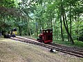 Bredgar and Wormshill Light Railway - geograph.org.uk - 5102951.jpg 3,264 × 2,448; 4.46 MB
-
 Bullocks in a field near Ringlestone - geograph.org.uk - 4483538.jpg 4,000 × 3,000; 4.2 MB
-

-
 Churchyard and church, Wormshill - geograph.org.uk - 4988415.jpg 640 × 480; 158 KB
-
 Corner of Crabtree Wood - geograph.org.uk - 3842498.jpg 640 × 480; 91 KB
-

-
 Drake Lane up the Downs - geograph.org.uk - 141630.jpg 640 × 480; 158 KB
-
 Drake Lane, near Wormshill - geograph.org.uk - 5026094.jpg 3,264 × 2,448; 2.25 MB
-
 Drake Lane, Wormshill - geograph.org.uk - 5026080.jpg 3,264 × 2,448; 2.84 MB
-
 Drake Lane, Wormshill - geograph.org.uk - 5026084.jpg 3,264 × 2,448; 2.51 MB
-
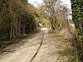
 Drake's Lane - geograph.org.uk - 1150254.jpg 640 × 481; 150 KB
-
 Drake's Lane turns left - geograph.org.uk - 1155256.jpg 640 × 481; 126 KB
-
 Field, Hedge, Lane, near Wormshill - geograph.org.uk - 3527641.jpg 4,608 × 3,456; 3.42 MB
-
 Fields near Swanton Street - geograph.org.uk - 2346038.jpg 640 × 480; 77 KB
-
 Flooded Lane - geograph.org.uk - 1150382.jpg 640 × 481; 120 KB
-
 Footpath from Stede Hill to Ringlestone - geograph.org.uk - 6579030.jpg 1,600 × 963; 448 KB
-
 Footpath near Hogbarn Wood - geograph.org.uk - 4483331.jpg 4,000 × 3,000; 4.09 MB
-
 Footpath near Ringlestone - geograph.org.uk - 4483534.jpg 4,000 × 3,000; 4.36 MB
-
 Footpath Near Wormshill - geograph.org.uk - 2051339.jpg 1,496 × 1,122; 466 KB
-
 Footpath to Ringlestone - geograph.org.uk - 4483535.jpg 4,000 × 3,000; 3.9 MB
-
 Gate to Field off Frinsted Road - geograph.org.uk - 1421333.jpg 640 × 480; 106 KB
-
 Harrietsham Manor - geograph.org.uk - 163753.jpg 640 × 480; 121 KB
-
 Hay bales - geograph.org.uk - 628682.jpg 640 × 480; 53 KB
-
 Hedgerow fruits - geograph.org.uk - 628683.jpg 640 × 480; 126 KB
-
 Hedgerow thistles - geograph.org.uk - 628694.jpg 480 × 640; 109 KB
-
 High Wood - geograph.org.uk - 1150370.jpg 640 × 481; 128 KB
-
 Hogbarn Holiday Village - geograph.org.uk - 326813.jpg 640 × 482; 96 KB
-
 Hogbarn Holiday Village - geograph.org.uk - 6191.jpg 640 × 480; 138 KB
-
 Jersey cows - geograph.org.uk - 628680.jpg 640 × 480; 82 KB
-
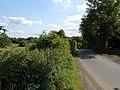
 Lane near Bedmonton - geograph.org.uk - 2346052.jpg 640 × 480; 124 KB
-
 Lane near Bedmonton - geograph.org.uk - 3842485.jpg 640 × 480; 153 KB
-
 Lane through Well Wood - geograph.org.uk - 3842517.jpg 640 × 480; 183 KB
-
 Lane to Park Farm - geograph.org.uk - 2346022.jpg 640 × 480; 113 KB
-
 Lime Kiln Road, Bottom Pond, near Wormshill - geograph.org.uk - 5016887.jpg 3,264 × 2,448; 2.12 MB
-
 Manor House - geograph.org.uk - 1155213.jpg 640 × 481; 122 KB
-
 Mattison Place, Wormshill - geograph.org.uk - 5016914.jpg 3,264 × 2,448; 2.06 MB
-

-
 Norwood Farmhouse.jpg 640 × 480; 113 KB
-
 Notice board, St Giles Wormshill - geograph.org.uk - 3203967.jpg 2,560 × 1,920; 1.17 MB
-
 Old Post Office - Wormshill - geograph.org.uk - 3055418.jpg 3,929 × 2,609; 5.41 MB
-
 OldPostOfficeWormshill.jpg 552 × 370; 103 KB
-
 Overgrown gravestone - geograph.org.uk - 628696.jpg 640 × 480; 158 KB
-
 Park Lane, Wormshill - geograph.org.uk - 5016922.jpg 3,264 × 2,448; 2.19 MB
-
 Post box at Ringlestone - geograph.org.uk - 4483339.jpg 4,000 × 3,000; 4.02 MB
-
 Rear of St Giles' church, Wormshill - geograph.org.uk - 3203965.jpg 2,560 × 1,920; 2.54 MB
-
 Ringlestone Inn, Ringlestone - geograph.org.uk - 6579034.jpg 1,600 × 1,292; 669 KB
-
 Ringlestone Road, Ringlestone - geograph.org.uk - 5017080.jpg 3,264 × 2,448; 2.07 MB
-
 Signalbox, Stony Shaw Station, Bredgar and Wormshill Railway - geograph.org.uk - 5102957.jpg 3,264 × 2,448; 2.47 MB
-
 St. Giles Church, Wormshill - geograph.org.uk - 2210177.jpg 1,164 × 788; 171 KB
-
 St. Giles Church, Wormshill - geograph.org.uk - 2210184.jpg 1,060 × 670; 373 KB
-
 Stile in corner of field - geograph.org.uk - 1155185.jpg 640 × 481; 140 KB
-
 Stile on The Street, Wormshill - geograph.org.uk - 1155234.jpg 640 × 481; 122 KB
-
 Stile to Ringlestone Road - geograph.org.uk - 4483341.jpg 4,000 × 3,000; 4 MB
-
 Stony Shaw, Bredgar and Wormshill Light Railway - geograph.org.uk - 5858983.jpg 1,024 × 684; 405 KB
-
 Stony Shaw, Bredgar and Wormshill Light Railway - geograph.org.uk - 5859271.jpg 1,024 × 684; 401 KB
-
 Swanton Street Road, near Bredgar - geograph.org.uk - 5026067.jpg 3,264 × 2,448; 2.12 MB
-
 Telephone Box at Wormshill - geograph.org.uk - 3055507.jpg 2,161 × 3,301; 1.06 MB
-
 The Street Wormshill - geograph.org.uk - 4904221.jpg 640 × 480; 121 KB
-
 The Street, Wormshill - geograph.org.uk - 5016909.jpg 3,264 × 2,448; 2.35 MB
-
 The Street, Wormshill - geograph.org.uk - 5016912.jpg 3,264 × 2,448; 2.12 MB
-
 The Street, Wormshill - geograph.org.uk - 5016926.jpg 3,264 × 2,448; 2.27 MB
-
 The way to Wormshill - geograph.org.uk - 4988375.jpg 640 × 480; 147 KB
-
 Track through High Wood - geograph.org.uk - 2346037.jpg 640 × 480; 151 KB
-
 Track to a barn - geograph.org.uk - 870566.jpg 640 × 480; 85 KB
-
 Two stiles, two footpaths - geograph.org.uk - 1155195.jpg 640 × 481; 102 KB
-
 Unfit for motor vehicles - geograph.org.uk - 3842544.jpg 640 × 480; 183 KB
-
 Unhealthy Ash - geograph.org.uk - 4988406.jpg 480 × 640; 170 KB
-
 Unnamed lane leading into Trundle Wood - geograph.org.uk - 5016896.jpg 3,264 × 2,448; 2.55 MB
-
 Unnamed lane leading to Bedmonton from Wormshill - geograph.org.uk - 5016906.jpg 3,264 × 2,448; 2.46 MB
-
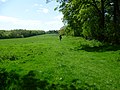
 Valley in between Woods - geograph.org.uk - 1150377.jpg 640 × 481; 94 KB
-
 Valley near Barrier Wood - geograph.org.uk - 1155243.jpg 640 × 481; 67 KB
-
 Victorian Post Box at Wormshill, Kent - geograph.org.uk - 3055454.jpg 2,391 × 1,571; 626 KB
-
 View across the Twin Hills - geograph.org.uk - 1956029.jpg 1,818 × 1,228; 827 KB
-
 View across valley between Wormshill and Bedmonton - geograph.org.uk - 2850541.jpg 5,184 × 3,456; 4.78 MB
-
 View east across to Barrows Wood - geograph.org.uk - 2850531.jpg 5,184 × 3,456; 5.82 MB
-
 Water Tower on Stede Hill - geograph.org.uk - 163744.jpg 480 × 640; 144 KB
-
 Whillphonebox.jpg 1,280 × 960; 377 KB
-
 William Tylden's grave - geograph.org.uk - 628698.jpg 640 × 480; 74 KB
-
 Windsock in Field - geograph.org.uk - 1155174.jpg 640 × 481; 77 KB
-
 WinterWormshill.jpg 512 × 384; 59 KB
-
 Wormshill church - geograph.org.uk - 4988916.jpg 640 × 480; 157 KB
-
 Wormshill Family Fun Day - geograph.org.uk - 1956011.jpg 1,818 × 1,228; 1.08 MB
-
 Wormshill field.JPG 1,280 × 960; 373 KB
-
 Wormshill Village Hall - geograph.org.uk - 1155209.jpg 640 × 481; 103 KB
-
 WormshillFarmhouse.JPG 1,280 × 960; 332 KB
-
 WormshillSign.JPG 1,280 × 960; 374 KB
-
 Barley near Madam's Court - geograph.org.uk - 16819.jpg 640 × 373; 48 KB
-
 Black Post near Wormshill - geograph.org.uk - 6180.jpg 638 × 413; 46 KB
-
 Bluebells - geograph.org.uk - 6175.jpg 640 × 480; 131 KB
-
 Burchells Wood Road - geograph.org.uk - 326818.jpg 480 × 640; 105 KB
-
 Cottages near Harrietsham Manor - geograph.org.uk - 326816.jpg 640 × 480; 119 KB
-
 DEFRA walk - Stede Court Estate - geograph.org.uk - 327286.jpg 640 × 480; 100 KB
-
 Downland Meadow near Wrinsted Court - geograph.org.uk - 16810.jpg 640 × 480; 58 KB
-
 Farmland north of Flint Lane - geograph.org.uk - 326857.jpg 640 × 480; 73 KB
-
 Flint Lane - geograph.org.uk - 326852.jpg 640 × 480; 103 KB
-
 Flint Lane, Lenham, Kent - geograph.org.uk - 62732.jpg 600 × 450; 292 KB
-
 Footpath through Stedehill Wood - geograph.org.uk - 327332.jpg 480 × 640; 148 KB
-
 Footpath to Hogbarn - geograph.org.uk - 326824.jpg 482 × 640; 128 KB
-

-
 Grass Landing Strip near Frinsted - geograph.org.uk - 17180.jpg 640 × 480; 66 KB
-
 Leafy lane, Lenham, Kent - geograph.org.uk - 62730.jpg 600 × 450; 381 KB
-
 Lone tree, Stede Hill, Harrietsham, Kent - geograph.org.uk - 62735.jpg 600 × 450; 291 KB
-
 Lord's Hill near Frinsted - geograph.org.uk - 17181.jpg 640 × 480; 84 KB
-
 Madam's Court - geograph.org.uk - 16825.jpg 640 × 483; 66 KB
-
 Merlewood Farm - geograph.org.uk - 326526.jpg 640 × 480; 88 KB
-
 Newage Farm from Flint Lane - geograph.org.uk - 326865.jpg 640 × 480; 104 KB
-
 Pasture on Stede Hill - geograph.org.uk - 163748.jpg 640 × 482; 94 KB
-
 Ploughed field - geograph.org.uk - 326829.jpg 640 × 478; 94 KB
-
 Pylons - geograph.org.uk - 6188.jpg 640 × 480; 77 KB
-
 Rabbit burrows - geograph.org.uk - 327313.jpg 483 × 640; 165 KB
-
 Small conifer plantation - geograph.org.uk - 326819.jpg 483 × 640; 109 KB
-
 Stede Hill near Merlewood Farm - geograph.org.uk - 326521.jpg 480 × 640; 159 KB
-
 Stedehill Wood - geograph.org.uk - 326827.jpg 557 × 640; 126 KB
-
 Stedehill Wood - geograph.org.uk - 326851.jpg 640 × 480; 160 KB
-
 Stock Wood from the south east - geograph.org.uk - 4579.jpg 640 × 480; 122 KB
-
 The top of the downs - geograph.org.uk - 327335.jpg 640 × 480; 75 KB
-
 Towards Wormshill - geograph.org.uk - 6185.jpg 640 × 430; 76 KB
-
 Track in Stedehill Wood - geograph.org.uk - 326850.jpg 640 × 482; 131 KB
-
 Track through chestnut coppice - geograph.org.uk - 326529.jpg 480 × 640; 155 KB
-
 Track to Newage Farm - geograph.org.uk - 326870.jpg 640 × 480; 79 KB
-
 View east to Marley Court - geograph.org.uk - 327299.jpg 640 × 480; 87 KB
-
 View from Flint Lane - geograph.org.uk - 327327.jpg 640 × 483; 141 KB
-
 White Post revisited - geograph.org.uk - 149120.jpg 640 × 480; 133 KB


