Category:Temburong
Jump to navigation
Jump to search
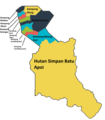
English: The Temburong District of Brunei — on northwestern Borneo island.
- An isolated territorial exclave, separated from the rest of Brunei by the Sarawak State of Malaysia.
district of Brunei | |||||
| Upload media | |||||
| Instance of |
| ||||
|---|---|---|---|---|---|
| Part of |
| ||||
| Location | Brunei | ||||
| Located in or next to body of water |
| ||||
| Capital | |||||
| Currency |
| ||||
| Population |
| ||||
| Area |
| ||||
| Elevation above sea level |
| ||||
| official website | |||||
 | |||||
Subcategories
This category has the following 11 subcategories, out of 11 total.
B
- Mukim Bokok (1 F)
- Bukit Pagon (3 F)
- Bukit Retak (3 F)
L
P
- Puni checkpoint (1 F)
T
- Temburong River (1 F)
U
- Ujung Jalan checkpoint (1 F)
Media in category "Temburong"
The following 11 files are in this category, out of 11 total.
-
Brunei-Temburong.png 100 × 80; 2 KB
-
Temburong mukims.png 696 × 565; 57 KB
-
Locator map Temburong in Brunei.svg 938 × 1,066; 104 KB
-
Habitats of Ancyronyx (10.3897-zookeys.912.47796) Figure 12.jpg 1,512 × 2,124; 3.61 MB
-
Inside,Longhouse.jpg 6,000 × 4,000; 6.94 MB
-
KampongsOfAmo.png 616 × 705; 76 KB
-
Limbang, Sarawak, Malaysia - panoramio (5).jpg 1,600 × 1,200; 221 KB
-
Outside Longhouse.jpg 5,825 × 4,000; 6.87 MB
-
Temburong-pronunciation-ms.ogg 0.7 s; 11 KB
-
TemburongKampongs.png 616 × 1,072; 134 KB
-
Unnamed Road, 98700 Limbang, Sarawak, Malaysia - panoramio.jpg 1,600 × 1,200; 363 KB


